Alagnon - Pinatelle
Add to my favorites


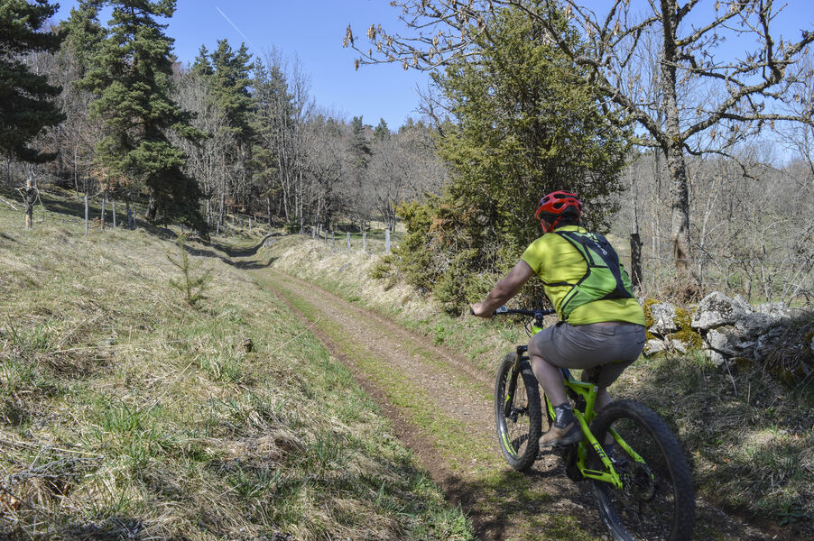
Circuit de niveau difficile ; intérêts : paysage et flore. Départs possibles depuis : Chavagnac, Virargues ou Murat. Itinéraire praticable en VTTAE (niveau rouge : difficile).
The characteristics of the route.
Murat (15)
- Distance 21.4 km
- Elevation gain 570 m
- Elevation lost 570 m
- Min. elevation 857 m
- Max. elevation. 1240 m
- Duration (depending on pace) 4h
- Marking Yes
Equipments : Parking, Admission fee : Free access.Opening : All year round.
Subject to favorable weather.
Report a problem Add a comment
Pdf file
Add your time and share your feelings
Services nearby

Lagloire Jean-Claude
Murat

Restaurant de la Paix
Murat
Céline Lepage Broderie d'Art
Murat
La Maison de Marie
Murat
Auberge du hameau
Murat


Information updated on 2021-01-19 by Hautes Terres Tourisme


Contact Carladès area
Carladès Tourist Office
Avenue A. Mercier
15800 Vic-sur-Cère
Tel. 04.71.47.50.68
Carladès Tourisme
tourisme@carlades.fr
![]()
Contact Hautes Terres area
Hautes Terres Tourist Office
Pl. Hôtel de ville - 15300 Murat
Tel. 04.71.20.09.47
Hautes Terres Tourisme
contact@hautesterrestourisme.fr
@hautesterrestourisme
@hautesterrestourisme


OK
Annuler