Sentier de l'Aiguille
Add to my favorites

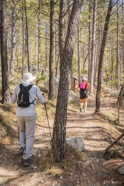
Take this trail, with its interpretation panels, around the Rocher de l'Aiguille. It winds through a wild setting dotted with flora representative of the Provençal Baronnies.
The characteristics of the route.

Buis-les-Baronnies (26)
- Distance 3.53 km
- Elevation gain 230 m
- Elevation lost 230 m
- Min. elevation 380 m
- Max. elevation. 608 m
- Duration (depending on pace) 1h15
- Marking Yes
Parking lot in front of the Fontaine d'Annibal vacation center.
1- Go up Allée des Cerisiers, cross the D 546, turn left for 50 m, then right on a tarred track which rises along an olive orchard. At the top of the olive grove, turn left onto the dirt track. The slope steepens, continue for 200 m until you reach the second bend in the track, from which a path leads off to the right.
2- Leave the track on your left and turn right onto the small path. Climb the switchbacks in the pine forest to gain height up to the crossroads at the foot of the Rocher de l'Aiguille east ridge.
3- Continue up to the signpost. Turn left onto the Aiguille path, which descends into the Bourges valley. After two hairpin bends, cross the small stream and turn left up the path that crosses the adret side of the valley until you reach the crossroads with another path.
4- At the intersection, continue straight on downhill. Rejoin the track at the edge of the olive groves and descend until you find the path from the outward journey.
5- By the same route as the outward journey, reach the Fontaine d'Annibal parking lot.Admission fee : Free access.Opening : All year round daily.
1- Go up Allée des Cerisiers, cross the D 546, turn left for 50 m, then right on a tarred track which rises along an olive orchard. At the top of the olive grove, turn left onto the dirt track. The slope steepens, continue for 200 m until you reach the second bend in the track, from which a path leads off to the right.
2- Leave the track on your left and turn right onto the small path. Climb the switchbacks in the pine forest to gain height up to the crossroads at the foot of the Rocher de l'Aiguille east ridge.
3- Continue up to the signpost. Turn left onto the Aiguille path, which descends into the Bourges valley. After two hairpin bends, cross the small stream and turn left up the path that crosses the adret side of the valley until you reach the crossroads with another path.
4- At the intersection, continue straight on downhill. Rejoin the track at the edge of the olive groves and descend until you find the path from the outward journey.
5- By the same route as the outward journey, reach the Fontaine d'Annibal parking lot.Admission fee : Free access.Opening : All year round daily.
Report a problem
Add your time and share your feelings
Services nearby
Camping la Fontaine d'Annibal
Buis-les-Baronnies
Village de Vacances La Fontaine d'Annibal
Buis-les-Baronnies
Sous l'Olivier
Buis-les-Baronnies

Baronnies Ventoux Aventures
Buis-les-Baronnies
Escalade,Via ferrata, canyoning, baptême parapente avec Baronnies Ventoux Aventures
Buis-les-Baronnies


Information updated on 2025-08-08 by Conseil départemental de la Drôme


Follow us on
the digital trails
the digital trails



 Espace Trail of Baronnies in Drôme Provençale - Parcours - Sentier de l'Aiguille
Hello, world! This is a toast message.
Espace Trail of Baronnies in Drôme Provençale - Parcours - Sentier de l'Aiguille
Hello, world! This is a toast message.
Espace Trail of Baronnies in Drôme Provençale - Parcours - Sentier de l'Aiguille
Hello, world! This is a toast message.


OK
Annuler