Le chemin de la Garde
Add to my favorites

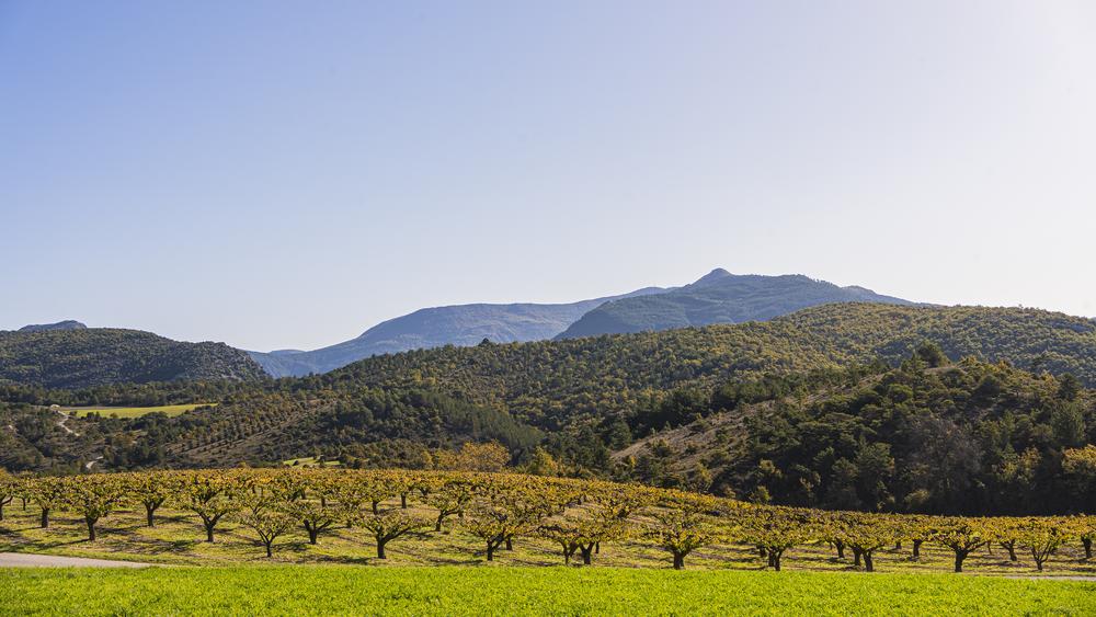
Departing from St Ferréol-Trente-Pas, set off on an ascent to the village of Eyroles, with views over the valley.
The characteristics of the route.

Saint-Ferréol-Trente-Pas (26)
- Distance 11.89 km
- Elevation gain 310 m
- Elevation lost 310 m
- Min. elevation 339 m
- Max. elevation. 619 m
- Duration (depending on pace) 1h11
- Marking Yes
This tour begins with a gentle climb to the village of Eyroles on a quiet road. You'll be able to take plenty of breaks to recover your strength while admiring the views over the valley. After the village of Eyroles, continue on an easy track over a small pass, then enjoy a long descent to the village of Condorcet. Return on the D70 towards Saint-Ferréol-Trente-Pas.
Point 1: Village square (km 0 - 420m).
Point 2: Cemetery (km 0.43 - 420m)
right, follow Eyroles
Point 3: Eyroles (km 3.01 - 570m)
go down into the village on the right, follow the track to the right
Point 4: Chemin de la garde (km 3.56 - 560m)
follow VTTn°2
Point 5: Point haut circuit (km 4.52 - 630m)
continue straight on
Point 6: Le chemin d'Eyroles (km 5.20 - 565m)
continue straight on
Point 7: La garde (km 5.68 - 540m)
follow VTTn°2
Point 8: La Passerelle (km 8.63 - 540m)
right, follow VTTn°2
Point 9: Condorcet (km 9.53 - 359m)
straight ahead on D70Admission fee : Free access.Opening : All year round daily.
Point 1: Village square (km 0 - 420m).
Point 2: Cemetery (km 0.43 - 420m)
right, follow Eyroles
Point 3: Eyroles (km 3.01 - 570m)
go down into the village on the right, follow the track to the right
Point 4: Chemin de la garde (km 3.56 - 560m)
follow VTTn°2
Point 5: Point haut circuit (km 4.52 - 630m)
continue straight on
Point 6: Le chemin d'Eyroles (km 5.20 - 565m)
continue straight on
Point 7: La garde (km 5.68 - 540m)
follow VTTn°2
Point 8: La Passerelle (km 8.63 - 540m)
right, follow VTTn°2
Point 9: Condorcet (km 9.53 - 359m)
straight ahead on D70Admission fee : Free access.Opening : All year round daily.
Report a problem
Add your time and share your feelings
Services nearby

Lou Cafetoun Bar-Restaurant
Curnier
La Scourtinerie
Nyons
Musée du Scourtin
Nyons

Philippe Meffre
Nyons

Séjour sur-mesure
Nyons


Information updated on 2026-07-09 by Conseil départemental de la Drôme


Follow us on
the digital trails
the digital trails



 Espace Trail of Baronnies in Drôme Provençale - Parcours - Le chemin de la Garde
Hello, world! This is a toast message.
Espace Trail of Baronnies in Drôme Provençale - Parcours - Le chemin de la Garde
Hello, world! This is a toast message.
Espace Trail of Baronnies in Drôme Provençale - Parcours - Le chemin de la Garde
Hello, world! This is a toast message.


OK
Annuler