Col de Porte - Le Mauchon
Add to my favorites

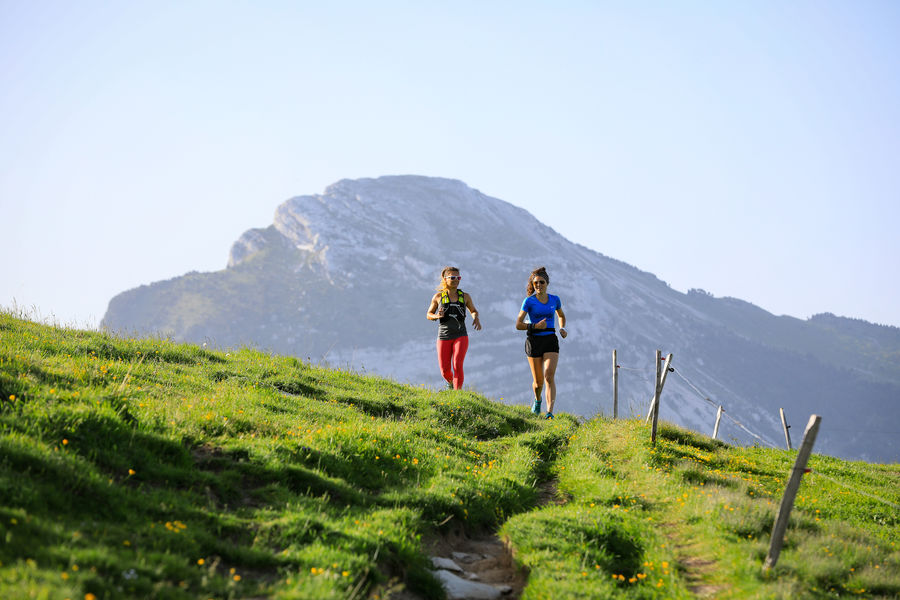
Route n°1 : An itinerary with plenty of shade, very pleasant in summer. Head for "La Pinéa" on the waymarked path.
The characteristics of the route.

Sarcenas (38)
- Distance 6.3 km
- Elevation gain 390 m
- Elevation lost 390 m
- Min. elevation 1141 m
- Max. elevation. 1527 m
- Marking Yes
Marking : Green trail marker n°1
The routes follow the hiking network and Trail markers are affixed to the directional posts. In addition to the specific Trail signage, you can also find your way by following the directions and markers on the ground.Admission fee : Free access.Opening : All year round daily.Step by step description : Follow this path to Les Frettes. This is where you can take the outward/return variant with a small single and some rock climbing before reaching the summit. You then descend to the riverbed before climbing back up to Gervais, then returning to Col de Porte via Le Mauchon.
Read before you go!
The calculation of the dif?culty of each course takes into account the length, the positive vertical drop, the greatest continuous positive or negative vertical drop as well as the technicality of the terrain.
The calculation of the dif?culty of each course takes into account the length, the positive vertical drop, the greatest continuous positive or negative vertical drop as well as the technicality of the terrain.
Area : Grenoble-Alpes Métropole
Report a problem
Website Col de Porte - Le Mauchon_Sarcenas Features of the application :
- Location and orientation on detailed maps thanks to the GPS of your smartphone
- Description of routes and points of interest on the route
- Photo gallery by route
- Detailed elevation profile
- Route tracking alert to warn you if you stray from the route
- Send predefined messages by SMS to your contacts
- Emergency module: trigger a call or send an emergency SMS in case of problem
- Agenda: access to events organized in the department
- News: find in the application the latest news on the web portal
- Adding achievements
- Add reports in case of problems encountered on the routes
- Share on social networks

Griccham
The 2024/06/23
En savoir plus
Ajouter votre chrono et partager vos sensations
2024/06/23 Griccham
L'exploitation forestière a détruit la majorité des chemins. C'est devenu glissant, dangereux, des arbres abattus laissés au milieu des chemins.
2024/06/23 Griccham
L'exploitation forestière a détruit la majorité des chemins. C'est devenu glissant, dangereux, des arbres abattus laissés au milieu des chemins.
Services nearby

Col de Porte
Sarcenas

Sappey-en-Chartreuse Tourist Information Center
Le Sappey-en-Chartreuse
Location de matériel au foyer de ski de fond
Saint-Pierre-de-Chartreuse

Museum Arcabas in Chartreuse
Saint-Pierre-de-Chartreuse

Espace naturel sensible du col du Coq
Plateau des Petites Roches


Information updated on 2026-01-30 by Office de Tourisme Grenoble Alpes


Follow us on
the digital trails
the digital trails





The Isère Outdoor application was created
by the Département de l'Isère
Infos & contact
Conseil départemental de l'Isère
7 rue Fantin Latour
CS 41096
38 022 Grenoble cedex 1
Tel. 04 76 00 38 38
 Isère Outdoor - Parcours - Col de Porte - Le Mauchon
Hello, world! This is a toast message.
Isère Outdoor - Parcours - Col de Porte - Le Mauchon
Hello, world! This is a toast message.
Isère Outdoor - Parcours - Col de Porte - Le Mauchon
Hello, world! This is a toast message.


OK
Annuler