Prévourey running tour - 8 km - Blue level
Add to my favorites

Caution! Zone of vigilance near the route
Brouffier - du 15/06/2026 au 15/09/2026 In progress
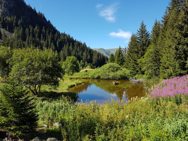
A beautiful and relatively smooth mountain route.
With three main climbs, it’s a great training loop offering a pleasant variety of terrain and viewpoints. The trail takes you through the Cirque du Louvet, where you can discover its hut and lake
The characteristics of the route.

Alpe Du Grand Serre (38)
- Distance 9 km
- Elevation gain 520 m
- Elevation lost 520 m
- Min. elevation 1345 m
- Max. elevation. 1621 m
- Marking Yes
The climb up to Le Louvet, right from the start, is the first challenge of the route. Fairly steady and shaded in the woods, it leads to a flat section and a lovely viewpoint.
Next comes the Louvet Hut, along a flat stretch that's as enjoyable as the scenery around it.
You can refill your water at the nearby fountain. A scenic singletrack descent follows, occasionally technical.
The trail then joins a forest road. Smooth, steady, and shorter than its two “sisters,” the second climb is ultimately the easiest of the three.
On the second descent, a small, technical singletrack trail, you may come across other runners making their way uphill.
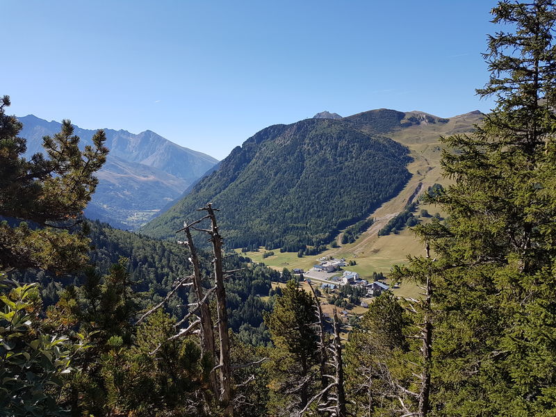
The final climb starts off gently at the edge of the forest, then becomes tougher in the final few hundred meters. Once back in the woods, pay close attention to marked intersections — the route crosses several Bike Park trails. The landscape then opens up, revealing the resort below and signs of life returning just beneath you. The loop finishes gently with a fast and flowing forest road descent, offering glimpses of the Désert hamlet and the Vercors mountains in the distance.Marking : Blue waymarking No. 2 (Alpe du Grand Serre – Sector No. 1) The routes follow the hiking trail network, and Trail markers are placed on directional signposts. In addition to the specific Trail signage, use the directional indications and waymarks on the ground to navigate.Equipments : Picnic area, Public WC, Delicate passages : Technical descent: Caution is advised when crossing the 50-meter rocky section of the trail, use the safety cables if needed for support. Important! You are in a protected natural area: Please stay on marked trails, take all your waste with you, and keep dogs on a leash at all times.Admission fee : Free access. Free pricing rundown at tourist office.Opening : All year round daily.
Next comes the Louvet Hut, along a flat stretch that's as enjoyable as the scenery around it.
You can refill your water at the nearby fountain. A scenic singletrack descent follows, occasionally technical.
The trail then joins a forest road. Smooth, steady, and shorter than its two “sisters,” the second climb is ultimately the easiest of the three.
On the second descent, a small, technical singletrack trail, you may come across other runners making their way uphill.
The final climb starts off gently at the edge of the forest, then becomes tougher in the final few hundred meters. Once back in the woods, pay close attention to marked intersections — the route crosses several Bike Park trails. The landscape then opens up, revealing the resort below and signs of life returning just beneath you. The loop finishes gently with a fast and flowing forest road descent, offering glimpses of the Désert hamlet and the Vercors mountains in the distance.Marking : Blue waymarking No. 2 (Alpe du Grand Serre – Sector No. 1) The routes follow the hiking trail network, and Trail markers are placed on directional signposts. In addition to the specific Trail signage, use the directional indications and waymarks on the ground to navigate.Equipments : Picnic area, Public WC, Delicate passages : Technical descent: Caution is advised when crossing the 50-meter rocky section of the trail, use the safety cables if needed for support. Important! You are in a protected natural area: Please stay on marked trails, take all your waste with you, and keep dogs on a leash at all times.Admission fee : Free access. Free pricing rundown at tourist office.Opening : All year round daily.
Area : Matheysine
Report a problem
Website Pdf file Features of the application :
- Location and orientation on detailed maps thanks to the GPS of your smartphone
- Description of routes and points of interest on the route
- Photo gallery by route
- Detailed elevation profile
- Route tracking alert to warn you if you stray from the route
- Send predefined messages by SMS to your contacts
- Emergency module: trigger a call or send an emergency SMS in case of problem
- Agenda: access to events organized in the department
- News: find in the application the latest news on the web portal
- Adding achievements
- Add reports in case of problems encountered on the routes
- Share on social networks
Add your time and share your feelings
Services nearby

Alpe du Grand Serre Tourist Office
Alpe Du Grand Serre

Belvédère Olivier Messiaen
Saint-Théoffrey

Romanche Museum
Livet-et-Gavet
Arselle Peatbog (Preserved Natural Area)
Chamrousse
Museum of the French Revolution
Vizille


Information updated on 2026-07-10 by Matheysine Tourisme


Follow us on
the digital trails
the digital trails





The Isère Outdoor application was created
by the Département de l'Isère
Infos & contact
Conseil départemental de l'Isère
7 rue Fantin Latour
CS 41096
38 022 Grenoble cedex 1
Tel. 04 76 00 38 38
 Isère Outdoor - Parcours - Prévourey running tour - 8 km - Blue level
Hello, world! This is a toast message.
Isère Outdoor - Parcours - Prévourey running tour - 8 km - Blue level
Hello, world! This is a toast message.
Isère Outdoor - Parcours - Prévourey running tour - 8 km - Blue level
Hello, world! This is a toast message.


OK
Annuler