Combe Lambert and the ridges path
Add to my favorites

A walk through Montrevel's woods to discover a part of our dauhpinoise history. Then the landscape will open up on one of the most beautiful views of the Vals du Dauphiné.
The characteristics of the route.

Montrevel (38)
- Distance 13.1 km
- Elevation gain 290 m
- Elevation lost 290 m
- Min. elevation 477 m
- Max. elevation. 686 m
- Duration (depending on pace) 3h45
- Marking Yes
MARKINGS AND SIGNS :
Follow the yellow signs and the following signposts:
La Touqueta > Chemin de Combe Lambert > Vaux > Bois du seigneur > Châtaignier de Bourrique > Radio-balise > Chardenouse > Doissin > Notre-Dame d'Artézieux > Retour MONTREVEL
ROUTE :
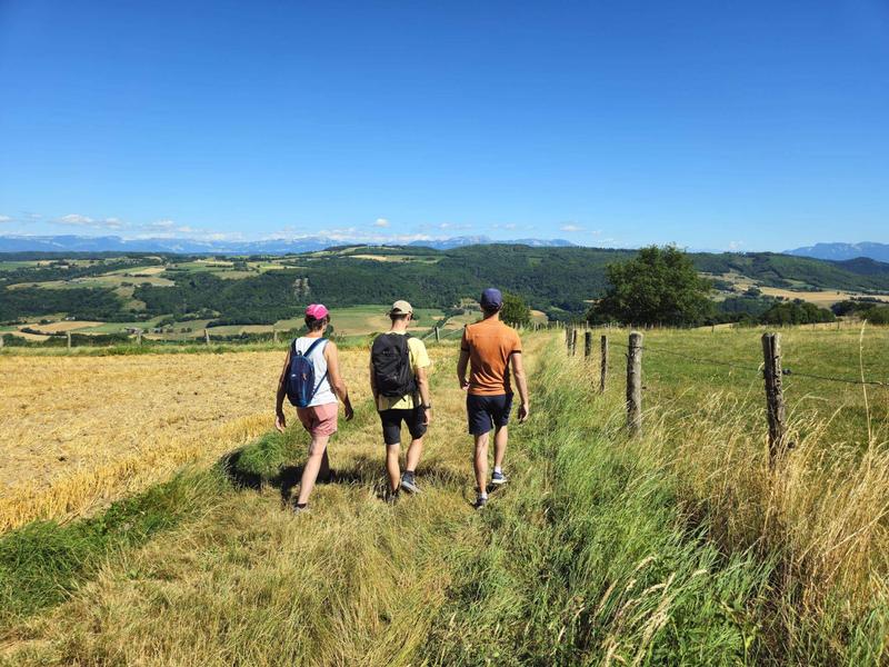
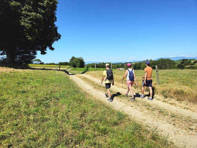
Take the path that climbs alongside the church to reach the woods of Montrevel. This is where the village once had its castle, so well evoked by the place known as ‘Château Désert’. Look up at the Trois Croix oratory and admire the view over the Hien valley and the wooded hills of Biol. Go through the pretty hamlet of Vaux and take the short, steep climb on your left to reach the path that leads up to the woods.
From the Bois du Seigneur onwards, the landscape opens up completely. In the foreground, the medieval castle of Virieu with its round towers pierces the opposite hills. In the background, the Chartreuse mountains, the Epine range and the Monts du Chat and Bugey come into view. View of Mont Blanc on a clear day.
Then descend to Doissin. On the way back to Montrevel, admire the buildings of an old tile factory as you head towards the marshes. Pass by the Notre-Dame d'Artézieux chapel before returning to the village centre and its old houses.
VARIATION :
In very hot weather, we recommend a shadier option. From ‘La Touqueta’, follow the forest track towards ‘Bois vert’, then ‘Taillis’ to return to the loop at ‘Bois du Seigneur’. This will extend the walk by around 1km, with an additional climb of around 40m.Marking : Follow the yellow signs and the following signposts: La Touqueta > Chemin de Combe Lambert > Vaux > Bois du seigneur > Châtaignier de Bourrique > Radio-balise > Chardenouse > Doissin > Notre-Dame d'Artézieux > Retour MONTREVELEquipments : Public WC, Car park, Admission fee : Free access.Opening : All year round daily.
Follow the yellow signs and the following signposts:
La Touqueta > Chemin de Combe Lambert > Vaux > Bois du seigneur > Châtaignier de Bourrique > Radio-balise > Chardenouse > Doissin > Notre-Dame d'Artézieux > Retour MONTREVEL
ROUTE :
Take the path that climbs alongside the church to reach the woods of Montrevel. This is where the village once had its castle, so well evoked by the place known as ‘Château Désert’. Look up at the Trois Croix oratory and admire the view over the Hien valley and the wooded hills of Biol. Go through the pretty hamlet of Vaux and take the short, steep climb on your left to reach the path that leads up to the woods.
From the Bois du Seigneur onwards, the landscape opens up completely. In the foreground, the medieval castle of Virieu with its round towers pierces the opposite hills. In the background, the Chartreuse mountains, the Epine range and the Monts du Chat and Bugey come into view. View of Mont Blanc on a clear day.
Then descend to Doissin. On the way back to Montrevel, admire the buildings of an old tile factory as you head towards the marshes. Pass by the Notre-Dame d'Artézieux chapel before returning to the village centre and its old houses.
VARIATION :
In very hot weather, we recommend a shadier option. From ‘La Touqueta’, follow the forest track towards ‘Bois vert’, then ‘Taillis’ to return to the loop at ‘Bois du Seigneur’. This will extend the walk by around 1km, with an additional climb of around 40m.Marking : Follow the yellow signs and the following signposts: La Touqueta > Chemin de Combe Lambert > Vaux > Bois du seigneur > Châtaignier de Bourrique > Radio-balise > Chardenouse > Doissin > Notre-Dame d'Artézieux > Retour MONTREVELEquipments : Public WC, Car park, Admission fee : Free access.Opening : All year round daily.
Area : Vals du Dauphiné
Report a problem
Website Features of the application :
- Location and orientation on detailed maps thanks to the GPS of your smartphone
- Description of routes and points of interest on the route
- Photo gallery by route
- Detailed elevation profile
- Route tracking alert to warn you if you stray from the route
- Send predefined messages by SMS to your contacts
- Emergency module: trigger a call or send an emergency SMS in case of problem
- Agenda: access to events organized in the department
- News: find in the application the latest news on the web portal
- Adding achievements
- Add reports in case of problems encountered on the routes
- Share on social networks
Elfy56
The 2025/12/23
En savoir plus
Ajouter votre chrono et partager vos sensations
2025/12/23 Elfy56
2025/12/23 Elfy56
Services nearby

Relais Cyné de Châbons
Châbons
Relais Cyné de Chateauvilain
Châteauvilain

Clog museum
Val-de-Virieu
Ecomusée rural
Longechenal
Relais Cyné de Colombe
Colombe


Information updated on 2025-08-05 by Office de Tourisme des Vals du Dauphiné


Follow us on
the digital trails
the digital trails


![]()
The Isère Outdoor application was created
by the Département de l'Isère
Infos & contact
Conseil départemental de l'Isère
7 rue Fantin Latour
CS 41096
38 022 Grenoble cedex 1
Tel. 04 76 00 38 38
 Isère Outdoor - Parcours - Combe Lambert and the ridges path
Hello, world! This is a toast message.
Isère Outdoor - Parcours - Combe Lambert and the ridges path
Hello, world! This is a toast message.
Isère Outdoor - Parcours - Combe Lambert and the ridges path
Hello, world! This is a toast message.


OK
Annuler