
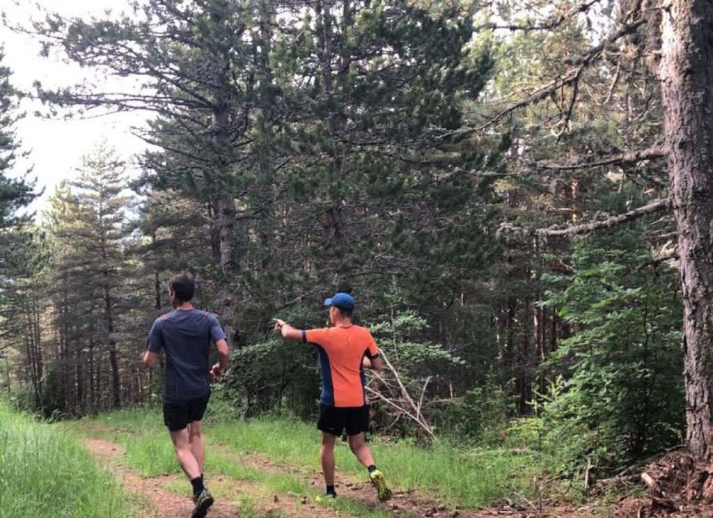
A short but complete loop: a pretty path along a brook, a charming hamlet, a handsome track in the forest… An ideal introduction to the joys of trail running and the bucolic outdoors.

- Distance 5.7 km
- Elevation gain 200 m
- Elevation lost 200 m
- Min. elevation 904 m
- Max. elevation. 1079 m
- Duration (depending on pace) 0h45
- Suivre le balisage Yes

Signposts will guide you all along this route: follow the waymarks for trail #7.
You leave the village on a rather steep path but don’t worry: the slope will soon become gentler! The path climbs slowly, first above and then below the D 41 road (you will quickly forget that the road is nearby, given how few cars use it). You run along the Rieu Frech brook, through magnificent green meadows with pretty flowers. A little bit of paradise! A short stony climb leads you to the hamlet of L'Oustal Crémat. You then take a handsome track that goes down slowly through the forest all the way to Bagnols-les-Bains.
Au départ de la "Bagnols-les-Bains", monter à « L’Oustal Crémat » par:
- « Avenue de la Gare »,
- « Route de la Loubière »,
- « Rue de la Jarretière »,
- « Les Goutelles »,
- « Les Faissettes » et
- "Menhir". Puis direction "Bagnols les Bains" par :
- « Lou Contrat », « Rue de la Jarretière », « Route de la Loubière » et « Avenue de la Gare ».
Circuit trail extrait du cartoguide Mont Lozère- Pays des sources, de la montagne du Goulet aux gorges du Bramont, réalisé par le pôle de Pleine nature mont Lozère.
Parking : parking des Thermes, Bagnols les Bains
Avant de vous engager sur un circuit, vérifiez qu'il est adapté à votre activité et à votre niveau. N'oubliez pas que le temps change vite en montagne. Refermez bien les clôtures et les portillons. Restez sur les chemins balisés.
Get all the routes on your smartphone with the Lozère outdoor app. You'll find all outdoor activities (summer and winter seasons) and a host of functions :
- Take advantage of detailed IGN maps
- Download data for consultation even when you're not connected to the network
- Geolocate yourself at any time on the route and altimeter profile
- Activate the off-track alarm to be alerted if you stray from the itinerary
- Share your experience (add a report, share your lap time)...


StephaneHDG
StephaneHDG



the digital trails





The Lozère Outdoor application was created
by the Lozère Department
Infos & contacts
Conseil départemental de la Lozère
sportsnature@lozere.fr
+33(0)4 66 49 66 32
Crédits photos
 Lozère Outdoor - Parcours - L'Oustal Crémat - Trail n°7
Lozère Outdoor - Parcours - L'Oustal Crémat - Trail n°7
Lozère Outdoor - Parcours - L'Oustal Crémat - Trail n°7
Lozère Outdoor - Parcours - L'Oustal Crémat - Trail n°7
Lozère Outdoor - Parcours - L'Oustal Crémat - Trail n°7


