Boucle d'Orteig
Add to my favorites

Route closed
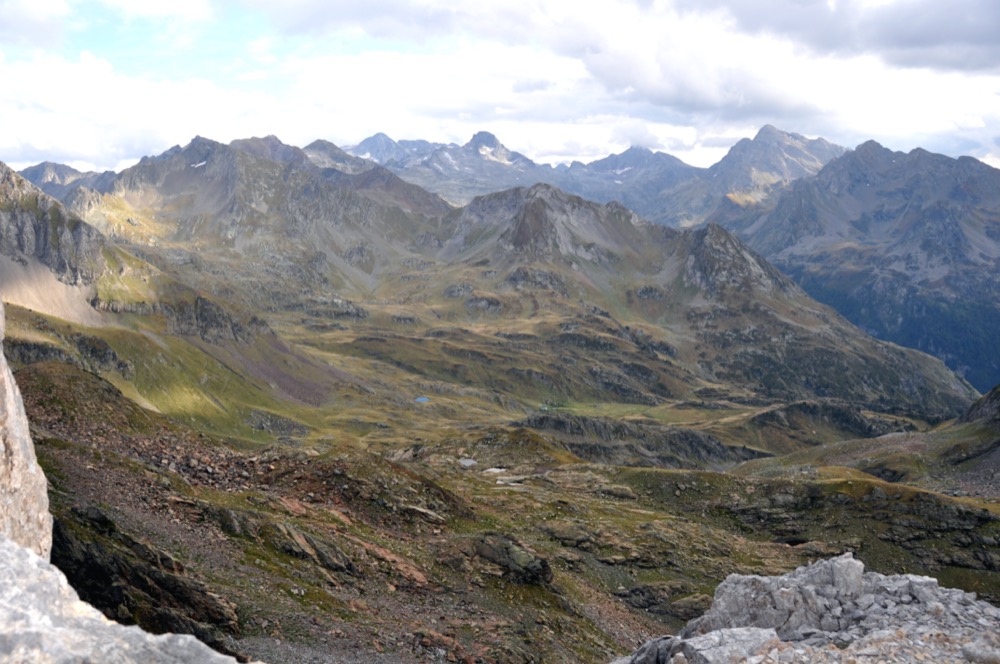
A highlight in the valley! This loop starts at Eaux-Bonnes and will surprise you with a variety of different landscapes. The ascent to the Hourquette d'Arre is often under a patch of snow that is difficult to get around. If it is closed, this route is not recommended.
The characteristics of the route.
Eaux-Bonnes (64)
- Distance 32.06 km
- Elevation gain 2240 m
- Elevation lost 2240 m
- Min. elevation 724 m
- Max. elevation. 2467 m
- Duration (depending on pace) 6h à 12h30
You may notice differences between the distance and elevation data displayed on the digital tools and the pdf file due to different data sources.
Report a problem
PDF - Boucle d'Orteig
Add your time and share your feelings
Services nearby
Eaux-Bonnes charging station
Eaux-Bonnes
Hôtel Le Richelieu
EAUX-BONNES
Camping Iscoo
EAUX-BONNES
Camping du Valentin (SARL)
LARUNS
Camping des Gaves
LARUNS


Follow us on
the digital trails
the digital trails


![]()
The Ossau Valley Tourist Office
Welcome desk of Laruns
Maison de la Vallée d’Ossau – 64 440 LARUNS
+33(0)5 59 05 31 41
Tourist Office
 Ossau valley Land of adventures - Parcours - Boucle d'Orteig
Hello, world! This is a toast message.
Ossau valley Land of adventures - Parcours - Boucle d'Orteig
Hello, world! This is a toast message.
Ossau valley Land of adventures - Parcours - Boucle d'Orteig
Hello, world! This is a toast message.


OK
Annuler