Tour 2 From mollières to burdet
Add to my favorites

Route opened
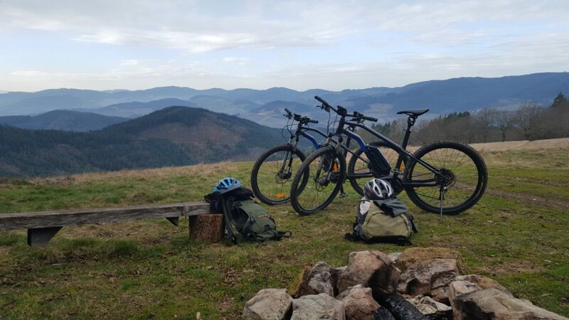
Varied and dynamic tour. First next to the forest with some beautiful points of view, then a descent in the Reins valley. Then, go up to the crest line, with a view on the Lake of the Fir trees, before going down to Cublize.
The characteristics of the route.
Cublize (69)
- Distance 20.2 km
- Elevation gain 700 m
- Elevation lost 700 m
- Min. elevation 439 m
- Max. elevation. 741 m
- Duration (depending on pace) 1h20 à 2h
- Marking Yes
Between 1h20 to 2h, depending on the pace.Marking : Mark orange with n°2 on a blue backgroundAdmission fee : Free access.
Area : Lac des Sapins
Report a problem
Website Site VTT FFC du Beaujolais Vert Roadbook for sail
Add your time and share your feelings
Services nearby

Glaces et confiseries artisanales - Fun' Yaourt
Cublize

Camping du Lac des Sapins
Cublize
Gîte l' Ambremy
Cublize
Studio dans villa neuve
Cublize
Snack "Au Bon Accueil"
Cublize


Information updated on 2021-08-26 by Office de Tourisme du Beaujolais Vert - Lac des sapins


Follow us on
the digital trails
the digital trails


![]()
Info & contacts
Office de Tourisme du Beaujolais Vert
Lac des Sapins - 69550 Cublize
04.74.89.58.03
accueil@beaujolaisvert.com
 Beaujolais Vert Pleine Nature - Parcours - Tour 2 From mollières to burdet
Hello, world! This is a toast message.
Beaujolais Vert Pleine Nature - Parcours - Tour 2 From mollières to burdet
Hello, world! This is a toast message.
Beaujolais Vert Pleine Nature - Parcours - Tour 2 From mollières to burdet
Hello, world! This is a toast message.


OK
Annuler