Tour 13 Entre les eaux
Add to my favorites

Route opened
Walk along the watershed, between the Mediterranean basin to the east and the Atlantic Ocean to the west.
The characteristics of the route.
Ranchal (69)
- Distance 12.6 km
- Elevation gain 380 m
- Elevation lost 380 m
- Min. elevation 696 m
- Max. elevation. 896 m
- Duration (depending on pace) 3h30
- Marking Yes
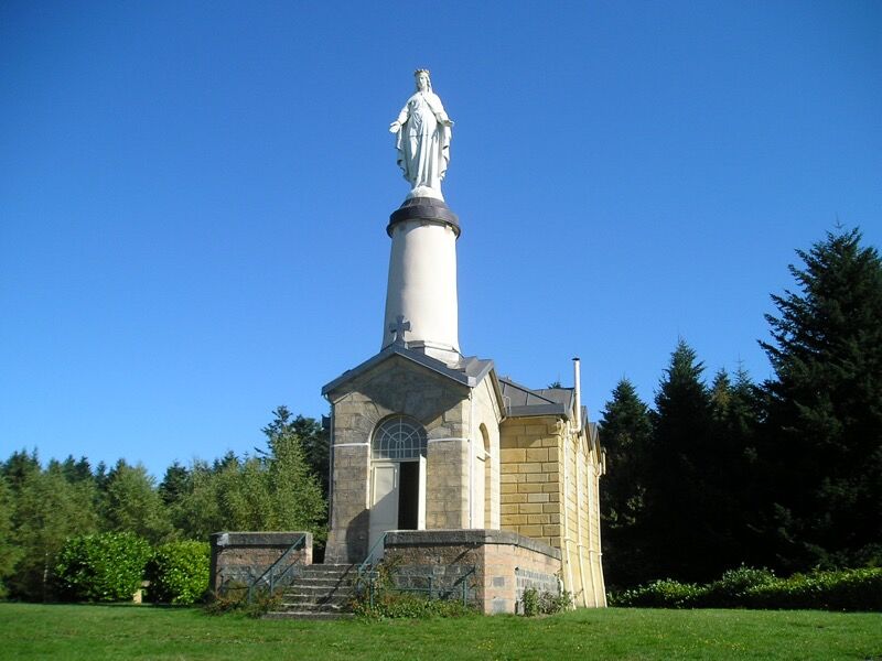
On the way back, enjoy a relaxing time at Notre-Dame de la Rochette. Take care when crossing the RD 54.
Average pace of 3.5km/h.Marking : Mark yellow with n°13 on a red backgroundAdmission fee : Free access.
Average pace of 3.5km/h.Marking : Mark yellow with n°13 on a red backgroundAdmission fee : Free access.
Area : Pays Amplepuis Thizy
Report a problem
Website Roadbook on sale Cfroget
The 2022/02/27
En savoir plus
Ajouter votre chrono et partager vos sensations
2022/02/27 Cfroget
Très belle petite randonnée, même pour des locaux comme nous ! Le site de Notre Dame de la Rochette vaut le détour.
2022/02/27 Cfroget
Très belle petite randonnée, même pour des locaux comme nous ! Le site de Notre Dame de la Rochette vaut le détour.
Services nearby

Auberge des Genêts d'Or
Ranchal

Auberge des Genêts d'Or
Ranchal

Gîte des Sapins
Ranchal

"Les Trembles" Centre des Eclaireuses et Eclaireurs de France
Ranchal
Le Chalet de Badou
Ranchal


Information updated on 2021-10-29 by Office de Tourisme du Beaujolais Vert - Lac des sapins


Follow us on
the digital trails
the digital trails


![]()
Info & contacts
Office de Tourisme du Beaujolais Vert
Lac des Sapins - 69550 Cublize
04.74.89.58.03
accueil@beaujolaisvert.com
 Beaujolais Vert Pleine Nature - Parcours - Tour 13 Entre les eaux
Hello, world! This is a toast message.
Beaujolais Vert Pleine Nature - Parcours - Tour 13 Entre les eaux
Hello, world! This is a toast message.
Beaujolais Vert Pleine Nature - Parcours - Tour 13 Entre les eaux
Hello, world! This is a toast message.


OK
Annuler