Tour 31 Points de vues
Add to my favorites

Route opened
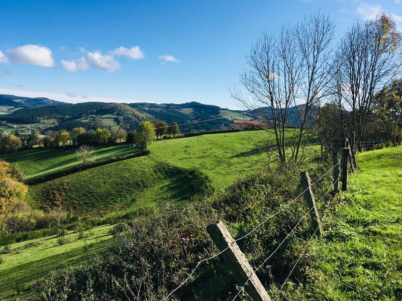
This sportive course, in one of the most wooded villages of the High Valley of Azergues, offers remarkable viewpoints along the way, especially on the ridge line where the GR7 passes.
The characteristics of the route.
Saint-Nizier-d'Azergues (69)
- Distance 20.5 km
- Elevation gain 820 m
- Elevation lost 820 m
- Min. elevation 443 m
- Max. elevation. 893 m
- Duration (depending on pace) 6h
- Marking Yes
At the end of the circuit, view of the railway loop, which allows trains to gain 43 m in altitude without exceeding the 11 mm per meter gradient. Beware, stony descent between the Bois des Princes and the Croix Baleu. At km 8.5, at the post ?Plat of Mollards?, possibility to return to the village (2.4 km).
Average pace of 3.5km/h.Marking : Mark yellow with n°31 on a black backgroundAdmission fee : Free access.
Average pace of 3.5km/h.Marking : Mark yellow with n°31 on a black backgroundAdmission fee : Free access.
Area : Haute Vallée d'Azergues
Report a problem
Website Roadbook on sale
Add your time and share your feelings
Services nearby

Traiteur DESPINASSE
Saint-Nizier-d'Azergues
L'Eldorado de Saint-Nizier
Saint-Nizier-d'Azergues
Château de la Porte
Saint-Nizier-d'Azergues
Gîte de groupe "Les Clés du Soleil"
Claveisolles
Chambres d'hôtes "Maison du Bonheur"
Claveisolles


Information updated on 2021-08-20 by Office de Tourisme du Beaujolais Vert - Lac des sapins


Follow us on
the digital trails
the digital trails


![]()
Info & contacts
Office de Tourisme du Beaujolais Vert
Lac des Sapins - 69550 Cublize
04.74.89.58.03
accueil@beaujolaisvert.com
 Beaujolais Vert Pleine Nature - Parcours - Tour 31 Points de vues
Hello, world! This is a toast message.
Beaujolais Vert Pleine Nature - Parcours - Tour 31 Points de vues
Hello, world! This is a toast message.
Beaujolais Vert Pleine Nature - Parcours - Tour 31 Points de vues
Hello, world! This is a toast message.


OK
Annuler