Tour 27 Du Haut du Soanan
Add to my favorites

Route opened
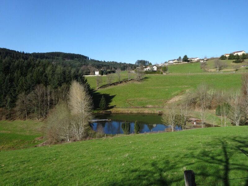
This walk will take you on a grand tour of Saint-Appolinaire, alternating forests, meadows, unobstructed views and peaks over 800 m in altitude, all in the greatest calm.
The characteristics of the route.
Saint-Appolinaire (69)
- Distance 13.7 km
- Elevation gain 430 m
- Elevation lost 430 m
- Min. elevation 574 m
- Max. elevation. 829 m
- Duration (depending on pace) 3h50
- Marking Yes
Average pace of 3.5km/h.Marking : Mark yellow with n°27 on a red backgroundAdmission fee : Free access.
Area : Pays de Tarare
Report a problem
Website Roadbook on sale Gab69490
finished in 02:35:52
The 2022/08/10
En savoir plus
Ajouter votre chrono et partager vos sensations
2022/08/10 02:35:52
Gab69490
Gab69490
Magnifique ! Calme, nature et repos
2022/08/10 02:35:52
Gab69490
Gab69490
Magnifique ! Calme, nature et repos
Services nearby

Gîte LA DATCHA
Saint-Appolinaire

Au bol d'Air
Saint-Appolinaire

Chambre d'hôte Au bol d'air
Saint-Appolinaire
Gîte La Cime du Bourg
Saint-Appolinaire
Le Moulin
Saint-Appolinaire


Information updated on 2021-08-20 by Office de Tourisme du Beaujolais Vert - Lac des sapins


Follow us on
the digital trails
the digital trails


![]()
Info & contacts
Office de Tourisme du Beaujolais Vert
Lac des Sapins - 69550 Cublize
04.74.89.58.03
accueil@beaujolaisvert.com
 Beaujolais Vert Pleine Nature - Parcours - Tour 27 Du Haut du Soanan
Hello, world! This is a toast message.
Beaujolais Vert Pleine Nature - Parcours - Tour 27 Du Haut du Soanan
Hello, world! This is a toast message.
Beaujolais Vert Pleine Nature - Parcours - Tour 27 Du Haut du Soanan
Hello, world! This is a toast message.


OK
Annuler