Le Beaujolais Vert - Around the summits of Beaujolais - Loop 3.1
Add to my favorites

Route opened
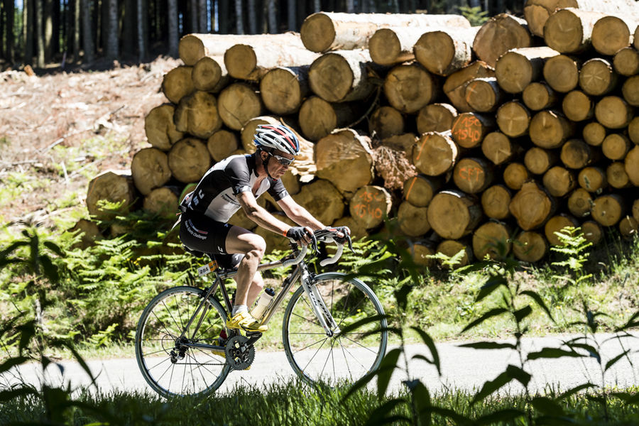
The Beaujolais Vert is a perfect area for regular cycle hikers looking for a difference in altitude. Among the 6 loops, 3 are rated “difficult” and 3 “very difficult”!
The characteristics of the route.
Claveisolles (42)
- Distance 37.8 km
- Elevation gain 810 m
- Elevation lost 810 m
- Min. elevation 451 m
- Max. elevation. 854 m
- Duration (depending on pace) 3h
- Marking Yes
Sporty side
Less than 40 km, but difficult, this route will delight experienced cyclists, lovers of steep climbs. Small gear ratios will be appreciated.
From the start of Claveisolles the road rises up to Poule-les-Echarmeaux (final slope of 10%). All that remains is to climb the Cols des Aillets, then the Echarmeaux and above all the Croix d’Ajoux (final around 15%…). Reaching the Col de la Casse Froide is easy and the beautiful descent (6%) of 5 km is appreciated reaching the finish.
Tourism side
Haut-Beaujolais surprises with the contrasting beauty of its landscapes: steep-sided valleys, bocage plateaus, valleys furrowed by the meanders of rivers… It is one of the main peaks of the Rhône: Saint-Rigaud, the highest in the department at 1,012 m, visible from the intersection of the RD 139 and 645, the Tourvéon (949 m), wooded pyramid which captures the eye when climbing to Les Aillets or the rock of Ajoux (970 m), pedestal mineral, which offers a remarkable panorama of the Alps and the Massif Central.Admission fee : Free access.Opening : All year round.
Area : Haute Vallée d'Azergues
Report a problem Add a comment
Website Details - La Haute Azergues
Add your time and share your feelings
Services nearby

Auberge des Tilleuls
Poule-les-Écharmeaux
Relais des Nations
Poule-les-Écharmeaux
Gîte des Monneries d'en Haut
Poule-les-Écharmeaux
Chateau de Fougères
Poule-les-Écharmeaux
Bar-pizzeria "Au Ricochet"
Poule-les-Écharmeaux


Information updated on 2022-11-13 by Office de Tourisme du Beaujolais Vert - Lac des sapins


Follow us on
the digital trails
the digital trails


![]()
Info & contacts
Office de Tourisme du Beaujolais Vert
Lac des Sapins - 69550 Cublize
04.74.89.58.03
accueil@beaujolaisvert.com


OK
Annuler