GTR – La Grande Traversée du Rhône VTT
Add to my favorites

Route opened
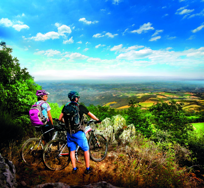
Du Beaujolais à Condrieu, la découverte sur 230 km de plaisirs aussi variés qu’imprévus. Singles, chemins larges, descentes rapides ou techniques, montées engagées ou roulantes, vignobles ou vergers, prenez en plein les yeux !
Durée : 4 à 8 jours.
The characteristics of the route.
Lancié (71)
- Distance 227.62 km
- Elevation gain 6760 m
- Elevation lost 6800 m
- Min. elevation 143 m
- Max. elevation. 860 m
- Marking Yes
Admission fee : Free access.Opening : All year round daily.
Subject to favorable weather.
Area : Lac des Sapins
Report a problem
Website Grande Traversée du Rhône Roadbook for sail
Add your time and share your feelings
Services nearby
Gîte LA CHÈVRE ET LE PAYSAN
Claveisolles
Gîte de la pive
Claveisolles

L'auberge de Laura
Chénelette
L'auberge de Laura
Chénelette
La Voisinée
Chénelette


Follow us on
the digital trails
the digital trails


![]()
Info & contacts
Office de Tourisme du Beaujolais Vert
Lac des Sapins - 69550 Cublize
04.74.89.58.03
accueil@beaujolaisvert.com
 Beaujolais Vert Pleine Nature - Parcours - GTR – La Grande Traversée du Rhône VTT
Hello, world! This is a toast message.
Beaujolais Vert Pleine Nature - Parcours - GTR – La Grande Traversée du Rhône VTT
Hello, world! This is a toast message.
Beaujolais Vert Pleine Nature - Parcours - GTR – La Grande Traversée du Rhône VTT
Hello, world! This is a toast message.


OK
Annuler