Log in
E-mail or username
Password
Login
Do you have
a Facebook or Apple account?
Don't have an account ?
Register
Forgot your password ?
Activities
Espace Trail
Services
Heritage
Mobile app
Useful infos
Les GR®
Les GR®
Voir la carte
routes
filtered
site(s)
filtered
Filters
Only my favorites
Delete filters
Around me :
< 5km
< 10km
< 25km
< 50km
Inactive
Difficulties :
Easy
Medium
Difficult
Expert
Durée :
<1h
1-2h
2-3h
3-4h
>4h
Distance (km) :
<10
10-25
25-50
50-75
>75
Distance (km) :
<25
25-50
50-100
100-150
>150
Elevation gain (m) :
<500
500-1000
1000-1500
1500-2500
>2500
Elevation lost (m) :
<500
500-1000
1000-1500
1500-2500
>2500
Tags :
Doubs Valley
Heritage
Forest
Itinerant route
Landscape Discovery
River
Mountain
Biodiversity
View on the city
Families
Sensations fortes
Nocturne
Auberge
Camping
Chambre d'Hôtes
Charte partenariat
Gite d'étape
Grand Tour VTT
Gîte
Hotel
Accueil Vélo
On Via Francigena way
Eurovélo 6
On GR route
Table d'Hôtes
Camping
Doubs Valley
Grand Tour VTT
Itinerant route
Bus access
Accueil Vélo
Eurovélo 6
Handicapped access
Families
Heritage
Open practice
Landscape Discovery
Biodiversity
Sportive route
View on the city
Advises
Repair
Rental
Eurovélo 6
Sportive route
Families
Guided tour and paying
Professional guide
Sportive route
Club
Animation
Jeu
Test
Areas :
Besançon
Besançon
Besançon
Besançon
Besançon
Besançon
Besançon
Plateau
Vallée du Doubs - aval (Besançon)
Besançon
Plateau
Besançon
Besançon
Vallée du Doubs - amont (Besançon)
Besançon
Plateau
Besançon
Vallée du Doubs - aval (Besançon)
Besançon
Chailluz
Plateau
Besançon
Besançon
Vallée du Doubs - aval (Besançon)
Besançon
GR 59
57.4km
1530m
1670m
Silley-Bléfond
Route opened
Landscape Discovery
Itinerant route
Doubs Valley
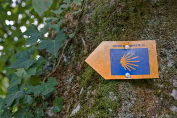
Liaison St-Jacques de Compostelle
21.5km
390m
510m
Franois
Route opened
Forest
Itinerant route
Heritage
River
GR de Pays - Ceinture de Besançon
56.6km
1370m
1370m
La Vèze
Route opened
Biodiversity
Landscape Discovery
Forest
Itinerant route
Mountain
Heritage
River
Doubs Valley
GR 145 - Via Francigena
57.7km
1190m
1070m
Cussey-sur-l’Ognon
Route opened
Biodiversity
Landscape Discovery
Forest
Itinerant route
Mountain
Heritage
River
View on the city
Retour
FR
International
OpenStreetMap
OpenTopoMap
France
IGN Maps
Plan IGN Vector Summer
Plan IGN Vector Winter
IGN Aerial Imagery
OK
Annuler