Sentier des Grands Prés
Add to my favorites

Route opened

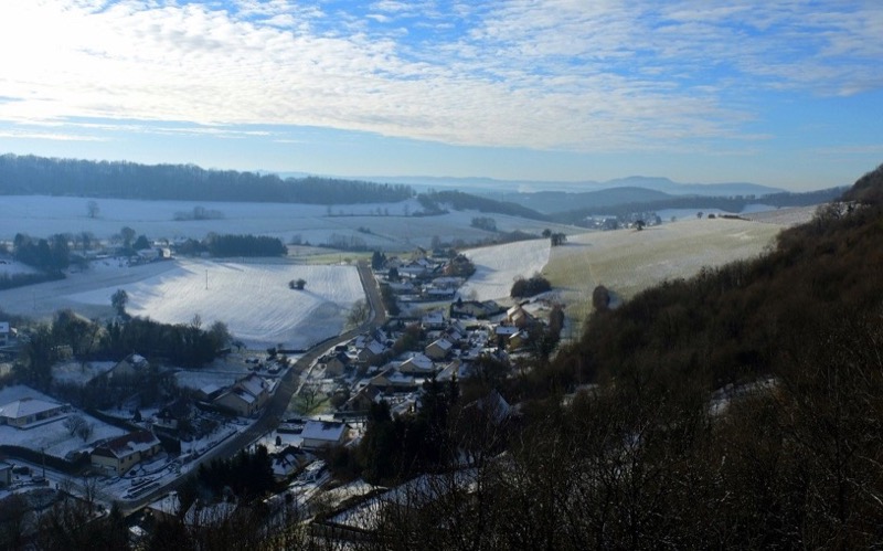
Discover the villages of Arguel and Pugey, nestled in the hills of the Grand Besançon. This hike is accessible to all (be careful, however, with a steep climb) and will take you through forests, fields and village streets to get a view of the natural and built heritage hidden in these beautiful settings. Thanks to the points of interest of the path, learn all the secrets of these two villages.
Access lines 85-86
The characteristics of the route.

Pugey (25)
- Distance 9.5 km
- Elevation gain 290 m
- Elevation lost 290 m
- Min. elevation 370 m
- Max. elevation. 499 m
- Duration (depending on pace) 2h30 à 3h
- Marking follow yellow/blue signs
Add your time and share your feelings
Services nearby

Le Jardin de Velotte
Besançon

La bicyclerie de Casamène
36 Av. de la 7ème Armée Américaine - 25000 Besançon
Mazagran house
Besançon
Ermitage de la Chapelle des Buis
Besançon
Chez Gervais
Chenecey Buillon


Follow us on
the digital trails
the digital trails


![]()
Info & contacts
Ville de Besançon
Direction des Sports
+33(0)3 81 41 23 05
Grand Besançon Métropole
Service Tourisme
+33(0)3 81 87 88 61


OK
Annuler