Route 4 blue - Chaudanne - Rosemont
Add to my favorites

Route opened

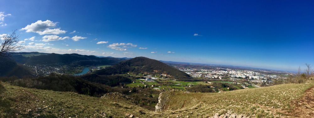
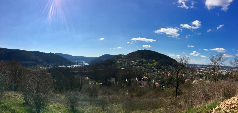
This route will allow you to discover the natural and architectural wealth of Besançon. You will enjoy a complete run on a constantly reviving elevation profile, ideal for training with many changes of rhythms on varied tracks.
The characteristics of the route.

Besançon (25)
- Distance 14.87 km
- Elevation gain 630 m
- Elevation lost 630 m
- Min. elevation 237 m
- Max. elevation. 461 m
- Duration (depending on pace) 1h30 à 3h20
- Marking yes, n°4 blue
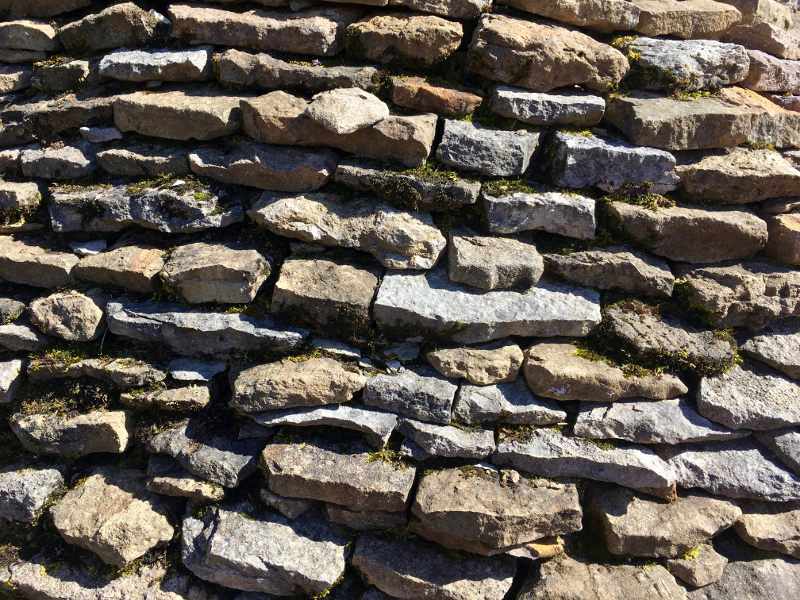
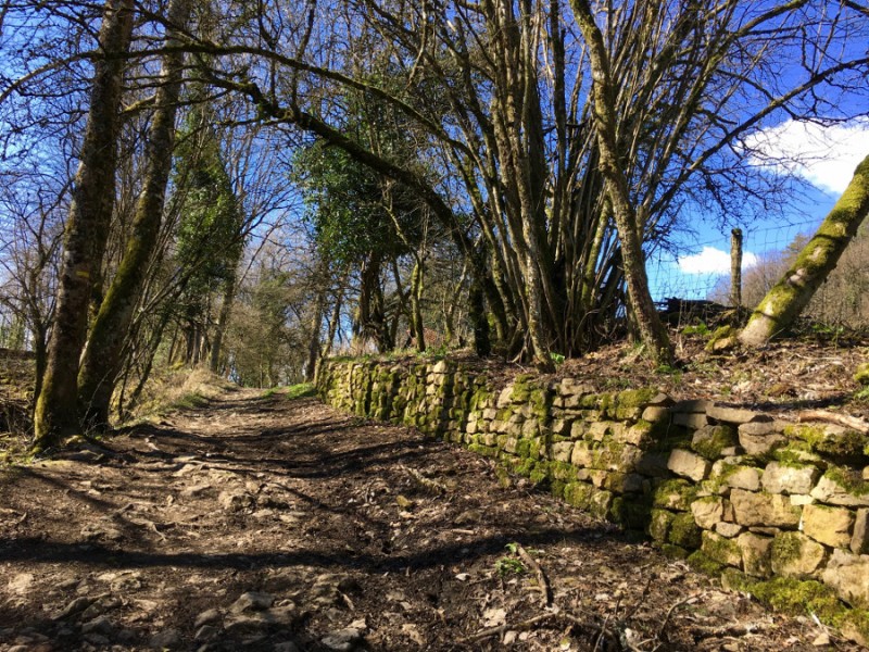
Firts, you will climb at the foot of the Citadel Vauban, a UNESCO World Heritage Site, before continuing to join Chaudanne Fortress and Rosemont Fortress. You will enjoy a breathtaking view of the Planoise Fortress before returning. You will discover cabordes, witnesses of the pastoral history of the place. The return to the starting point will be by the canal fluvial, under the citadel.
Area : Besançon
Report a problem
Roadbook route 4 The latest reviews & times
Charly430
finished in 01:51:07
The 2023/03/22
En savoir plus
Charly430
finished in 01:51:07
The 2023/03/22
En savoir plus
EmGo
The 2022/10/17
En savoir plus
Olisyl
The 2021/01/25
En savoir plus
coulou
finished in 01:39:23
The 2020/03/08
En savoir plus
See all reviews & times
2023/03/22 01:51:07
Charly430
Charly430
Super parcours avec un bon balisage.
2023/03/22 01:51:07
Charly430
Charly430
Super parcours avec un bon balisage.
2022/10/17 EmGo
J'ai fait le parcours aujourd'hui : aucun problème. Parcours praticable. Très beau.
2021/01/25 Olisyl
Parcours très technique à déconseiller aux débutants si vous ne voulez pas marcher 60% du parcours. Jolies grimpettes et descentes dans des pierriers. Très belles vues à découvrir.
2020/03/08 01:39:23
coulou
coulou
2019/07/29 01:32:51
MANU25
MANU25
Super parcours avec we belles montées et parcous tout en relance
Bravo aux traceurs
2019/07/28 01:15:00
Clement Brie
Clement Brie
Magnifique parcours, parfait pour s’entraîner et progresser, grâce a ces deux jolies grimpettes
2019/07/13 01:35:00
bourdeauxp
bourdeauxp
2019/03/03 01:45:00
Marco69
Marco69
2019/03/03 01:29:39
MomoLeSniper
MomoLeSniper
2019/02/24 01:28:27
MomoLeSniper
MomoLeSniper
2019/02/23 02:40:00
Arnaud Schultz Humbert
Arnaud Schultz Humbert
Super parcours
2018/12/31 02:07:08
Thomas25000
Thomas25000
2018/12/29 01:42:40
Marco69
Marco69
2018/12/23 01:47:15
Marco69
Marco69
2023/03/22 01:51:07
Charly430
Charly430
Super parcours avec un bon balisage.
2023/03/22 01:51:07
Charly430
Charly430
Super parcours avec un bon balisage.
2022/10/17 EmGo
J'ai fait le parcours aujourd'hui : aucun problème. Parcours praticable. Très beau.
2021/01/25 Olisyl
Parcours très technique à déconseiller aux débutants si vous ne voulez pas marcher 60% du parcours. Jolies grimpettes et descentes dans des pierriers. Très belles vues à découvrir.
2020/03/08 01:39:23
coulou
coulou
2019/07/29 01:32:51
MANU25
MANU25
Super parcours avec we belles montées et parcous tout en relance
Bravo aux traceurs
2019/07/28 01:15:00
Clement Brie
Clement Brie
Magnifique parcours, parfait pour s’entraîner et progresser, grâce a ces deux jolies grimpettes
2019/07/13 01:35:00
bourdeauxp
bourdeauxp
2019/03/03 01:45:00
Marco69
Marco69
2019/03/03 01:29:39
MomoLeSniper
MomoLeSniper
2019/02/24 01:28:27
MomoLeSniper
MomoLeSniper
2019/02/23 02:40:00
Arnaud Schultz Humbert
Arnaud Schultz Humbert
Super parcours
2018/12/31 02:07:08
Thomas25000
Thomas25000
2018/12/29 01:42:40
Marco69
Marco69
2018/12/23 01:47:15
Marco69
Marco69
Services nearby

Grand Besançon Trail Académie
Besançon
SNB canoë kayak dragon boat
Besançon

SNB canoë kayak dragon boat
Besançon
SNB Aviron
Besançon

Grand Besançon Trail Académie
Besançon


Follow us on
the digital trails
the digital trails


![]()
Info & contacts
Ville de Besançon
Direction des Sports
+33(0)3 81 41 23 05
Grand Besançon Métropole
Service Tourisme
+33(0)3 81 87 88 61
 Besançon Grandes Heures Nature - Parcours - Route 4 blue - Chaudanne - Rosemont
Hello, world! This is a toast message.
Besançon Grandes Heures Nature - Parcours - Route 4 blue - Chaudanne - Rosemont
Hello, world! This is a toast message.
Besançon Grandes Heures Nature - Parcours - Route 4 blue - Chaudanne - Rosemont
Hello, world! This is a toast message.


OK
Annuler