
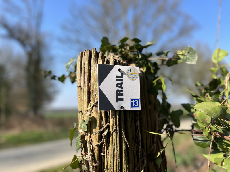
To help you find your way around, the Brocéliande Espace Trail courses is equipped with trail markers. On each marker will be affixed the number(s) of the course to be followed on their difficulty colour (green - blue - red - black).
You can also use the other supports at your disposal :
- GPX files
- PDF files
- Trail Connect mobile app (destination to discover)
Before your run :
- Check the weather forecast before you leave, the itineraries can be dangerous in case of bad weather.
- Find out about the state of the route
- Before you leave Inform someone close to you of your itinerary and the planned timetables
- Take water and food and drink
On the routes :
- Please respect the natural and agricultural environments you pass through ;
- Close the barriers after you have passed through
- Stay on the paths and do not cut the laces.
- All parts of the route using public roads are subject to the Highway Code.
- Please make sure that you observe them.
- Keep all your rubbish with you.
A problem ? Report it ! In the event of problem (lack of markings, maintenance problems, environmental problems...), do not hesitate to signal this problem by using the reporting tool available on the route page, on the website (button under the map). You will be able to geolocate the problem and also send a corresponding photo. The Espace manager will be automatically notified of your report and will be able to check and deal with the problem.

Office de tourisme de Ploërmel Communauté
Place de l'Hôtel de Ville - 50120 Josselin
+33(0)2 97 22 36 43
Office de Tourisme
Contact mail
![]()
Montfort Communauté Tourist Office
Lac de Trémelin - 35750 Iffendic
+33(0)2 99 09 06 50
Tourist Office
send mail

