

Au cœur de Guerlédan, un patrimoine industriel à découvrir au fil de l’eau… Depuis la rive sud du lac de Guerlédan, vous serez époustouflé par les vues panoramiques sur cette vallée engloutie par les eaux. La construction du barrage de Guerlédan en 1930 a entraîné l’immersion de 17 écluses du canal de Nantes à Brest. Il s’agit de la plus importante retenue d’eau potable de Bretagne ! Départ du circuit depuis le parking de l'église de Saint Aignan

- Distance 13.1 km
- Elevation gain 390 m
- Elevation lost 390 m
- Min. elevation 81 m
- Max. elevation. 233 m
- Duration (depending on pace) 2h
- Marking Jaune

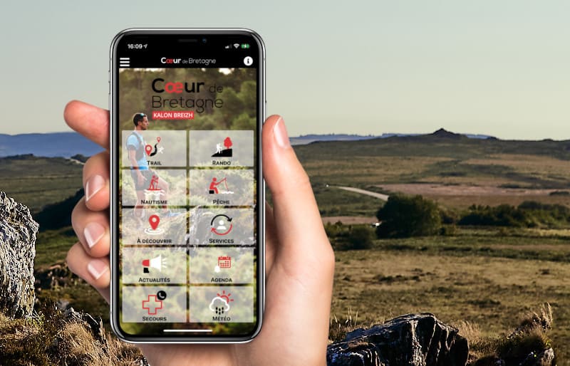
The Cœur de Bretagne app allows you to find all the trail running, hiking, biking and horseriding trails on your smartphone, and much more!
A lot of features are in the app, including:
- geolocalisation on the route
- download data for offline access
- detailed IGN maps
- add your chrono on the route
- find the services nearby...






the digital trails



Infos & contact
Destination Coeur de Bretagne - Kalon Breizh
6 rue Joseph Pennec
22110 Rostrenen
Tel. +33(0)2 96 29 26 53
 Destination Cœur de Bretagne - Parcours - Circuit du barrage de Guerlédan
Destination Cœur de Bretagne - Parcours - Circuit du barrage de Guerlédan
Destination Cœur de Bretagne - Parcours - Circuit du barrage de Guerlédan
Destination Cœur de Bretagne - Parcours - Circuit du barrage de Guerlédan
Destination Cœur de Bretagne - Parcours - Circuit du barrage de Guerlédan


