Gers circuit (n°4 Flaine)
Add to my favorites

Caution! Zone of vigilance near the route
LES SALAMANES - du 10/07/2026 au 01/09/2026 Upcoming
SALES - du 30/06/2026 au 20/07/2026 Upcoming
LES FOGES - du 05/07/2026 au 25/09/2026 Upcoming
CURALLA PLATE - du 01/07/2026 au 30/09/2026 Upcoming
Route closed
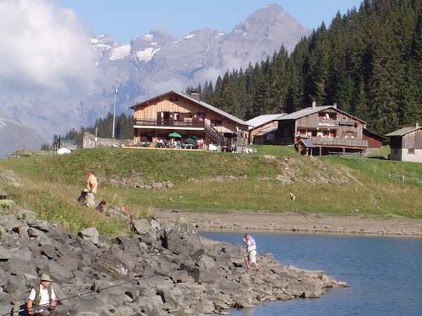
From the top of the Grandes Platières, follow the signs for the “Lac et Refuge de Gers”. The trail leads down into a combe, skirting around the lake and passing through the Chalets de Gers, before heading to the “Combe des foges”. The trail then climbs back up to the Chalets de Foges via the Pas des Foges. As you make your way up the valley side, enjoy beautiful views of the Haut Giffre mountains. At the Col de Platé, head back to the Grandes Platières.
The characteristics of the route.

Sixt-Fer-à-Cheval (74)
- Distance 15.66 km
- Elevation gain 1050 m
- Elevation lost 1050 m
- Min. elevation 1501 m
- Max. elevation. 2478 m
- Duration (depending on pace) 6h
- Marking yes
PierreRando
finished in 07:15:00
The 2024/08/24
En savoir plus
PierreRando
finished in 07:15:00
The 2024/08/24
En savoir plus
Ajouter votre chrono et partager vos sensations
2024/08/24 07:15:00
PierreRando
PierreRando
Belle randonné à la journée et qui mérite son classement rouge.
Faite en famille avec un rythme adapté et de nombreuses pauses nous avons mis 7h15, dont 3 heures en descente.
Le passage qui nécessite un surcroît d’attention est le premier 1,5 km de descente dans la combe de Gers car le sol est de la caillasse et un peu glissant mais le chemin étant assez large cela reste sûr à deux ou trois passages près.
Le timing est juste pour tout faire sur l’ouverture du DMC si on prend son temps.


Follow us on
the digital trails
the digital trails


![]()
Infos & contacts
Flaine Tourist Office
Tél. +33 (0)4 50 90 80 01
Les Carroz sports club
sports@aracheslafrasse.fr - Tél. +33 (0)4 50 90 24 80
Cluses Arve & montagnes Tourist Office
Tél. +33 (0)4 50 96 69 69
 Espace Trail Flaine - Les Carroz - Cluses Arve et Montagnes - Parcours - Gers circuit (n°4 Flaine)
Hello, world! This is a toast message.
Espace Trail Flaine - Les Carroz - Cluses Arve et Montagnes - Parcours - Gers circuit (n°4 Flaine)
Hello, world! This is a toast message.
Espace Trail Flaine - Les Carroz - Cluses Arve et Montagnes - Parcours - Gers circuit (n°4 Flaine)
Hello, world! This is a toast message.


OK
Annuler