
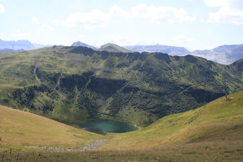
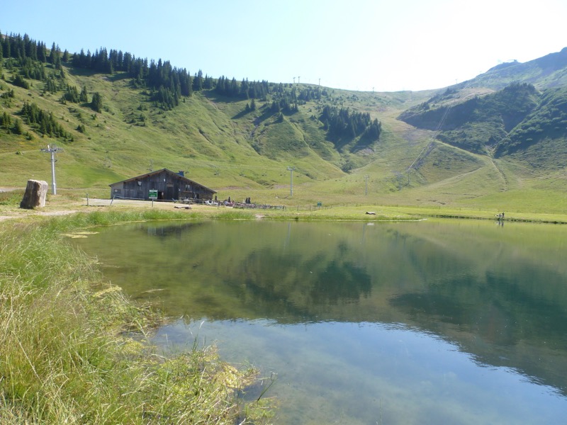
From the Grandes Platières cable car departure station (Flaine forum), follow signs for «les Grands Vans». At «Balacha» (Flaine Forêt), head for the “Col de Pierre Carrée”. At the col, follow signs for “Vernant”. At the Vernant car park, follow signs for “l’Airon”. As you leave the woods, enjoy a beautiful view of the Aravis mountains and the Arve valley. The path winds through dwarf willows (the forest's way of adapting to the harsh weather conditions and avalanches). Before reaching the chalet at l'Airon, you will cross the marshy bottom of the depression that was covered with ice during the last ice age (Little Ice Age = Middle Ages). From the Lac de l'Airon, take the forest road up to the Pointe de Cupoire, from where you can look out over Les Carroz d'Arâches and the Arve valley. From the summit, follow signs for “Tête du Pré des Saix”, where stunning panoramic views await you at altitudes of 2,114 metres. From the Tête du Pré des Saix (Bérard cross), go back down to the Col de Vernant and then the Lac de Vernant. Once you reach the Vernant car park, go back to Flaine the same way you came.

- Distance 18.52 km
- Elevation gain 850 m
- Elevation lost 850 m
- Min. elevation 1599 m
- Max. elevation. 2107 m
- Duration (depending on pace) 5h
- Marking yes


the digital trails


![]()
Infos & contacts
Flaine Tourist Office
Tél. +33 (0)4 50 90 80 01
Les Carroz sports club
sports@aracheslafrasse.fr - Tél. +33 (0)4 50 90 24 80
Cluses Arve & montagnes Tourist Office
Tél. +33 (0)4 50 96 69 69
 Espace Trail Flaine - Les Carroz - Cluses Arve et Montagnes - Parcours - Pré des Saix Circuit (n°9 Flaine)
Espace Trail Flaine - Les Carroz - Cluses Arve et Montagnes - Parcours - Pré des Saix Circuit (n°9 Flaine)
Espace Trail Flaine - Les Carroz - Cluses Arve et Montagnes - Parcours - Pré des Saix Circuit (n°9 Flaine)
Espace Trail Flaine - Les Carroz - Cluses Arve et Montagnes - Parcours - Pré des Saix Circuit (n°9 Flaine)
Espace Trail Flaine - Les Carroz - Cluses Arve et Montagnes - Parcours - Pré des Saix Circuit (n°9 Flaine)

