The blessed lake - Hike
Add to my favorites

Route opened
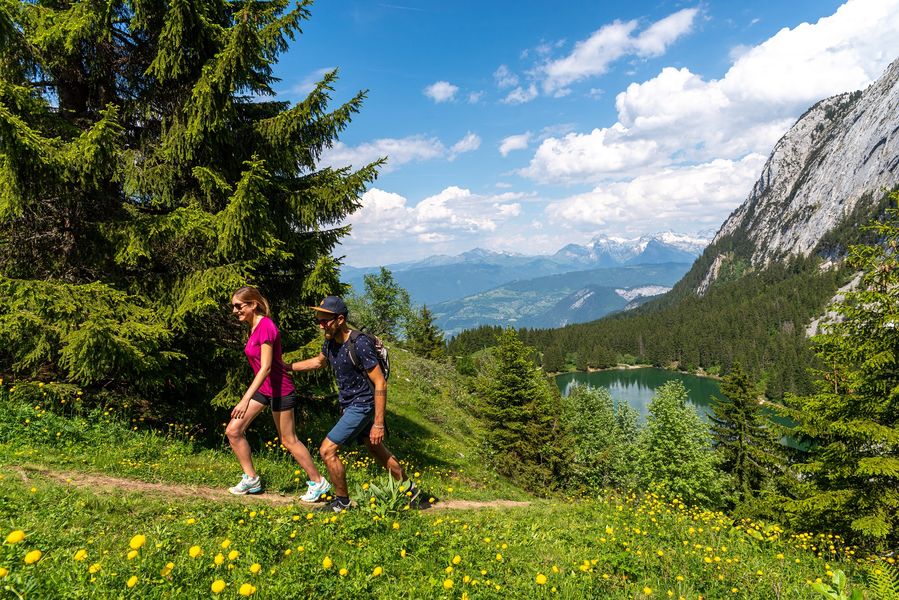
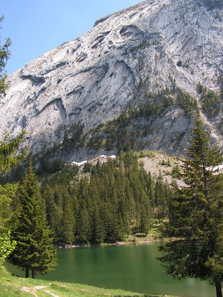
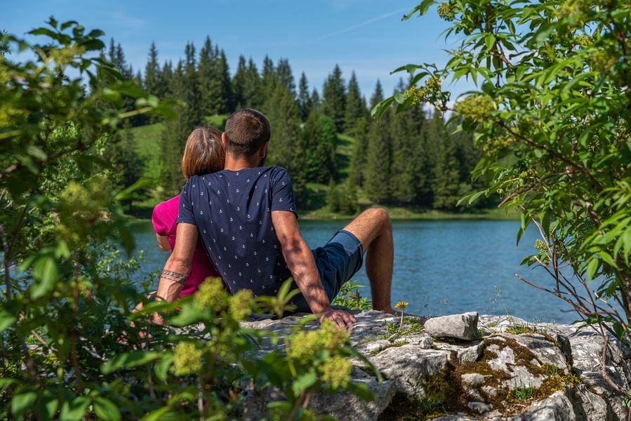
A lovely family walk that offers a wonderful view of the surrounding valleys and mountains.
Bivouac is prohibited around the lake.
The characteristics of the route.

Mont-Saxonnex (74)
- Distance 7.78 km
- Elevation gain 490 m
- Elevation lost 490 m
- Min. elevation 1146 m
- Max. elevation. 1576 m
- Duration (depending on pace) 3h
- Marking Yes
Step-by-step guide : From the car park, follow the wide track which goes up in the direction of Lac Bénit. It goes up in the forest before going alongside the ski lift. In front of you, the two characteristic eyes of little Bargy. At the Pierre à Muselire, descend by the lake. The return is by the same route. To make the Lac Bénit loop more: From Lac Bénit to Morsullaz (parking): 1h20 Go up to the Pierre à Muselire sign. Go left towards Enténiou. Go around the top of the chairlift on the left to descend towards Morsullaz (parking). Under the cliffs of Grand Bargy, you will reach the ski slope. Take a right to enter the forest and join the departure of the chairlift. From Morsullaz (parking) to Bété (parking): 25 minutes Follow the path on the right across the fields towards Les Côtes. At Bété d´en Haut, leave the path and take the paved road which will bring you back to the Bété car park.Buvette du Lac Bénit open from Pentecost to September.
Possibility of fishing in Lake Bénit from June. License on sale at the Tourist Office.Marking : Trail marked with directional posts (PDIPR)Equipments : Sustainable development, Outhouse, Picnic area, Good plans : Buvette du Lac Bénit open from Pentecost to September.
Possibility of fishing in Lake Bénit from June. License on sale at the Tourist Office.Admission fee : Free access. Guidebook on sale at the Tourist Office.Opening : From 01/03 to 14/11 daily.
Area : Cluses Arve & Montagnes
Report a problem
Website Instructions to follow PDF map Camillebdll
The 2023/07/26
En savoir plus
mjjm
The 2021/08/17
En savoir plus
Ajouter votre chrono et partager vos sensations
2023/07/26 Camillebdll
Super randonnée. Beaux panoramas fait avec un bébé de 2 ans en port bébé. Retour dangereux (pente raide + cailloux) par temps humide je pense que dans le sens inverse ça serait plus simple.
2021/08/17 mjjm
Excellente randonnée. Si vous avez de la chance vous verrez même le couple de gypaètes barbus ;) ca vaut la peine et munissez vous de jumelles si possible


Information updated on 2026-04-28 by Cluses Arve & montagnes Tourisme


Follow us on
the digital trails
the digital trails


![]()
Infos & contacts
Flaine Tourist Office
Tél. +33 (0)4 50 90 80 01
Les Carroz sports club
sports@aracheslafrasse.fr - Tél. +33 (0)4 50 90 24 80
Cluses Arve & montagnes Tourist Office
Tél. +33 (0)4 50 96 69 69
 Espace Trail Flaine - Les Carroz - Cluses Arve et Montagnes - Parcours - The blessed lake - Hike
Hello, world! This is a toast message.
Espace Trail Flaine - Les Carroz - Cluses Arve et Montagnes - Parcours - The blessed lake - Hike
Hello, world! This is a toast message.
Espace Trail Flaine - Les Carroz - Cluses Arve et Montagnes - Parcours - The blessed lake - Hike
Hello, world! This is a toast message.


OK
Annuler