Chevran "panorama" - Hike
Add to my favorites

Caution! Zone of vigilance near the route
Bouche du Chevran - du 31/10/2025 au 30/10/2026 In progress
Route opened

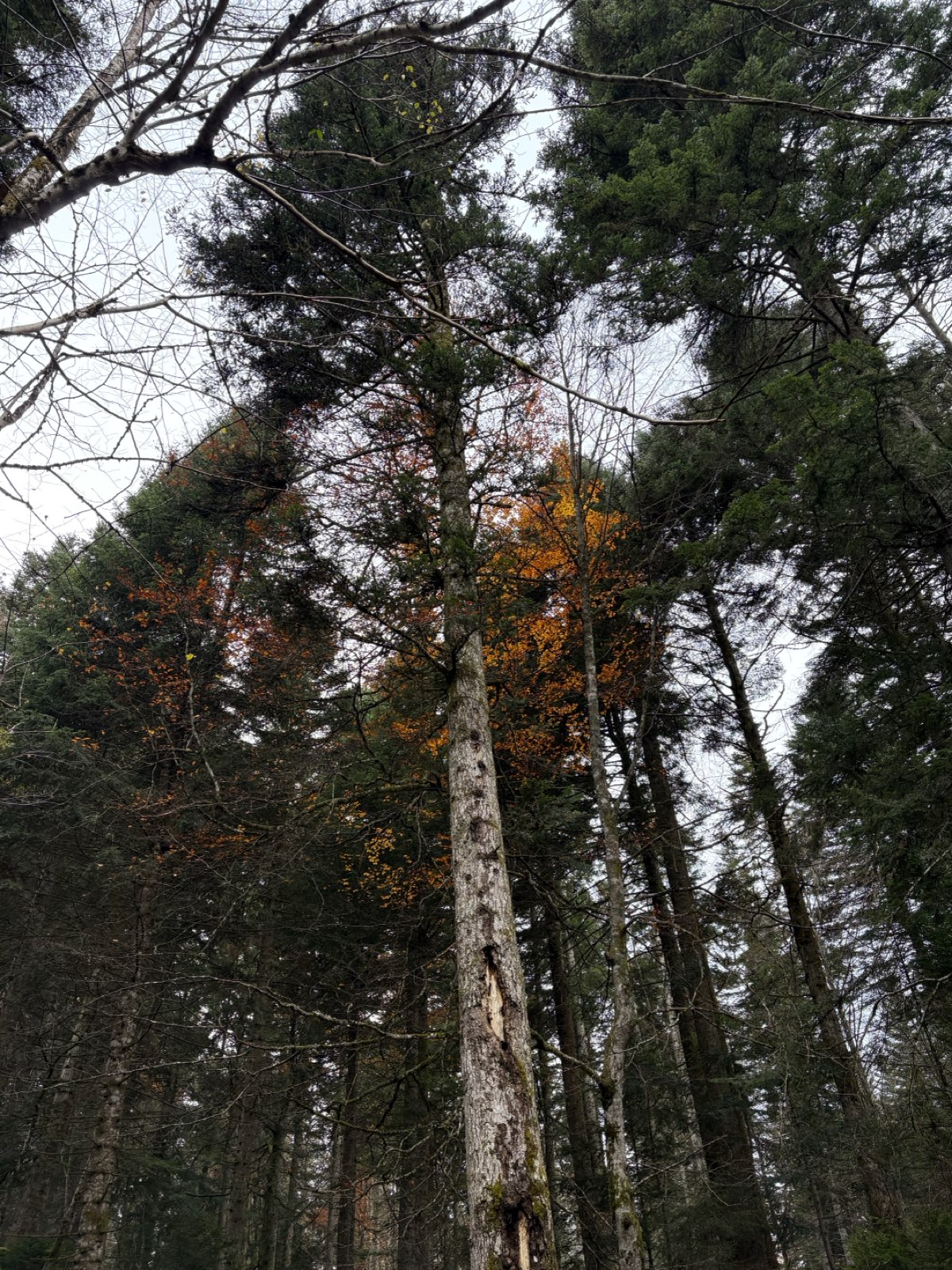
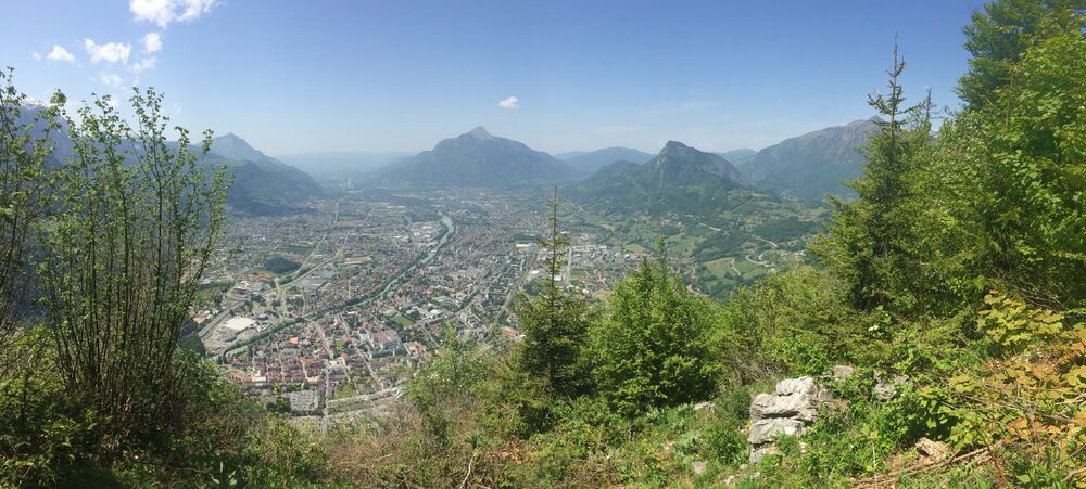
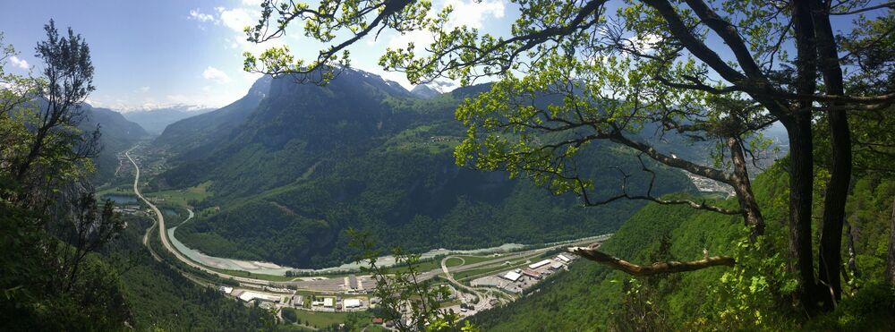
The Chevran mountain offers lovely views of the Arve valley and the surrounding mountains. A path, easy to access and without difficulty, takes you through mountain pastures and forests before arriving at the exceptional panorama.
The characteristics of the route.

Saint-Sigismond (74)
- Distance 3.9 km
- Elevation gain 270 m
- Elevation lost 260 m
- Min. elevation 947 m
- Max. elevation. 1195 m
- Duration (depending on pace) 2h
- Marking Yes
Step-by-step guide : From the Cross to the Maladière cliff: 40 minutes. Climb the carriage path. It is steep for a few meters. Cross the mountain pastures of Chevran from below and from above. Continue straight ahead to the viewpoint at the edge of the cliff. Variant: go to the Chevran panorama (15 min one way) to admire the view of the Arve Valley From the Maladière cliff to the intersection of the motorable path: 1h20 Continue your way taking the direction of "La Dent", while enjoying the viewpoints. You will find the educational trail with information terminals. A specific theme is developed at each station. All you have to do is follow the markings (small stakes with red arrows). In places you will have a handrail to hold on to, but there is no difficulty. To do more from Cluses: Le Tour du Chevran (for good walkers, steep passages): 2h50 (one way). Starting point: boulevard du Chevran – Cluses.The loop is dotted with information terminals on the geology, the habitat, the varied flora and fauna at this location, sometimes even surprising (lime, umbrella pine, etc.)Marking : Red ArrowGood plans : The loop is dotted with information terminals on the geology, the habitat, the varied flora and fauna at this location, sometimes even surprising (lime, umbrella pine, etc.)Admission fee : Free access.Opening : From 01/04 to 15/11.
Depending on weather conditions.
Subject to favorable weather.
Area : Cluses Arve & Montagnes
Report a problem
Website PDF map The latest reviews & times
Alexdauba
finished in 01:16:00
The 2025/10/29
En savoir plus
Alexdauba
The 2025/10/30
En savoir plus
Renard1-
The 2023/04/25
En savoir plus
mjjm
The 2022/07/31
En savoir plus
See all reviews & times
2025/10/30 Alexdauba
très belle balade mais accessibilité compliquée en raison de deux problèmes: présence de deux patous menaçants,( non signalés par un panneau) prêts à sauter la petite clôture nous obligeant à faire demi tour avec notre chien ( en laisse pourtant)-Tour réalisé à moitié et sentier pédagogique très intéressant mais jalonné de crevasses cachées sous les feuilles ( assez dangereux pour les chevilles)
2023/04/25 Renard1-
Avril 2023 : travaux de bûcheronnage vers le sentier pédagogique. itinéraire gras et encombré
2022/07/31 mjjm
Le superbe panorama se mérite!


Information updated on 2024-09-02 by Cluses Arve & montagnes Tourisme


Follow us on
the digital trails
the digital trails


![]()
Infos & contacts
Flaine Tourist Office
Tél. +33 (0)4 50 90 80 01
Les Carroz sports club
sports@aracheslafrasse.fr - Tél. +33 (0)4 50 90 24 80
Cluses Arve & montagnes Tourist Office
Tél. +33 (0)4 50 96 69 69
 Espace Trail Flaine - Les Carroz - Cluses Arve et Montagnes - Parcours - Chevran "panorama" - Hike
Hello, world! This is a toast message.
Espace Trail Flaine - Les Carroz - Cluses Arve et Montagnes - Parcours - Chevran "panorama" - Hike
Hello, world! This is a toast message.
Espace Trail Flaine - Les Carroz - Cluses Arve et Montagnes - Parcours - Chevran "panorama" - Hike
Hello, world! This is a toast message.


OK
Annuler