Mont-Ferront chalet - Hike
Add to my favorites

Route opened
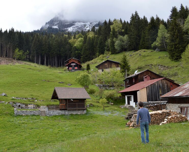
A pleasant hike in the middle of a calm and wild nature. Located on the Aravis range, The mountain pastures of Mont-Ferront are on a Zone
Natural (ZNIEFF): you can therefore see a great diversity of birds in this sector.
The characteristics of the route.

Magland (74)
- Distance 4.84 km
- Elevation gain 470 m
- Elevation lost 470 m
- Min. elevation 838 m
- Max. elevation. 1308 m
- Duration (depending on pace) 2h15
- Marking Yes
From Chéron to Creux de Varny: 45 minutes From the chapel, take the tarmac road on the left. Go up to the last house, and at the end of the road, take the path that goes up into the forest on your left. Then follow the white and red markings of the GR 96. At the first intersection, turn right. After about 30 minutes of climbing, you will reach a parking lot, Creux de Varny. From Creux de Varny to Mont-Ferront: 35 minutes Behind the explanatory panel, climb the "single-track" path which climbs into the forest. Cross the forest road and take the path opposite. After about 30 minutes on foot, you will reach the mountain pasture. The Notre-Dame des Chalets chapel in the Mont-Ferront mountain pasture is actually an oratory, erected in 1954. Continue on the path to gain height and admire the panorama. From Mont-Ferront to Chéron: 50 minutes Return by the same route.Respect the flora and fauna already weakened by winter. Keep your dogs on a leash. Bring back your rubbish.Marking : Trail marked with directional posts (PDIPR)Admission fee : Free access. Guidebook on sale at the Tourist Office.Opening : From 01/04 to 15/11 daily.
Subject to favorable weather.
Area : Cluses Arve & Montagnes
Report a problem
Website PDF map THIS ROUTE IN YOUR MOBILE PHONE
Download Flaine Carroz 2ccam Outdoor app
Get all the routes on your smartphone with Flaine Carroz 2ccam Outdoor app. You'll find a host of functions :
- Take advantage of detailed IGN maps
- Download data for consultation even when you're not connected to the network
- Geolocate yourself at any time on the route and altimeter profile
- Activate the off-track alarm to be alerted if you stray from the itinerary
- Find nearby services
- Share your experience (add a report, share your lap time)...

Add your time and share your feelings


Information updated on 2026-04-29 by Cluses Arve & montagnes Tourisme


Follow us on
the digital trails
the digital trails


![]()
Infos & contacts
Flaine Tourist Office
Tél. +33 (0)4 50 90 80 01
Les Carroz sports club
sports@aracheslafrasse.fr - Tél. +33 (0)4 50 90 24 80
Cluses Arve & montagnes Tourist Office
Tél. +33 (0)4 50 96 69 69
 Espace Trail Flaine - Les Carroz - Cluses Arve et Montagnes - Parcours - Mont-Ferront chalet - Hike
Hello, world! This is a toast message.
Espace Trail Flaine - Les Carroz - Cluses Arve et Montagnes - Parcours - Mont-Ferront chalet - Hike
Hello, world! This is a toast message.
Espace Trail Flaine - Les Carroz - Cluses Arve et Montagnes - Parcours - Mont-Ferront chalet - Hike
Hello, world! This is a toast message.


OK
Annuler