Pointe d'Orchez - Hike
Add to my favorites

Route opened

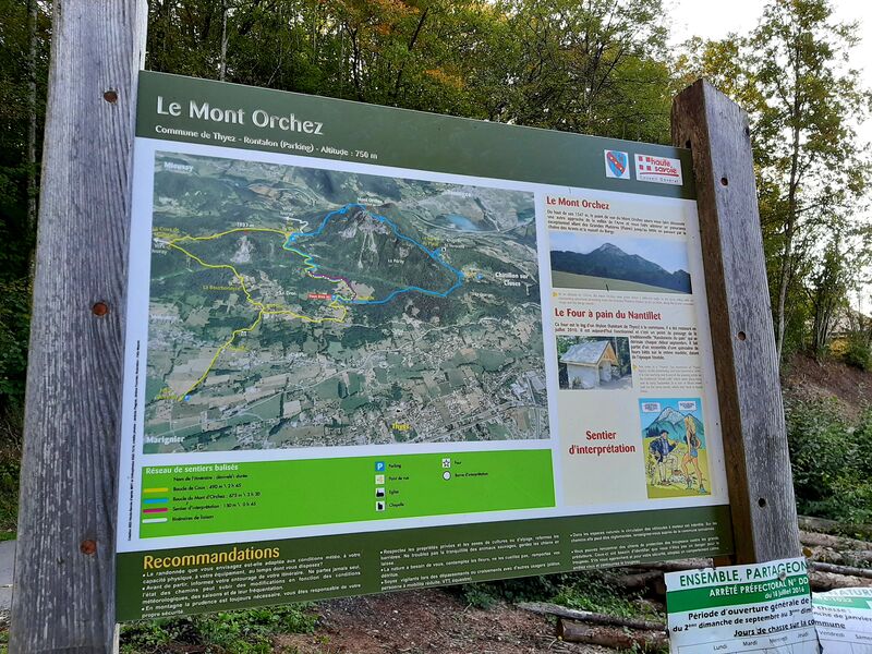
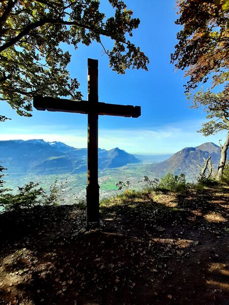
The Pointe d'Orchex offers you a superb panorama over the Arve valley, the Môle and the Bargy Massif. Designed for young and old, this fun and educational route is offered to you to understand the characteristic environment of the territory.
The characteristics of the route.

Thyez (74)
- Distance 7.11 km
- Elevation gain 680 m
- Elevation lost 680 m
- Min. elevation 737 m
- Max. elevation. 1337 m
- Duration (depending on pace) 3h
- Marking Yes
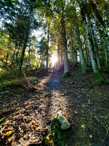
Step-by-step guide : From Rontalon to the top of Mont Orchez: 1h45 From the Rontalon car park, take the direction of Mont Orchez. The climb begins a bit on the road, then the path climbs to the left in the pastures. On leaving the park, turn right between the buildings. The path then passes through the undergrowth and cuts through the departmental road several times before arriving at a place called "Sur le Coux" (country atmosphere, inn, etc.). The climb continues through a beautiful forest by a sometimes very steep path. A handrail secures a technical passage that cannot be avoided: a handrail is installed to help you. At the top, a lovely view over the Arve valley, facing the Môle and the Bargy chain. From Mont Orchez to a place called Les Larroz: 50 min For the descent, follow the direction of Larroz via the Creux du Plane. You will meander through a pretty forest, on a fairly steep descent but without any difficulty. At Creux du Plane, take the direction of Larroz. You will arrive in the hamlet. From Larroz to Rontalon car park: 30 min Cross the hamlet of Larroz, and take the direction of the Rontalon car park. You will follow a balcony path, which will offer a beautiful view of the massifs. At the end of the forest, you will arrive in a meadow, go towards the chalet, and take the direction of the car park.Thyez is a city whose economy and urban landscape are marked by
industry (watchmaking then bar turning). Many Gallo-Roman remains have been found during excavations around the Roman parish church.Marking : Trail marked with directional posts (PDIPR)Admission fee : Free access. Guidebook on sale at the Tourist Office.Opening : From 01/04 to 15/11.
Subject to favorable weather.
Area : Cluses Arve & Montagnes
Report a problem
Website PDF map mjjm
The 2021/08/11
En savoir plus
Ajouter votre chrono et partager vos sensations
2021/08/11 mjjm
Très belle rando avec des points de vue fantastiques!
2021/08/11 mjjm
Très belle rando avec des points de vue fantastiques!


Information updated on 2025-02-25 by Cluses Arve & montagnes Tourisme


Follow us on
the digital trails
the digital trails


![]()
Infos & contacts
Flaine Tourist Office
Tél. +33 (0)4 50 90 80 01
Les Carroz sports club
sports@aracheslafrasse.fr - Tél. +33 (0)4 50 90 24 80
Cluses Arve & montagnes Tourist Office
Tél. +33 (0)4 50 96 69 69
 Espace Trail Flaine - Les Carroz - Cluses Arve et Montagnes - Parcours - Pointe d'Orchez - Hike
Hello, world! This is a toast message.
Espace Trail Flaine - Les Carroz - Cluses Arve et Montagnes - Parcours - Pointe d'Orchez - Hike
Hello, world! This is a toast message.
Espace Trail Flaine - Les Carroz - Cluses Arve et Montagnes - Parcours - Pointe d'Orchez - Hike
Hello, world! This is a toast message.


OK
Annuler