La Caronière - Winter hike
Add to my favorites

Route closed
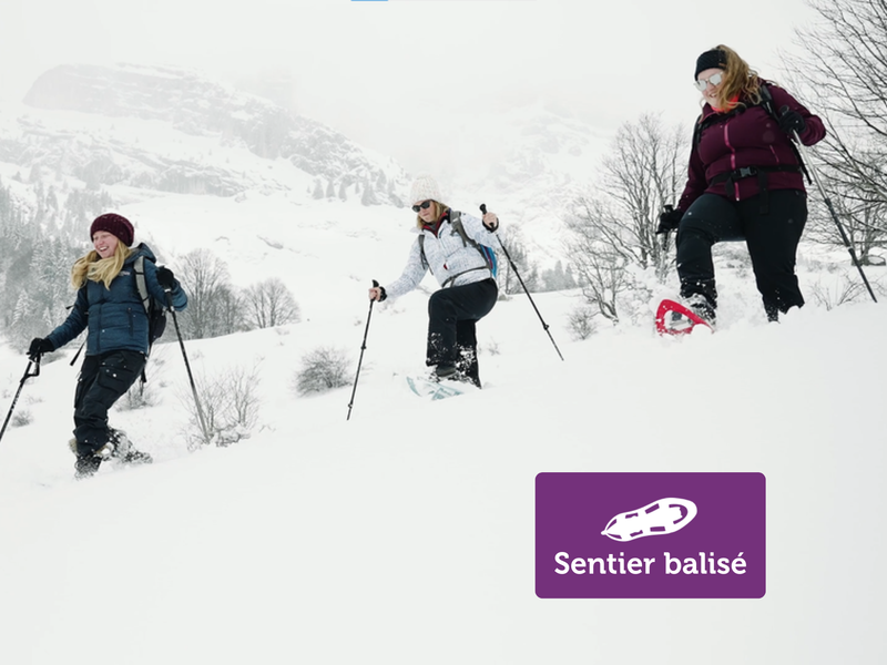
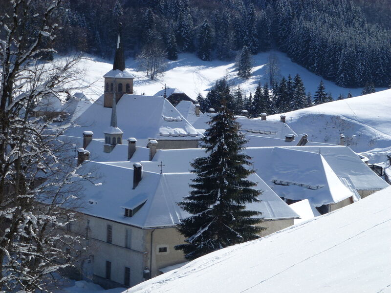
Enjoy breathtaking views over the roofs of Le Carmel and the surrounding peaks on this short hike from Le Reposoir. A signposted itinerary, ideal for walking in complete safety and admiring the beauty of the mountain scenery.
The characteristics of the route.
Le Reposoir (74)
- Distance 1.9 km
- Elevation gain 130 m
- Elevation lost 130 m
- Min. elevation 1041 m
- Max. elevation. 1167 m
- Duration (depending on pace) 1h30
- Marking Yes
The route starts at the edge of the lake. Follow the banks in the direction of the Carmel du Reposoir. Depending on snow conditions, you can put on your snowshoes here. At the foot of the Carmel, take the path that rises to your right. After a short climb, fork left to follow the path along the edge of the forest. This balcony passage offers a spectacular view of the roofs of Carmel below, nestled in its mountain setting. Take time to admire the architecture of this historic monument from this natural belvedere. Continue to the end of the forested area. Here, turn right into the woods. The path winds pleasantly under the trees, offering a hushed atmosphere typical of winter outings. At the end of this woodland, the landscape opens up again. Continue along the main path, which climbs to the left through snow-covered alpine meadows. This last section takes you to the Chalet de la Caronière, the highest point of your hike. Return: after enjoying the peace and quiet of the valley, take the same route back as on the outward journey. The descent allows you to rediscover the views of the Reposoir valley from a different angle.Opening subject to snow conditions.Marking : Purple signsEquipments : Free car park, Car park, Admission fee : Free access. Snowshoeing guidebook on sale at the Tourist Office.Opening : Closed temporarily.
Area : Cluses Arve & Montagnes
Report a problem
Website PDF map
Add your time and share your feelings


Information updated on 2026-04-21 by Cluses Arve & montagnes Tourisme


Follow us on
the digital trails
the digital trails


![]()
Infos & contacts
Flaine Tourist Office
Tél. +33 (0)4 50 90 80 01
Les Carroz sports club
sports@aracheslafrasse.fr - Tél. +33 (0)4 50 90 24 80
Cluses Arve & montagnes Tourist Office
Tél. +33 (0)4 50 96 69 69
 Espace Trail Flaine - Les Carroz - Cluses Arve et Montagnes - Parcours - La Caronière - Winter hike
Hello, world! This is a toast message.
Espace Trail Flaine - Les Carroz - Cluses Arve et Montagnes - Parcours - La Caronière - Winter hike
Hello, world! This is a toast message.
Espace Trail Flaine - Les Carroz - Cluses Arve et Montagnes - Parcours - La Caronière - Winter hike
Hello, world! This is a toast message.


OK
Annuler