La Bordaz (Agy) - Winter hike
Add to my favorites

Route closed
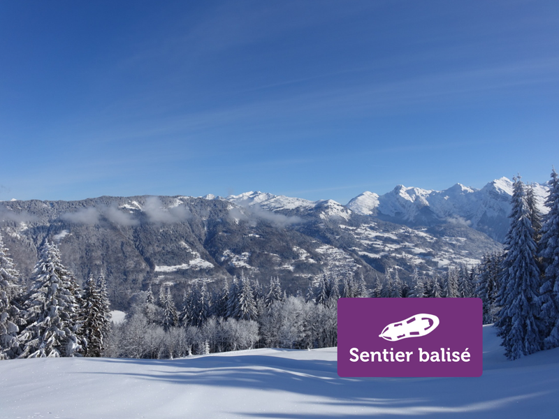
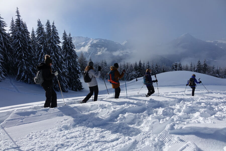
Enjoy an ideal walk with children on the Agy plateau! This easy itinerary offers a unique panorama of the Arve valley and the emblematic summit of Le Môle. A magical moment to share with your family in the fresh air.
The characteristics of the route.
Saint-Sigismond (74)
- Distance 4.5 km
- Elevation gain 140 m
- Elevation lost 140 m
- Min. elevation 1275 m
- Max. elevation. 1394 m
- Duration (depending on pace) 1h15
- Marking Yes
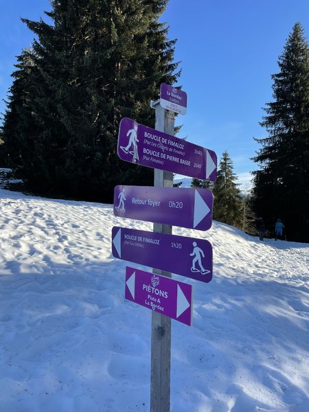
Take the departure of the footpaths on the right. You start with a small climb that goes along the ski slopes. At the "La Bordaz" intersection, turn right towards "Boucle de Fimaloz - par les Chalets". Then continue on the path that goes under the woods. At the "Fimaloz" sign, turn left to return to the ski center. Find the wide path of "Tête Noire" and continue your path straight until the start of the hike.Opening subject to snow conditions.Marking : "Boucle A", purple signEquipments : Free car park, Covered picnic area, Car park, Public WC, Picnic area, Admission fee : Free access. Snowshoeing guidebook on sale at the Tourist Office.Opening : Closed temporarily.
Area : Cluses Arve & Montagnes
Report a problem
Website Nordic slope map PDF map
Add your time and share your feelings


Information updated on 2026-04-21 by Cluses Arve & montagnes Tourisme


Follow us on
the digital trails
the digital trails


![]()
Infos & contacts
Flaine Tourist Office
Tél. +33 (0)4 50 90 80 01
Les Carroz sports club
sports@aracheslafrasse.fr - Tél. +33 (0)4 50 90 24 80
Cluses Arve & montagnes Tourist Office
Tél. +33 (0)4 50 96 69 69
 Espace Trail Flaine - Les Carroz - Cluses Arve et Montagnes - Parcours - La Bordaz (Agy) - Winter hike
Hello, world! This is a toast message.
Espace Trail Flaine - Les Carroz - Cluses Arve et Montagnes - Parcours - La Bordaz (Agy) - Winter hike
Hello, world! This is a toast message.
Espace Trail Flaine - Les Carroz - Cluses Arve et Montagnes - Parcours - La Bordaz (Agy) - Winter hike
Hello, world! This is a toast message.


OK
Annuler