Tour de la Tête de Romme - Winter hike
Add to my favorites

Route opened
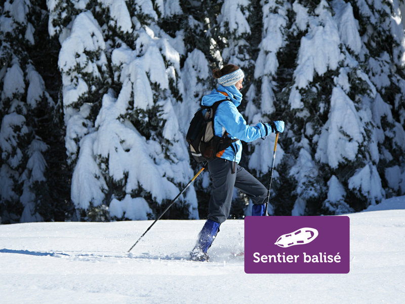
Walk to discover forest life and a hamlet like that of Romme. With a departure from the center of the village, this hike is accessible both in summer and in winter. Snowshoes are therefore recommended during snowfall.
The characteristics of the route.
Nancy-sur-Cluses (74)
- Distance 3.8 km
- Elevation gain 220 m
- Elevation lost 220 m
- Min. elevation 1291 m
- Max. elevation. 1411 m
- Duration (depending on pace) 1h20
- Marking Yes
From the restaurant, continue on the road for 100 m and watch out for the path on your left, signposted "Tour de la tête de Romme". Before the forest, follow the signs for "Tour de la tête de Romme par Charvet" on your right. Then follow the signs for "Tour de la tête de Romme". The main difficulty of this loop is the steep 300 m descent. After this descent, turn left onto the path signposted "Tour de Romme par les sangles"; it takes you back to the hamlet. Alternative : Take the steep climb for 150 m, on the left, at the start of the descent. You'll reach the top of the tête de Romme (1463 m). Continue straight on to retrace your steps. Itinerary to be avoided in bad weather - rocky ridgeOpening subject to snow conditions.Marking : Purple signEquipments : Covered picnic area, Public WC, Picnic area, Admission fee : Free access. Snowshoeing guidebook on sale at the Tourist Office.Opening : Closed temporarily.
Area : Cluses Arve & Montagnes
Report a problem
Website PDF map
Add your time and share your feelings


Information updated on 2026-04-21 by Cluses Arve & montagnes Tourisme


Follow us on
the digital trails
the digital trails


![]()
Infos & contacts
Flaine Tourist Office
Tél. +33 (0)4 50 90 80 01
Les Carroz sports club
sports@aracheslafrasse.fr - Tél. +33 (0)4 50 90 24 80
Cluses Arve & montagnes Tourist Office
Tél. +33 (0)4 50 96 69 69
 Espace Trail Flaine - Les Carroz - Cluses Arve et Montagnes - Parcours - Tour de la Tête de Romme - Winter hike
Hello, world! This is a toast message.
Espace Trail Flaine - Les Carroz - Cluses Arve et Montagnes - Parcours - Tour de la Tête de Romme - Winter hike
Hello, world! This is a toast message.
Espace Trail Flaine - Les Carroz - Cluses Arve et Montagnes - Parcours - Tour de la Tête de Romme - Winter hike
Hello, world! This is a toast message.


OK
Annuler