Montarquis cave - Hike
Add to my favorites

Caution! Zone of vigilance near the route
AUFFERAND - du 30/06/2026 au 05/08/2026 Upcoming
PEYRE - du 10/06/2026 au 10/07/2026 In progress
MONTARQUIS - du 01/06/2026 au 20/10/2026 In progress
Route opened
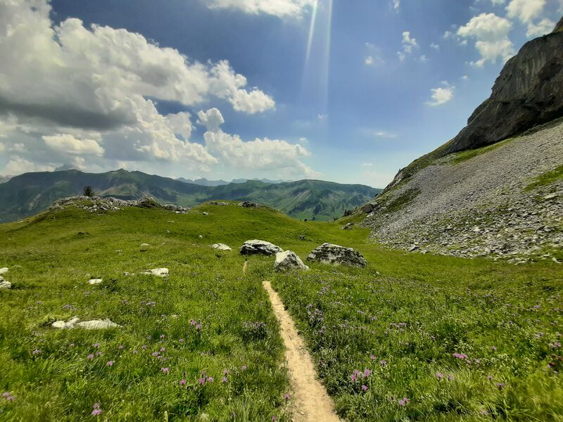
Departing from Col de la Colombière, after 2 hours of walking through lawns and scree, you can access these caves, located at an altitude of nearly 2000 m at the start of the Bargy chain.
The characteristics of the route.

Le Reposoir (74)
- Distance 7.12 km
- Elevation gain 490 m
- Elevation lost 490 m
- Min. elevation 1607 m
- Max. elevation. 1987 m
- Duration (depending on pace) 3h30
- Marking Yes
Step-by-step guide : Special recommendation: be careful, patous on the area Itinerary: The start is located near the Col de la Colombière chalet-restaurant. Follow the marked path "Grotte de Montarquis (2h20)" and quickly leave the other path to the left which leads to the Jalouvre. After a 30-minute walk, you arrive at the Chalets de la Colombière. Then turn right towards the cave. Follow the hilly path and cross a park where there is a flock of sheep. Continue like this for 25 minutes, until you reach the sign "Montarquis (Ruines)". The path then becomes steeper, leave the park and turn left at the small sign “Grotte de Montarquis”. Continue for 35 minutes before reaching the final climb (about 45 minutes) in a scree. At the top, enjoy the life on the Aravis massif and the fresh air that emanates from the cave. The descent is made by the same path as on the way out.Marking : Trail marked with directional posts (PDIPR)Equipments : Car park, Delicate passages : The end of the trail is steep and in scree.Admission fee : Free access. Guidebook on sale at the Tourist Office.Opening : From 01/06 to 15/11 daily.
The opening periods vary depending on the opening of the col de la Colombière departmental road, which is closed throughout the winter season.
Road closure depending on weather conditions.
Canceled or closed.
Area : Cluses Arve & Montagnes
Report a problem
Website PDF map THIS ROUTE IN YOUR MOBILE PHONE
Download Flaine Carroz 2ccam Outdoor app
Get all the routes on your smartphone with Flaine Carroz 2ccam Outdoor app. You'll find a host of functions :
- Take advantage of detailed IGN maps
- Download data for consultation even when you're not connected to the network
- Geolocate yourself at any time on the route and altimeter profile
- Activate the off-track alarm to be alerted if you stray from the itinerary
- Find nearby services
- Share your experience (add a report, share your lap time)...

Add your time and share your feelings


Information updated on 2026-06-01 by Cluses Arve & montagnes Tourisme


Follow us on
the digital trails
the digital trails


![]()
Infos & contacts
Flaine Tourist Office
Tél. +33 (0)4 50 90 80 01
Les Carroz sports club
sports@aracheslafrasse.fr - Tél. +33 (0)4 50 90 24 80
Cluses Arve & montagnes Tourist Office
Tél. +33 (0)4 50 96 69 69
 Espace Trail Flaine - Les Carroz - Cluses Arve et Montagnes - Parcours - Montarquis cave - Hike
Hello, world! This is a toast message.
Espace Trail Flaine - Les Carroz - Cluses Arve et Montagnes - Parcours - Montarquis cave - Hike
Hello, world! This is a toast message.
Espace Trail Flaine - Les Carroz - Cluses Arve et Montagnes - Parcours - Montarquis cave - Hike
Hello, world! This is a toast message.


OK
Annuler