La Cha - Winter hike
Add to my favorites

Caution! Zone of vigilance near the route
Chalet Neuf - glissement terrain - du 01/11/2023 au 01/12/2024 In progress
Alpage de la Cha - du 01/06/2024 au 15/09/2024 In progress
Route closed
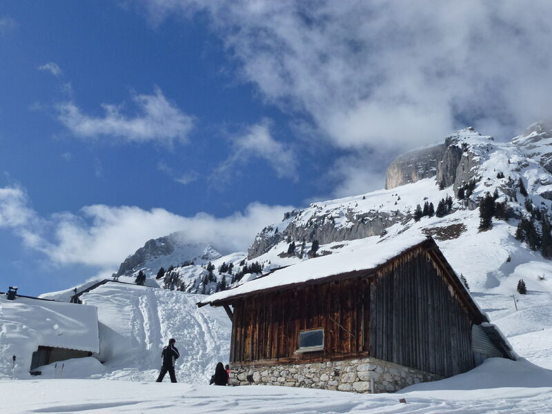
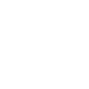
Beautiful hike in the unspoiled alpine pastures of le Reposoir. You will cross through several alpine chalets.
The characteristics of the route.
Le Reposoir ()
- Distance 4 km
- Elevation gain 290 m
- Elevation lost 290 m
- Min. elevation 1235 m
- Max. elevation. 1525 m
- Duration (depending on pace) 2h
- Marking No
The uphill hike starts at the locality «Saint-Bruno» close to a beautiful former farm with clapboard facade. Take the 4x4 trail that goes up to «La Cha». The path goes by the Malatrait halt, a former residence that closely resembles its original version. The path continues in the forest with a sharper ascent to the La
Cha chalets. Take the same route to go back.Equipments : Car park, Free car park, Delicate passages : Follow the summer sign.Admission fee : Free access. Guidebook on sale at the Tourist Office.Opening : From 15/12 to 31/03.
Opening depending on snow conditions.
Subject to favorable snow and weather conditions.
Area : Cluses Arve & Montagnes
Report a problem Add a comment
Website PDF map
Add your time and share your feelings


Information updated on 2023-02-01 by Cluses Arve & montagnes Tourisme


Follow us on
the digital trails
the digital trails


![]()
Infos & contacts
Flaine Tourist Office
Tél. +33 (0)4 50 90 80 01
Les Carroz sports club
sports@aracheslafrasse.fr - Tél. +33 (0)4 50 90 24 80
Cluses Arve & montagnes Tourist Office
Tél. +33 (0)4 50 96 69 69


OK
Annuler