The Glaciers - Winter hike
Add to my favorites

Route closed
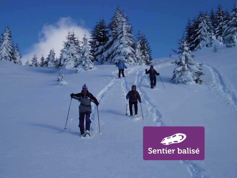
An ideal route for families and beginners in the heart of the Mont-Saxonnex forests. Taste the joy of freedom in the heart of nature on this easy, rejuvenating route. A truly enchanted mountain interlude!
The characteristics of the route.
Mont-Saxonnex (74)
- Distance 4.1 km
- Elevation gain 210 m
- Elevation lost 210 m
- Min. elevation 999 m
- Max. elevation. 1209 m
- Duration (depending on pace) 2h15
- Marking No
From the goat farm, take the path that climbs steadily through the forest to the oratory of La Gouille. It comes out on a small road at the sign "La Gouille". Then turn right, in the direction of "Les Glaciers". Continue straight on to the chalets. Come-back by the same route. Follow the summer signs.Opening subject to snow conditions.Equipments : Free car park, Car park, Admission fee : Free access. Snowshoeing guidebook on sale at the Tourist Office.Opening : Closed temporarily.
Area : Cluses Arve & Montagnes
Report a problem
Website PDF map THIS ROUTE IN YOUR MOBILE PHONE
Download Flaine Carroz 2ccam Outdoor app
Get all the routes on your smartphone with Flaine Carroz 2ccam Outdoor app. You'll find a host of functions :
- Take advantage of detailed IGN maps
- Download data for consultation even when you're not connected to the network
- Geolocate yourself at any time on the route and altimeter profile
- Activate the off-track alarm to be alerted if you stray from the itinerary
- Find nearby services
- Share your experience (add a report, share your lap time)...

Add your time and share your feelings


Information updated on 2026-04-21 by Cluses Arve & montagnes Tourisme


Follow us on
the digital trails
the digital trails




Infos & contacts
Flaine Tourist Office
Tél. +33 (0)4 50 90 80 01
Les Carroz sports club
sports@aracheslafrasse.fr - Tél. +33 (0)4 50 90 24 80
Cluses Arve & montagnes Tourist Office
Tél. +33 (0)4 50 96 69 69
 Espace Trail Flaine - Les Carroz - Cluses Arve et Montagnes - Parcours - The Glaciers - Winter hike
Hello, world! This is a toast message.
Espace Trail Flaine - Les Carroz - Cluses Arve et Montagnes - Parcours - The Glaciers - Winter hike
Hello, world! This is a toast message.
Espace Trail Flaine - Les Carroz - Cluses Arve et Montagnes - Parcours - The Glaciers - Winter hike
Hello, world! This is a toast message.


OK
Annuler