The secret balconies of the Reposoir - Hike
Add to my favorites

Caution! Zone of vigilance near the route
Chalet Neuf - glissement terrain - du 01/11/2023 au 01/12/2024 In progress
Caronière - du 20/04/2024 au 04/05/2024 In progress
Route closed
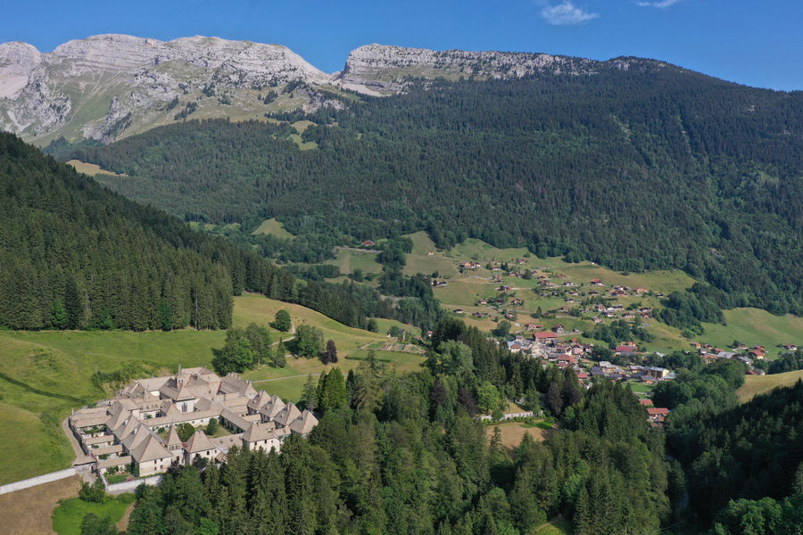
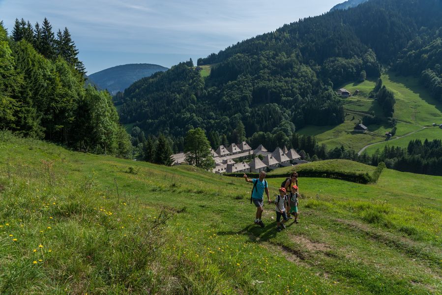
A hiking route to discover the Reposoir. A varied walk with shaded areas in the forest, open areas and magnificent views of the peaks.
The characteristics of the route.

Le Reposoir ()
- Distance 8.7 km
- Elevation gain 490 m
- Elevation lost 490 m
- Min. elevation 976 m
- Max. elevation. 1330 m
- Duration (depending on pace) 3h30
- Marking No
From the church to Planzury: 40 minutes
Cross the bridge and go left on the road. In the first bend, take the path next to the house “Le Perce-neige”. It crosses the fields and the road to go opposite on the steep ascent of Bellegarde, after the oratory. Follow the beacon posts in the housing estate to the Bellegarde farm. Continue to climb up to the Colombière road. Follow this road to the right for about 200 meters, until the intersection of Planzury.
From Planzury to the David coast: 1h35
Leave the road and go up in the field on the right following the beacon posts. The trail continues through the undergrowth to a hairpin. Follow the path to the right and continue straight in the direction of Malatrait then Saint-Bruno. Cross the road and go down to Côte David.
From Côte David to La Caronière: 40 minutes
Follow the road to go on the opposite side to La Touvière. The road ends after this farm and continues through the forest on a path. Follow the direction of La Caronière
From La Caronière to the church: 35 minutes
At La Caronière, take the direction of the basin then the Chartreuse du Reposoir. Walk along the body of water and follow the beacon posts on the left to reach the Fréchet cross. Continue straight until the village.Equipments : Public WC,
Area : Cluses Arve & Montagnes
Report a problem Add a comment
PDF map
Add your time and share your feelings


Information updated on 2023-02-25 by Cluses Arve & montagnes Tourisme


Follow us on
the digital trails
the digital trails


![]()
Infos & contacts
Flaine Tourist Office
Tél. +33 (0)4 50 90 80 01
Les Carroz sports club
sports@aracheslafrasse.fr - Tél. +33 (0)4 50 90 24 80
Cluses Arve & montagnes Tourist Office
Tél. +33 (0)4 50 96 69 69


OK
Annuler