2-day walking circuit around Saint-Sigismond - Stage 1
Add to my favorites

Caution! Zone of vigilance near the route
Bouche du Chevran - du 31/10/2025 au 30/10/2026 In progress
Route opened
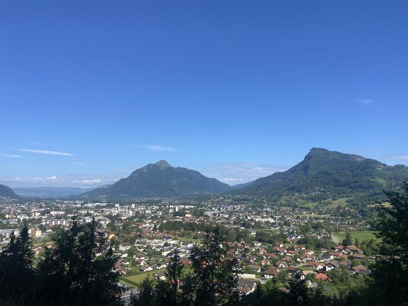
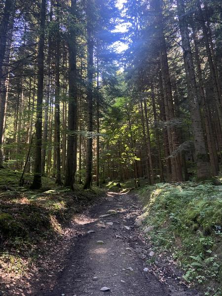
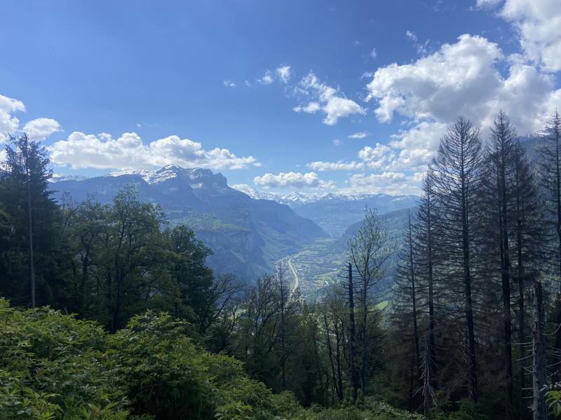
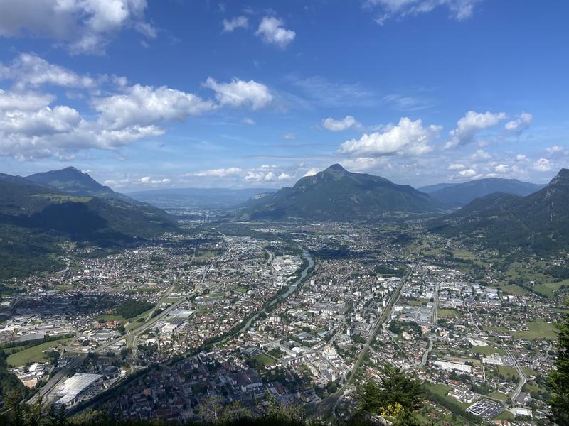
Starting from Le Chevran, you climb the paths beneath the forest, with a magnificent view over the Arve Valley. After a fine climb, you reach the Plateau d'Agy, before heading for Saint-Sigismond, a haven of peace at altitude.
The characteristics of the route.

Cluses (74)
- Distance 12.8 km
- Elevation gain 930 m
- Elevation lost 500 m
- Min. elevation 495 m
- Max. elevation. 1374 m
- Duration (depending on pace) 4h55
- Marking Yes
This first stage immerses you in nature, with a gradual climb under the leafy trees of the Chevran. The reward: a breathtaking panoramic view of the Arve Valley. Continue on to the Plateau d'Agy, a vast alpine area perfect for hiking, where you can admire a variety of landscapes between mountain pastures and forests. The day ends in the quiet, authentic village of Saint-Sigismond, 900 m above sea level. An ideal place to recharge your batteries in the heart of nature.
Recommended overnight accommodation (subject to availability) :
- Chambre d'hôtes Romarica - 2 people :
450, Les bas Choseaux - 74 300 SAINT-SIGISMOND
+33(0)4 50 34 37 74 / mf.bielicki@wanadoo.fr / www.romarica.com
- Gîte La ferme des cousines *** - 8 people :
826, route des Alluaz - 74 300 SAINT-SIGISMOND
+33(0)6 10 23 25 27 / lafermedescousines@gmail.com / www.lafermedescousines.comFrom Cluses to Pont de la Motte : From the Tourist Office, take Rue du 8 mai (to the right of the town hall), pass the Zanin chocolate factory, cross the railway line and continue straight ahead on Boulevard du Chevran. At the ‘Michel Vaillant’ company, take the Chemin de St-Sigismond up into the forest. At the top of the road, take the path on the left. You will pass the ‘La Perrière’ signposts and then come to the ‘Pont de la Motte’. From Pont de la Motte to Croix de la Joux: From here, follow the signs for ‘Chez Bouvier’, crossing the local road in several places. Cross the fields until you reach a track where you turn left to reach Le Planey. Take the Route du Planey on your right and then the track in the fields on your right a few metres further on. You will come to the main road, cross over to the right and continue for 50 metres until you come to the track on your left. You will arrive at the Croix de la Joux. From the Croix de la Joux to the Chalets de Fimaloz : Take the road to the left (opposite the cross) then at the junction turn right. Follow the Alluaz road. At the signpost for ‘Chemin du Jourdil’ on your left, follow the signs for ‘Agy (La Croix)’. At the next signpost, ‘La Pierre du Crêt’, follow ‘Agy (La Croix) par Les Granges de la Frasse’. The path is now in the shade in the woods. When you reach the Granges, follow ‘Agy (La Croix)’ again. You will arrive at the Chalets de Fimaloz, where you can enjoy a beautiful view. From Chalets de Fimaloz to Agy (La Croix): When you reach the signpost called ‘Fimaloz’, head towards ‘Agy (La Croix) par La Bordaz’. Then continue towards ‘Agy (La Croix)’. You will pass the La Tanière restaurant and the cross-country skiing centre. Once you have passed the car park, you will arrive at Agy (La Croix). From Agy (La Croix) to the Croix du Chêne : To get back down from La Croix, retrace your steps. Get back on the main road and follow the path on the left, which goes down under the road. After around 500 metres, cross the road again and continue down to the village of Agy. The path crosses the road several times before reaching the hamlet of Hauts Choseaux. At the crossroads, go straight on towards the Croix du Chêne before reaching the ‘Croix du Chêne’ sign at the end of your first leg. If your accommodation is further down in the village of Saint-Sigismond, take the tarmac road on the left as far as its end. This road becomes a footpath: turn left at the crossroads to reach the Mairie de Saint-Sigismond.Equipments : Free car park, Car park, Admission fee : Free access. There is no charge for the loop itself, just for accommodation (gîtes, refuges, hotels) and services (accompanied by a mountain professional). Hiking guide on sale at the tourist office.Opening : From 15/04 to 01/11. Subject to favorable snow and weather conditions.
Area : Cluses Arve & Montagnes
Report a problem
Website
Add your time and share your feelings


Information updated on 2025-02-20 by Conseil Départemental de la Haute-Savoie


Follow us on
the digital trails
the digital trails


![]()
Infos & contacts
Flaine Tourist Office
Tél. +33 (0)4 50 90 80 01
Les Carroz sports club
sports@aracheslafrasse.fr - Tél. +33 (0)4 50 90 24 80
Cluses Arve & montagnes Tourist Office
Tél. +33 (0)4 50 96 69 69
 Espace Trail Flaine - Les Carroz - Cluses Arve et Montagnes - Parcours - 2-day walking circuit around Saint-Sigismond - Stage 1
Hello, world! This is a toast message.
Espace Trail Flaine - Les Carroz - Cluses Arve et Montagnes - Parcours - 2-day walking circuit around Saint-Sigismond - Stage 1
Hello, world! This is a toast message.
Espace Trail Flaine - Les Carroz - Cluses Arve et Montagnes - Parcours - 2-day walking circuit around Saint-Sigismond - Stage 1
Hello, world! This is a toast message.


OK
Annuler