Cé's gorge - Hike
Add to my favorites

Route closed
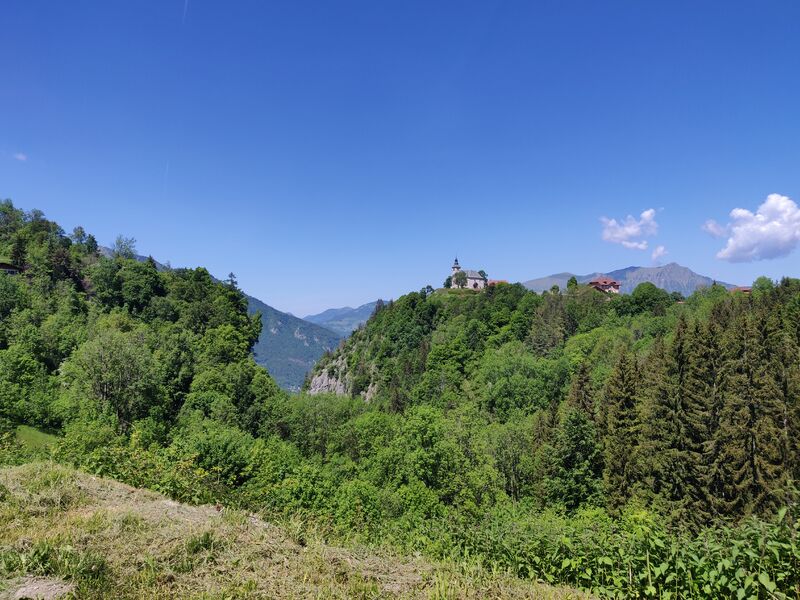
The loop of the gorges du Cé is an unusual route. The itinerary is cool; Ideal for hot weather. Please note that this hike is not recommended in wet weather. A steep slope can be slippery.
The characteristics of the route.
Mont-Saxonnex (74)
- Distance 3.64 km
- Elevation gain 260 m
- Elevation lost 260 m
- Min. elevation 735 m
- Max. elevation. 991 m
- Duration (depending on pace) 1h45
- Marking Yes
Step-by-step guide :
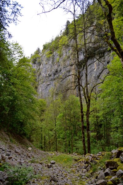
From the school car-park to the Cé's gorge : 15mins From the car-park, go in the Corrioz dead-end and immediately take right, on the path going down to the gorge between the chalet and the house. Follow the path that will take you close to the river and at the Cé's gorge, follow the direction of “Chamoule (0h30)”. From the gorge to Chamoule : 30mins The surrondings can be surprising ! The walls seems to get closer to offer a tight passage between the cliffs. After you pass it, cross the river to go on the opposite side. At the crossing of a 4x4 road, turn left. 50 meters away, take the direction of Chamoule by crossing the field and taking a path that goes under a house. Follow the paved road going through the hamlet. It goes up to the basin. From gere, take the “chemin du Bèle” and follow the arrows. From Chamoule to the school car-park : 1hr The path crosses the road and takes you in Les Monts hamlet. To cross it, take the small road on your right. Follow straight on the road between the chalets until “Chemin des Poussins”. Leave the paved road and go straight down the path along a stone wall. At “Chemin de Cremelin”, follow straight to come across the car-park.The Church of Our Lady of the Assumption: the promontory of the church of Mont-Saxonnex is one of the most beautiful points of view over the Arve valley. The church and its bulbous bell tower dominate the valley of more than 5000 meters of sheer. It was burnt down by lightning twice, then rebuilt between 1929 and 1934 and very richly decorated. Built from 1829 to 1834 on the site of an older church, it is neoclassical in the shape of a Greek cross.Marking : Trail marked with directional posts (PDIPR)Equipments : Free car park, Car park, Good plans : In the fresh! An unusual route, in a cool place: ideal in case of hot weather.Delicate passages : Be careful of the path going down in the gorges. The path gets slippery during 200 meters when the gorge gets tight. You will have to cross the river by walking on wet stones.Admission fee : Free access.Opening : All year round daily. Subject to favorable weather. Canceled or closed.
From the school car-park to the Cé's gorge : 15mins From the car-park, go in the Corrioz dead-end and immediately take right, on the path going down to the gorge between the chalet and the house. Follow the path that will take you close to the river and at the Cé's gorge, follow the direction of “Chamoule (0h30)”. From the gorge to Chamoule : 30mins The surrondings can be surprising ! The walls seems to get closer to offer a tight passage between the cliffs. After you pass it, cross the river to go on the opposite side. At the crossing of a 4x4 road, turn left. 50 meters away, take the direction of Chamoule by crossing the field and taking a path that goes under a house. Follow the paved road going through the hamlet. It goes up to the basin. From gere, take the “chemin du Bèle” and follow the arrows. From Chamoule to the school car-park : 1hr The path crosses the road and takes you in Les Monts hamlet. To cross it, take the small road on your right. Follow straight on the road between the chalets until “Chemin des Poussins”. Leave the paved road and go straight down the path along a stone wall. At “Chemin de Cremelin”, follow straight to come across the car-park.The Church of Our Lady of the Assumption: the promontory of the church of Mont-Saxonnex is one of the most beautiful points of view over the Arve valley. The church and its bulbous bell tower dominate the valley of more than 5000 meters of sheer. It was burnt down by lightning twice, then rebuilt between 1929 and 1934 and very richly decorated. Built from 1829 to 1834 on the site of an older church, it is neoclassical in the shape of a Greek cross.Marking : Trail marked with directional posts (PDIPR)Equipments : Free car park, Car park, Good plans : In the fresh! An unusual route, in a cool place: ideal in case of hot weather.Delicate passages : Be careful of the path going down in the gorges. The path gets slippery during 200 meters when the gorge gets tight. You will have to cross the river by walking on wet stones.Admission fee : Free access.Opening : All year round daily. Subject to favorable weather. Canceled or closed.
Area : Cluses Arve & Montagnes
Report a problem
THIS ROUTE IN YOUR MOBILE PHONE
Download Flaine Carroz 2ccam Outdoor app
Get all the routes on your smartphone with Flaine Carroz 2ccam Outdoor app. You'll find a host of functions :
- Take advantage of detailed IGN maps
- Download data for consultation even when you're not connected to the network
- Geolocate yourself at any time on the route and altimeter profile
- Activate the off-track alarm to be alerted if you stray from the itinerary
- Find nearby services
- Share your experience (add a report, share your lap time)...

Add your time and share your feelings


Information updated on 2026-06-03 by Cluses Arve & montagnes Tourisme


Follow us on
the digital trails
the digital trails




Infos & contacts
Flaine Tourist Office
Tél. +33 (0)4 50 90 80 01
Les Carroz sports club
sports@aracheslafrasse.fr - Tél. +33 (0)4 50 90 24 80
Cluses Arve & montagnes Tourist Office
Tél. +33 (0)4 50 96 69 69
 Espace Trail Flaine - Les Carroz - Cluses Arve et Montagnes - Parcours - Cé's gorge - Hike
Hello, world! This is a toast message.
Espace Trail Flaine - Les Carroz - Cluses Arve et Montagnes - Parcours - Cé's gorge - Hike
Hello, world! This is a toast message.
Espace Trail Flaine - Les Carroz - Cluses Arve et Montagnes - Parcours - Cé's gorge - Hike
Hello, world! This is a toast message.



OK
Annuler