Col de Menée - mountain pass
Add to my favorites

Caution! Zone of vigilance near the route
Aigle royal - du 01/01/2024 au 31/08/2024 In progress

The ascent of Col de Menée is an alpine experience. You absolutely must turn around to admire the view over Mont-Aiguille. Pass through the tunnel and you are suddenly in Provence, with different vegetation and the scent of lavender.
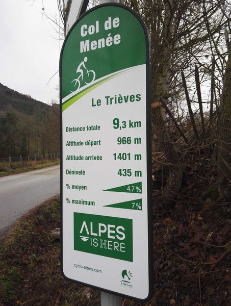
The characteristics of the route.

Chichilianne (38)
- Distance 9.3 km
- Elevation gain 500 m
- Elevation lost 50 m
- Min. elevation 964 m
- Max. elevation. 1412 m
- Marking Yes
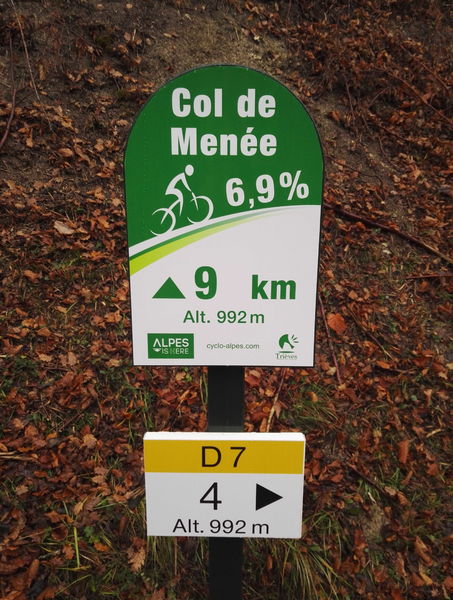
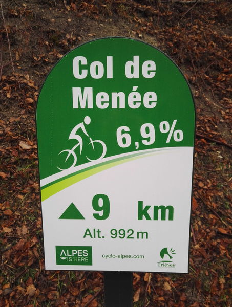
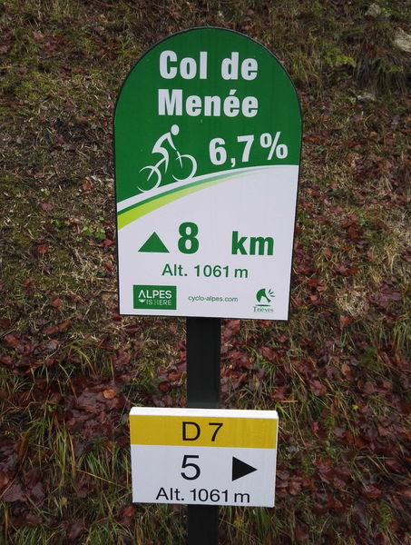
Starting from Les Oches hamlet in Chichiliane, take the D7 towards the Col de Menée.
The Col du Payet is 3.5 km away.
Continue climbing on the D7 up to Col de Menée, which separates the Isère and Drôme departments.Marking : Green and white signs for "Col de Menée"Admission fee : Free access.Opening : From 01/05 to 31/10. Subject to favorable weather.
The Col du Payet is 3.5 km away.
Continue climbing on the D7 up to Col de Menée, which separates the Isère and Drôme departments.Marking : Green and white signs for "Col de Menée"Admission fee : Free access.Opening : From 01/05 to 31/10. Subject to favorable weather.
Area : Trièves
Report a problem Add a comment
Website Features of the application :
- Location and orientation on detailed maps thanks to the GPS of your smartphone
- Description of routes and points of interest on the route
- Photo gallery by route
- Detailed elevation profile
- Route tracking alert to warn you if you stray from the route
- Send predefined messages by SMS to your contacts
- Emergency module: trigger a call or send an emergency SMS in case of problem
- Agenda: access to events organized in the department
- News: find in the application the latest news on the web portal
- Adding achievements
- Add reports in case of problems encountered on the routes
- Share on social networks
Add your time and share your feelings
Services nearby

Point d'information Chichilianne
Chichilianne

Foyer nordique de Chichilianne
Chichilianne

Espace Giono
Lalley
Foyer nordique de Gresse-en-Vercors
Gresse-en-Vercors
Bureau d'Informations Touristiques de Gresse en Vercors - Office de Tourisme du Trièves
Gresse-en-Vercors


Information updated on 2021-08-10 by Office de Tourisme du Trièves


Follow us on
the digital trails
the digital trails


![]()
The Isère Outdoor application was created
by the Département de l'Isère
Infos & contact
Conseil départemental de l'Isère
7 rue Fantin Latour
CS 41096
38 022 Grenoble cedex 1
Tel. 04 76 00 38 38


OK
Annuler