Le sentier médiéval de Bocsozel
Add to my favorites

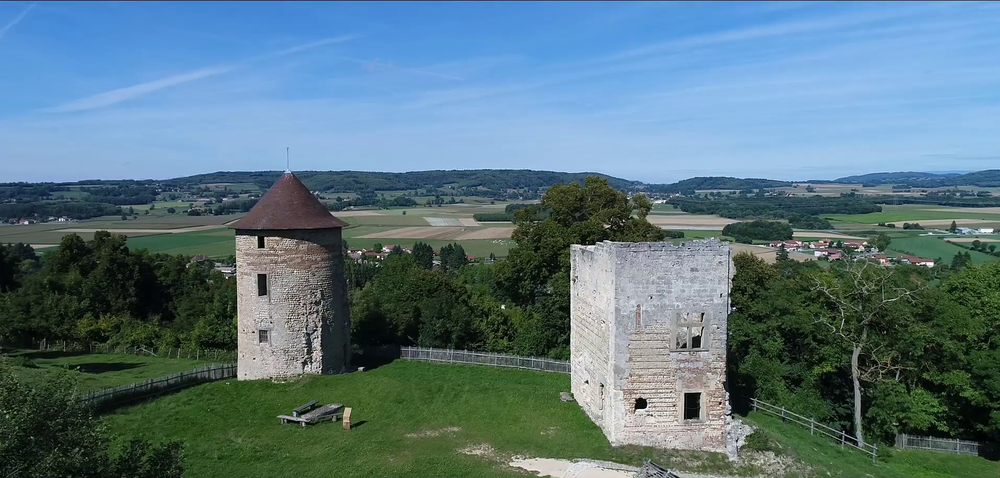
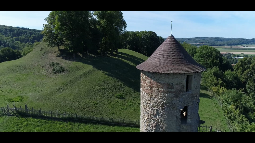
Châteaux et maisons fortes émaillent les paysages de la campagne dauphinoise. La chapelle Notre-Dame-du-Mont, lieu de légende, ainsi que les vestiges du château de Bocsozel – rappelant l’illustre famille – méritent bien quelques détours…
Route labeled FFRandonnée

The characteristics of the route.

Saint-Hilaire-de-la-Côte (38)
- Distance 11.9 km
- Elevation gain 390 m
- Elevation lost 390 m
- Min. elevation 429 m
- Max. elevation. 644 m
- Duration (depending on pace) 4h
- Marking Yes
Equipments : Car park, Admission fee : Free access.Opening : All year round.
Subject to favorable weather.
Area : Bièvre Isère
Report a problem 1 comment
Website Pdf file Features of the application :
- Location and orientation on detailed maps thanks to the GPS of your smartphone
- Description of routes and points of interest on the route
- Photo gallery by route
- Detailed elevation profile
- Route tracking alert to warn you if you stray from the route
- Send predefined messages by SMS to your contacts
- Emergency module: trigger a call or send an emergency SMS in case of problem
- Agenda: access to events organized in the department
- News: find in the application the latest news on the web portal
- Adding achievements
- Add reports in case of problems encountered on the routes
- Share on social networks
Tilius
The 2023/05/17
En savoir plus
Ajouter votre chrono et partager vos sensations
2023/05/17 Tilius
Belle rando avec une belle descente et donc une belle montée !
2023/05/17 Tilius
Belle rando avec une belle descente et donc une belle montée !
Services nearby

Ecomusée rural
Longechenal
Musée des Liqueurs Cherry-Rocher
La Côte-Saint-André
Hector berlioz Museum
La Côte-Saint-André

La Côte-Saint-André Tourist information center
La Côte-Saint-André
St Etienne de St Geoirs Tourist information center
Saint-Étienne-de-Saint-Geoirs


Information updated on 2023-10-05 by Isère Attractivité


Follow us on
the digital trails
the digital trails


![]()
The Isère Outdoor application was created
by the Département de l'Isère
Infos & contact
Conseil départemental de l'Isère
7 rue Fantin Latour
CS 41096
38 022 Grenoble cedex 1
Tel. 04 76 00 38 38


OK
Annuler