Randonnée autour de la Chapelle Notre-Dame de la Salette
Add to my favorites

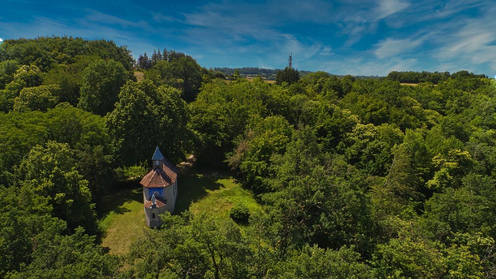
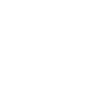
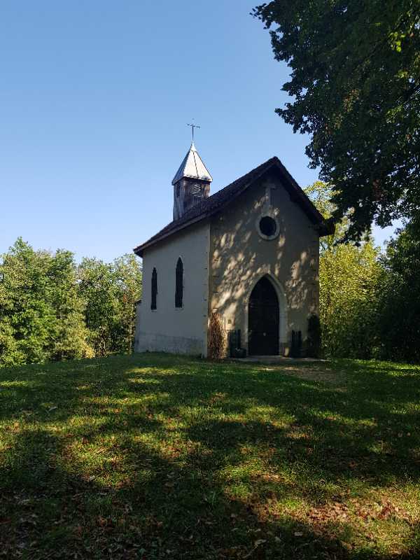
La descente le long de la chapelle de la Salette offre une perspective sur la vallée du Bion avant de retrouver le plateau de Maubec.
The characteristics of the route.
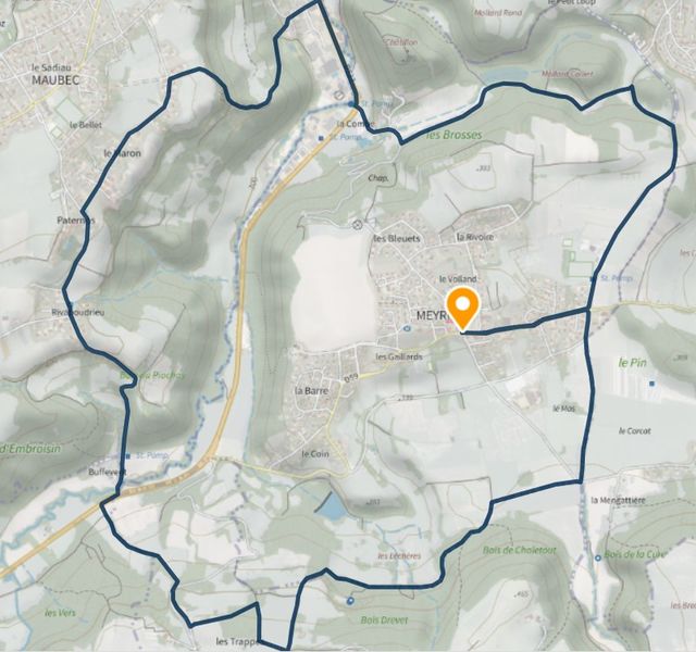
Meyrié (38)
- Distance 11.1 km
- Elevation gain 320 m
- Elevation lost 320 m
- Min. elevation 278 m
- Max. elevation. 435 m
- Duration (depending on pace) 4h
- Marking Yes
Equipments : Car park, Admission fee : Free access.Opening : All year round.
Area : Porte de l'Isère
Report a problem 1 comment
Website Pdf file Features of the application :
- Location and orientation on detailed maps thanks to the GPS of your smartphone
- Description of routes and points of interest on the route
- Photo gallery by route
- Detailed elevation profile
- Route tracking alert to warn you if you stray from the route
- Send predefined messages by SMS to your contacts
- Emergency module: trigger a call or send an emergency SMS in case of problem
- Agenda: access to events organized in the department
- News: find in the application the latest news on the web portal
- Adding achievements
- Add reports in case of problems encountered on the routes
- Share on social networks
Tilius
finished in 02:35:00
The 2022/08/28
En savoir plus
Tilius
The 2022/08/28
En savoir plus
Ajouter votre chrono et partager vos sensations
2022/08/28 Tilius
Beau parcours qu on recommande sans difficulté
Par contre un passage d environ 400m sur la route ..pas très drôle
Quelques belles montées mais pas trop longues ! Et une belle descente avec pas des pierres mais qui se fait tranquillement
Possible de prendre un petit sentier à la place de la dernière partie sur la route
2022/08/28 02:35:00
Tilius
Tilius
Beau parcours qu on recommande
Pas de difficulté
Quelques belles montées mais pas trop longues ! Et une belle descente avec pas mal de pierres
Possible de prendre un petit sentier à la place de la dernière partie sur la route
2022/08/28 Tilius
Beau parcours qu on recommande sans difficulté
Par contre un passage d environ 400m sur la route ..pas très drôle
Quelques belles montées mais pas trop longues ! Et une belle descente avec pas des pierres mais qui se fait tranquillement
Possible de prendre un petit sentier à la place de la dernière partie sur la route
Services nearby

Musée de Bourgoin-Jallieu
Bourgoin-Jallieu

Office de Tourisme CAPI Porte de l'Isère
Bourgoin-Jallieu

Etang de Gôle Sensitive Natural Area
Montcarra
Saint-Chef Museum
Saint-Chef
Saint-Chef - Balcons du Dauphine Tourist Information Office
Saint-Chef


Information updated on 2022-09-09 by Office de Tourisme CAPI - Porte de l'Isère


Follow us on
the digital trails
the digital trails


![]()
The Isère Outdoor application was created
by the Département de l'Isère
Infos & contact
Conseil départemental de l'Isère
7 rue Fantin Latour
CS 41096
38 022 Grenoble cedex 1
Tel. 04 76 00 38 38


OK
Annuler