Waterfalls
Add to my favorites

Route opened
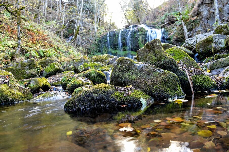
This trail is a superb compromise between built and natural heritage. On one side, a buron, a cross, an oratory and a royal milestone; on the other, forest, mountain scenery and ... 3 waterfalls: Vergnes, Prés Longs and Prapsou.
The characteristics of the route.
Albepierre-Bredons (15)
- Distance 9.05 km
- Elevation gain 340 m
- Elevation lost 340 m
- Min. elevation 1026 m
- Max. elevation. 1342 m
- Duration (depending on pace) 2h50
- Marking Yes
Marking : Yellow markings.Equipments : Free car park, Car park, Picnic area, Good plans : -For your safety, please check the weather forecast before setting off on your hike. -To preserve the environment in which you are located, please avoid leaving garbage in nature. -Remember to take the appropriate equipment for the weather conditions and the hiking itinerary (hiking boots, water bottle, cap, sunglasses, jacket...).Admission fee : Free access.Opening : All year round daily.
Subject to favorable weather.
Area : Albepierre
Report a problem
Website Pdf file AnnaEli
The 2023/08/21
En savoir plus
Ajouter votre chrono et partager vos sensations
2023/08/21 AnnaEli
Frais et ombragé, idéal par temps caniculaire. La première et la dernière sont baignables, nous avons regretté de ne pas avoir pris les maillots.
2023/08/21 AnnaEli
Frais et ombragé, idéal par temps caniculaire. La première et la dernière sont baignables, nous avons regretté de ne pas avoir pris les maillots.
Services nearby

Rigal Florence
Albepierre-Bredons
Bastien Lydie
Albepierre-Bredons
Gîte Les cascades
Albepierre-Bredons
Loussert Lucienne et Daniel
Albepierre-Bredons

Hotel Bar Restaurant Le Plomb du Cantal
Albepierre-Bredons


Information updated on 2026-05-01 by Hautes Terres Tourisme


Follow us on
the digital trails
the digital trails


![]()
Contact
Carladès Tourist Office
Avenue A. Mercier
15800 Vic-sur-Cère
Tel. 04.71.47.50.68
Carladès Tourisme
tourisme@carlades.fr
 Espace Trail Carladès - Parcours - Waterfalls
Hello, world! This is a toast message.
Espace Trail Carladès - Parcours - Waterfalls
Hello, world! This is a toast message.
Espace Trail Carladès - Parcours - Waterfalls
Hello, world! This is a toast message.


OK
Annuler