Tour du col de la Molède
Add to my favorites

Route closed
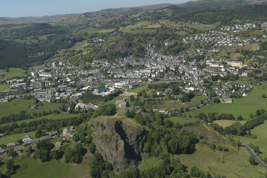
This path takes you past Bredons and its priory to the Col de la Molède, where you can enjoy the view and, on your way, the cliffs and quarry of Cunes.
The characteristics of the route.
Murat (15)
- Distance 15.53 km
- Elevation gain 600 m
- Elevation lost 600 m
- Min. elevation 883 m
- Max. elevation. 1330 m
- Duration (depending on pace) 5h10
- Marking Yes
Marking : Green signposting.Equipments : Free car park, Car park, Public WC, Picnic area, Good plans : -For your safety, please check the weather forecast before setting off on your hike. -To preserve the environment in which you are located, please avoid leaving garbage in nature. -Remember to take equipment adapted to the weather conditions and the hiking itinerary (hiking boots, water bottle, cap, sunglasses, jacket...).Admission fee : Free access.Opening : All year round daily.
Subject to favorable weather.
Area : Murat
Report a problem
Website Pdf file
Add your time and share your feelings
Services nearby

Le Comptoir
Murat
La Crêperie
Murat
Céline Lepage Broderie d'Art
Murat
Ayurvéda et Massages
Murat
Lagloire Jean-Claude
Murat


Information updated on 2026-05-01 by Hautes Terres Tourisme


Follow us on
the digital trails
the digital trails


![]()
Contact
Carladès Tourist Office
Avenue A. Mercier
15800 Vic-sur-Cère
Tel. 04.71.47.50.68
Carladès Tourisme
tourisme@carlades.fr
 Espace Trail Carladès - Parcours - Tour du col de la Molède
Hello, world! This is a toast message.
Espace Trail Carladès - Parcours - Tour du col de la Molède
Hello, world! This is a toast message.
Espace Trail Carladès - Parcours - Tour du col de la Molède
Hello, world! This is a toast message.


OK
Annuler