Rombière
Add to my favorites

Route closed

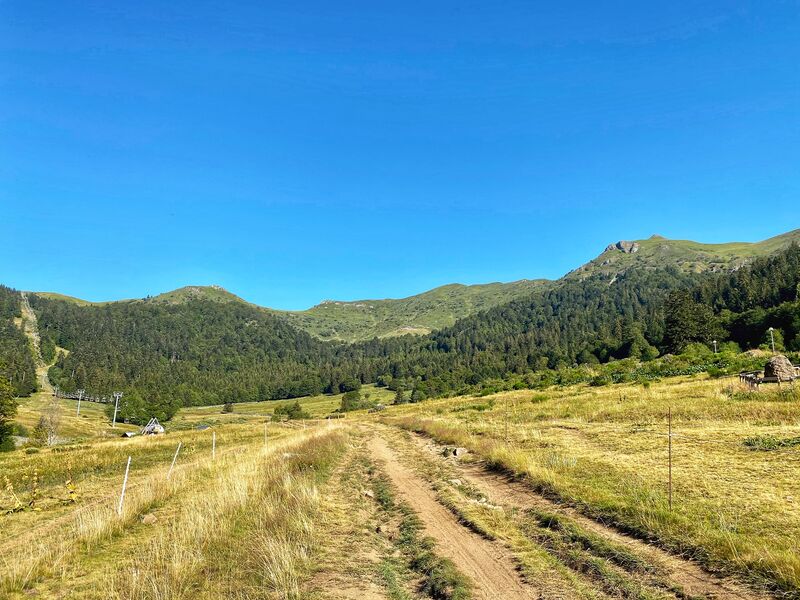
From the Col de Rombière, view of the Jordanne valley, dominated from right to left by Puy de Payre Arse, Puy Mary and Puy Chavaroche. On the steep slopes of Peyre Arse, you may catch a glimpse of chamois!
The characteristics of the route.

Le Lioran (15)
- Distance 7.1 km
- Elevation gain 380 m
- Elevation lost 380 m
- Min. elevation 1194 m
- Max. elevation. 1552 m
- Duration (depending on pace) 2h45
- Marking Yes
Marking : Yellow markingsEquipments : Car park, Free car park, Good plans : -For your safety, please check the weather forecast before setting off on your hike. -To preserve the environment in which you are located, please avoid leaving garbage in nature. -Remember to take the appropriate equipment for the weather conditions and the hiking itinerary (hiking boots, water bottle, cap, sunglasses, jacket...).Delicate passages : Frequent snow accumulations in spring along the Col de Rombière.Admission fee : Free access.Opening : All year round.
Subject to favorable snow and weather conditions.
Read before you go!
Frequent snow accumulations in spring along the Col de Rombière.
Frequent snow accumulations in spring along the Col de Rombière.
Area : Le Lioran
Report a problem Add a comment
Website Pdf file
Add your time and share your feelings
Services nearby

@ Café by J'Sports
Le Lioran

J'Sports - Font d'Alagnon
Le Lioran

Intersport - Portes du Sud
Le Lioran

Action Ski
Le Lioran

Malvezin Nicole and Michel
Le Lioran
Contact 04 71 49 50 08
Information updated on 2022-05-20 by Hautes Terres Tourisme

OK
Annuler


