Le Tour des Vaches Rouges - Main itinerary - Departure Allanche, Cantal
Add to my favorites

Route opened
At the junction of the Cantal and Puy de Dôme départements, the Tour des Vaches Rouges takes in the vast Cézallier plateau. The main 135 km route takes 8 days to complete. Variants can be added to shorten or lengthen the itinerary.
The characteristics of the route.
Allanche (15)
- Distance 135.6 km
- Elevation gain 3970 m
- Elevation lost 3970 m
- Min. elevation 732 m
- Max. elevation. 1340 m
- Duration (depending on pace) 6h
- Marking Yes
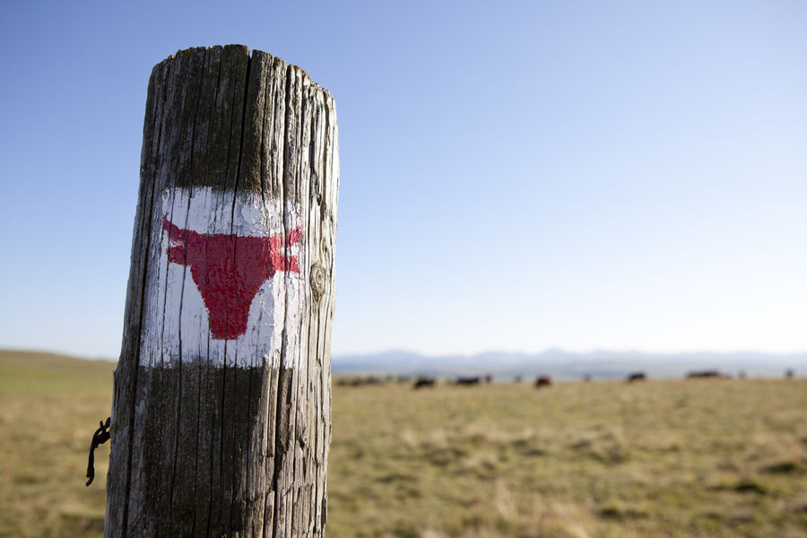
Marking : Markings: red cow heads.Good plans : -For your safety, please check the weather forecast before setting off on your hike. -To preserve the environment in which you are located, please avoid leaving garbage in nature. -Remember to take the appropriate equipment for the weather conditions and the hiking itinerary (hiking boots, water bottle, cap, sunglasses, jacket...).Delicate passages : Crossing summer pastures: presence of herds.Admission fee : Free access.Opening : From 15/04 to 31/10.
Subject to favorable weather.
Read before you go!
Crossing summer pastures: presence of herds.
Crossing summer pastures: presence of herds.
Report a problem Add a comment
Website Pdf file
Add your time and share your feelings
Services nearby

Veyrond Michèle
Allanche
B&B - L'eau berge
Allanche
B&B - La Verte Salamandre
Allanche
Veyrond Joëlle and Patrick
Allanche

Allanche municipal motorhome park
Allanche


Information updated on 2024-04-19 by Hautes Terres Tourisme


Contact Carladès area
Carladès Tourist Office
Avenue A. Mercier
15800 Vic-sur-Cère
Tel. 04.71.47.50.68
Carladès Tourisme
tourisme@carlades.fr
![]()
Contact Hautes Terres area
Hautes Terres Tourist Office
Pl. Hôtel de ville - 15300 Murat
Tel. 04.71.20.09.47
Hautes Terres Tourisme
contact@hautesterrestourisme.fr
@hautesterrestourisme
@hautesterrestourisme


OK
Annuler