Route 8 - le Tour de Courtille
Add to my favorites

Route opened
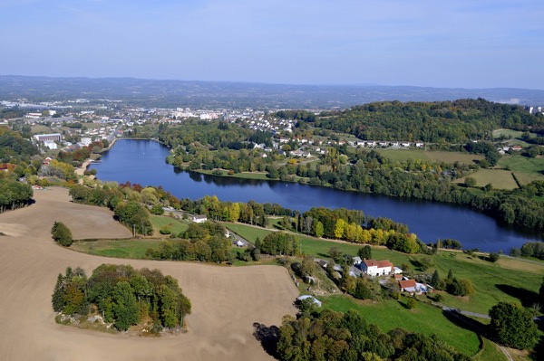
Around the Courtille Lake.
The characteristics of the route.
Guéret (23)
- Distance 2.9 km
- Elevation gain 10 m
- Elevation lost 10 m
- Min. elevation 458 m
- Max. elevation. 463 m
- Duration (depending on pace) 0h40
- Marking yellow
Lira
The 2026/04/27
En savoir plus
Ajouter votre chrono et partager vos sensations
2026/04/27 Lira
2026/04/27 Lira
Services nearby

Tremplin Nature
GUERET

Location de vélos et VAE : Creuse Oxygène
GUERET

Chambre d'hôtes 2 personnes -Chez Agnès
GUERET

Brit Hôtel Auclair
GUERET

Grand Guéret tourist office
Guéret


Follow us on
the digital trails
the digital trails


![]()
Info & contacts :
Communauté d'Agglomération du Grand Guéret
Service Sports de nature
Tel : +33(0)5 55 41 04 48
contact@sportsnature-montsdegueret.com
 Station Sports Nature des Monts de Guéret - Parcours - Route 8 - le Tour de Courtille
Hello, world! This is a toast message.
Station Sports Nature des Monts de Guéret - Parcours - Route 8 - le Tour de Courtille
Hello, world! This is a toast message.
Station Sports Nature des Monts de Guéret - Parcours - Route 8 - le Tour de Courtille
Hello, world! This is a toast message.


OK
Annuler