
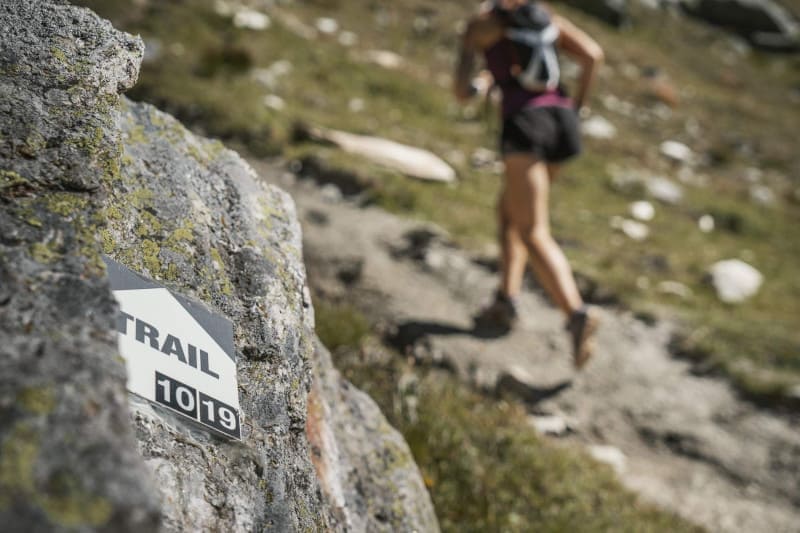
To orient you during your run, trail-running routes are equipped with trail directional markers. Each marker is printed with the number(s) of the itinerary(s) to be followed with their colour of difficulty (green - blue - red - black).
The trail-running markers are placed in a regular way, at each directional change. Between two trail directional markers, follow the existing hiking markers.
Please note : there are no trail markings on the Swiss side. For cross-border routes, take the GPX track of the circuit and follow the existing hiking signs.
Before your run :
- Check the weather forecast before you leave, the itineraries can be dangerous in case of bad weather
- Find out about the state of the route
- Before you leave Inform someone close to you of your itinerary and the planned timetables
- Take water and food and drink
On the routes :
- Please respect the natural and agricultural environments you pass through
- Close the barriers after you have passed through
- Stay on the paths and do not cut the laces
- All parts of the route using public roads are subject to the Highway Code please make sure that you observe them
- Keep all your rubbish with you
A problem ? Report it ! In the event of problem (lack of markings, maintenance problems, environmental problems...), do not hesitate to signal this problem by using the reporting tool available on the route page, on the website (button under the map) or in the mobile app. You will be able to geolocate the problem and also send a corresponding photo. The Espace manager will be automatically notified of your report and will be able to check and deal with the problem.


 Espace Trail Lacs et montagnes du Haut-Doubs - Useful infos

