Les chalets de Pertuis (loop)
Add to my favorites

Route opened
Hiking in the "Mont de Grange" hunting reserve, which has more than 500 chamois deer and mouflon sheep. Pertuis is also an area where marmottes have been reintroduced. Enjoy your walk.
The characteristics of the route.
Abondance (74)
- Distance 9 km
- Elevation gain 830 m
- Elevation lost 780 m
- Min. elevation 959 m
- Max. elevation. 1778 m
- Duration (depending on pace) 4h
- Marking Yes
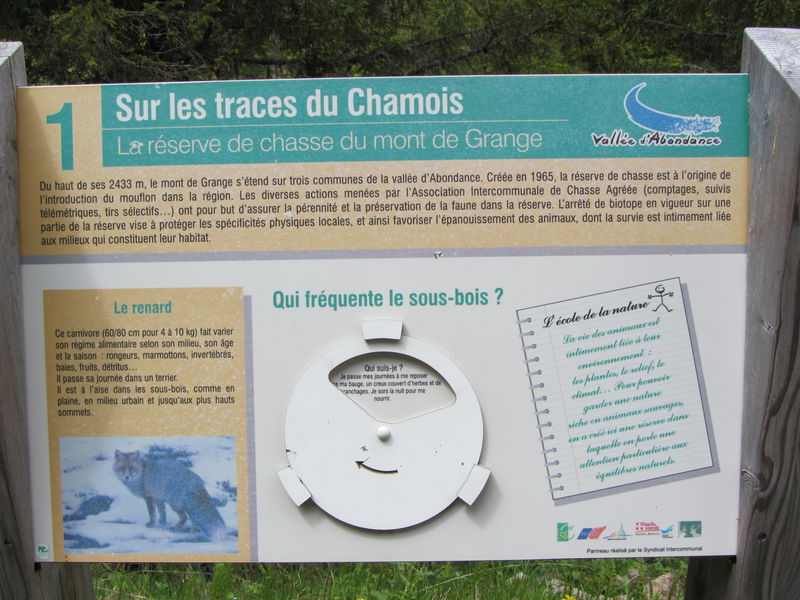
A medium difficulty hike in the Mont de Grange hunting reserve, the highest mountain in the valley at 2432m. It is a Natura 2000 reserve where chamois, mouflons and marmots live together.
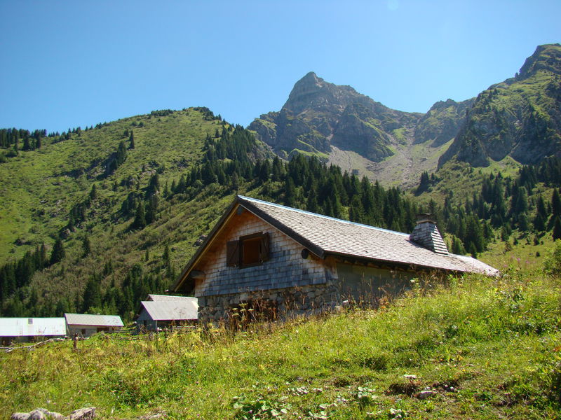
The departure is located at Chez les Ogays at the start of Richebourg in Abondance.
You will take the direction of the Chalets de la Plagne and discover its mountain pastures.
You will join the discovery trail "in the footsteps of the Chamois" passing by the Chon and the Chable de la Plagne to reach Pertuis.
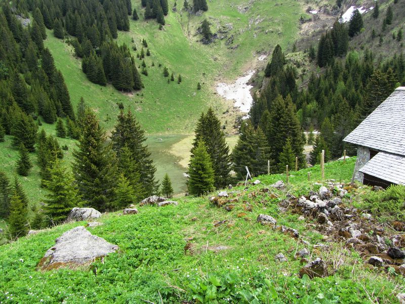
At the chalets of Pertuis, you will discover an ancient glacial valley with a small lake dug by the glacier, which dries up at the end of the summer, and its large lateral moraine.
To go back down, you will continue on the Bel Air ridge (1783 m) with a magnificent view of Abondance and the surrounding mountains.
You will then reach the chalets of Leschaux and Plaine Joux. You will then head towards the Chosalets to reach the start of the hike.Marking : PDIPR departmental signposting.Equipments : Parking, Admission fee : Free access.Opening : From 15/06 to 15/09. Accessible outside the snow period and depending on weather conditions. Check with the Tourist Office beforehand to find out the current access conditions. Recommended practice period: spring - summer - autumn.
The departure is located at Chez les Ogays at the start of Richebourg in Abondance.
You will take the direction of the Chalets de la Plagne and discover its mountain pastures.
You will join the discovery trail "in the footsteps of the Chamois" passing by the Chon and the Chable de la Plagne to reach Pertuis.
At the chalets of Pertuis, you will discover an ancient glacial valley with a small lake dug by the glacier, which dries up at the end of the summer, and its large lateral moraine.
To go back down, you will continue on the Bel Air ridge (1783 m) with a magnificent view of Abondance and the surrounding mountains.
You will then reach the chalets of Leschaux and Plaine Joux. You will then head towards the Chosalets to reach the start of the hike.Marking : PDIPR departmental signposting.Equipments : Parking, Admission fee : Free access.Opening : From 15/06 to 15/09. Accessible outside the snow period and depending on weather conditions. Check with the Tourist Office beforehand to find out the current access conditions. Recommended practice period: spring - summer - autumn.
Report a problem
Website Hiking map Chalets de Pertuis
Add your time and share your feelings


Information updated on 2023-06-08 by Office de Tourisme intercommunal Pays d'Evian Vallée d'Abondance


Follow us on
the digital trails
the digital trails


![]()
Info & contacts
Portes du Soleil Association
1401, route de Vonnes
74390 Châtel FRANCE
+33(0)4.50.73.32.54
info@portesdusoleil.com
 Trail Running Portes du Soleil - Parcours - Les chalets de Pertuis (loop)
Hello, world! This is a toast message.
Trail Running Portes du Soleil - Parcours - Les chalets de Pertuis (loop)
Hello, world! This is a toast message.
Trail Running Portes du Soleil - Parcours - Les chalets de Pertuis (loop)
Hello, world! This is a toast message.


OK
Annuler