Circuit de Trébentaz
Add to my favorites

Route closed
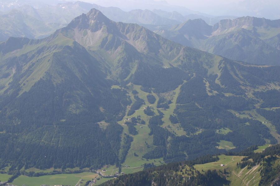
In the heart of the Mont de Grange hunting reserve, you will follow forest paths to reach the Trebentaz refuge. Magnificent views of the Valais and Vaud Swiss Alps await you.
The characteristics of the route.
La Chapelle-d'Abondance (74)
- Distance 9.2 km
- Elevation gain 770 m
- Elevation lost 770 m
- Min. elevation 1263 m
- Max. elevation. 2018 m
- Duration (depending on pace) 4h25
- Marking Yes
A pretty hike of difficult difficulty in the Mont de Grange reserve, a Natura 2000 reserve and game reserve, where 300 hectares of nature are preserved, a refuge for remarkable wildlife: chamois, mouflons, roe deer, stags, wild boar, marmots, golden eagles, capercaillie, etc., and a varied flora with some rare species: alpine columbine, Martagon lily, Paradise lily, bear-eared primrose.
From Plan des Feux, follow the forest track towards Louennaz, then head for the refuge de Trébentaz.
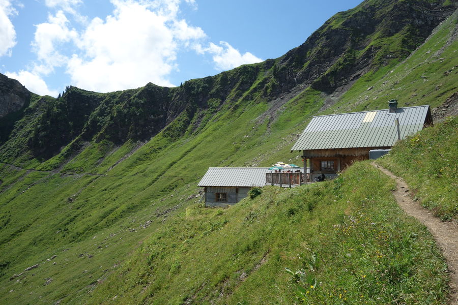
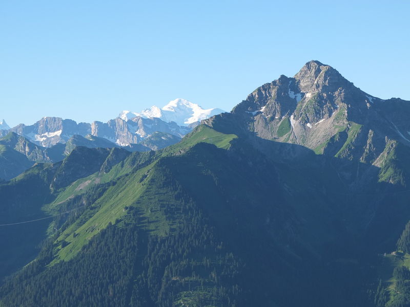
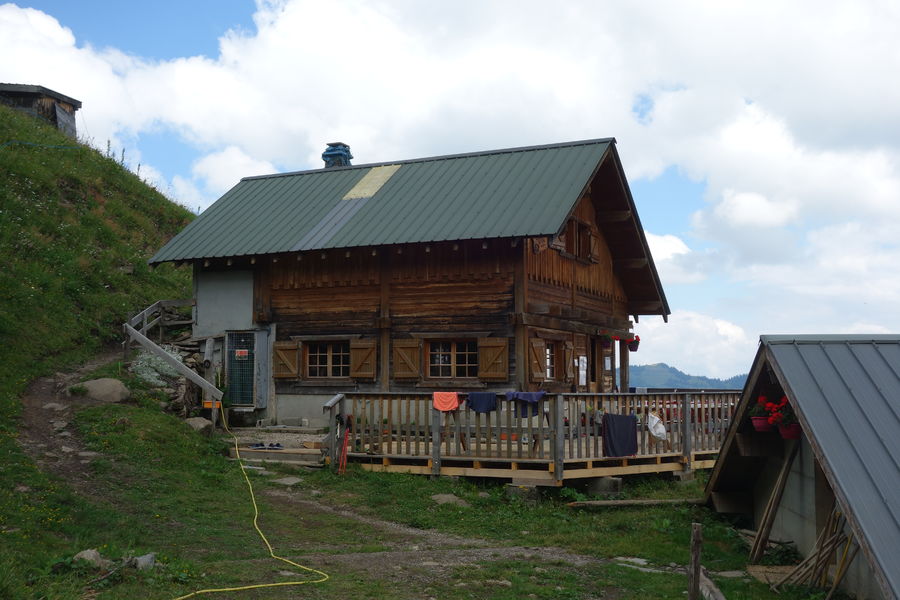
The refuge is a stage on the GR5. You can enjoy an exceptional panorama during a well-deserved lunch break!
From the hut, take a short path to the "Altitude 2,020 m" sign, the highest point of the route and the best view of the Swiss Alps. The descent is via the Chalets d'alpage du Folliet through a combe. Return in the direction of Plan des Feux.
Departures from the village: you can start the hike from Crêt Béni or Le Moulin. Allow an extra 1h45 walking time.Marking : Departmental markings called P.D.I.P.R. on beige metal panels with green lettering.Equipments : Picnic area, Parking, Admission fee : Free access.Opening : From 01/06 to 30/09. Accessible except during snow and depending on weather conditions. Please check with the Tourist Office for the latest information on access conditions. This route is usually suitable for strong walkers during spring, summer, and autumn, except in adverse weather.
From Plan des Feux, follow the forest track towards Louennaz, then head for the refuge de Trébentaz.
The refuge is a stage on the GR5. You can enjoy an exceptional panorama during a well-deserved lunch break!
From the hut, take a short path to the "Altitude 2,020 m" sign, the highest point of the route and the best view of the Swiss Alps. The descent is via the Chalets d'alpage du Folliet through a combe. Return in the direction of Plan des Feux.
Departures from the village: you can start the hike from Crêt Béni or Le Moulin. Allow an extra 1h45 walking time.Marking : Departmental markings called P.D.I.P.R. on beige metal panels with green lettering.Equipments : Picnic area, Parking, Admission fee : Free access.Opening : From 01/06 to 30/09. Accessible except during snow and depending on weather conditions. Please check with the Tourist Office for the latest information on access conditions. This route is usually suitable for strong walkers during spring, summer, and autumn, except in adverse weather.
Report a problem Add a comment
Website Pdf file
Add your time and share your feelings


Information updated on 2023-06-09 by Office de Tourisme intercommunal Pays d'Evian Vallée d'Abondance


Follow us on
the digital trails
the digital trails


![]()
Info & contacts
Portes du Soleil Association
1401, route de Vonnes
74390 Châtel FRANCE
+33(0)4.50.73.32.54
info@portesdusoleil.com


OK
Annuler