Arvouin pass and lake
Add to my favorites

Route closed
A hike without difficulties to contemplate the lake of Arvouin, the mountains of Chablais and sumptuous landscapes on the summits of La Chapelle d'Abondance.
The characteristics of the route.
La Chapelle-d'Abondance (74)
- Distance 5.6 km
- Elevation gain 270 m
- Elevation lost 270 m
- Min. elevation 1589 m
- Max. elevation. 1865 m
- Duration (depending on pace) 2h05
- Marking Yes
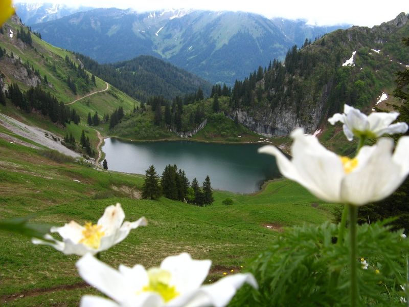
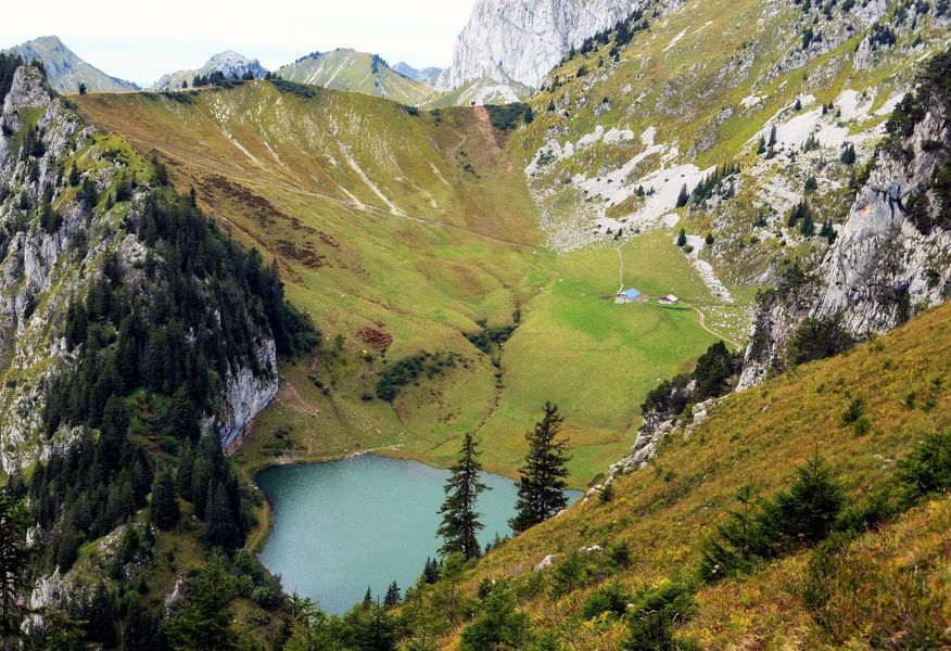
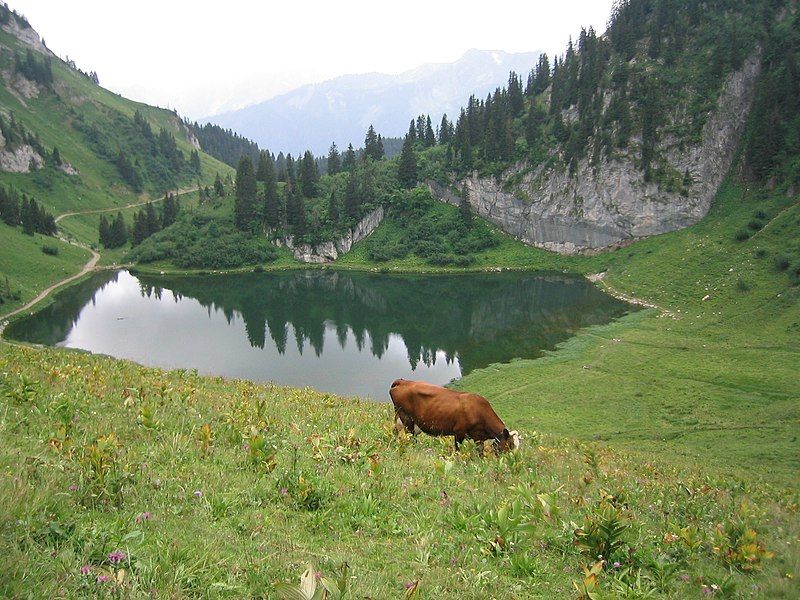
The hike to the Col and the lake of Arvouin is a half-day hike that will allow you to discover a grandiose landscape starting from the Sevan car park, situated just 300 metres below.
You will first reach the glacial lake located at the foot of the Linleu summit, in the heart of the Cornettes de Bise massif.
Near the lake of Arvouin, the mountain pasture of the same name is home to herds of Abondance cows which provide the milk for the local cheese.
You then reach the Col d'Arvouin or Savalenaz, situated at 1856 m, which acts as a border between France and our Swiss neighbours.
In summer, it is possible to take the Panthiaz cable car to reach the start of the hike (check with the tourist office for openings).Marking : Departmental markings called P.D.I.P.R. on beige metal panel and green writing.Equipments : Parking, Admission fee : Free access.Opening : From 01/06 to 30/10. Accessible except during snow and depending on weather conditions. Please check with the Tourist Office for the latest information on access conditions. This route is usually suitable for strong walkers during spring, summer, and autumn, except in adverse weather. Subject to favorable weather.
Report a problem Add a comment
Website Pdf file
Add your time and share your feelings


Information updated on 2023-03-09 by Conseil Départemental de la Haute-Savoie


Follow us on
the digital trails
the digital trails


![]()
Info & contacts
Portes du Soleil Association
1401, route de Vonnes
74390 Châtel FRANCE
+33(0)4.50.73.32.54
info@portesdusoleil.com


OK
Annuler