Tour of the Pointe d'Ardens from Lac des Plagnes
Add to my favorites

Route opened
A sporty hike that will take you to discover the Plagnes lake and the Tavaneuse lake, on the foothills of one of the many peaks of the Chablais massif: La Pointe d'Ardens.
The characteristics of the route.
Abondance (74)
- Distance 12.4 km
- Elevation gain 890 m
- Elevation lost 890 m
- Min. elevation 1179 m
- Max. elevation. 1917 m
- Duration (depending on pace) 4h35
- Marking Yes
The hike around the Pointe d'Ardens by its lakes will allow you to discover all the beauty of the Haute-Savoie landscape.
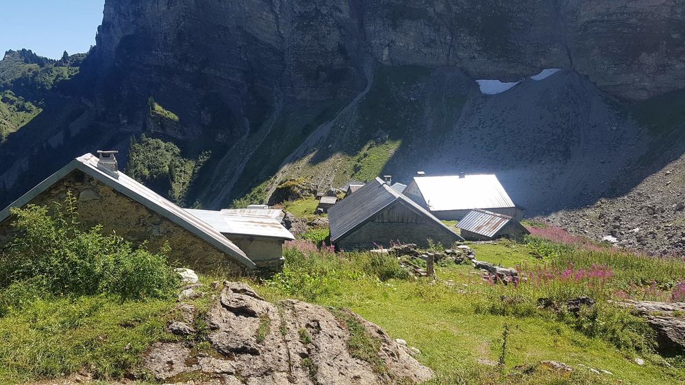
Starting from the Plagnes lake, you will first go through the Ardens chalet located south of the summit of the same name: La Pointe d'Ardens, which culminates at 1959 m in altitude.
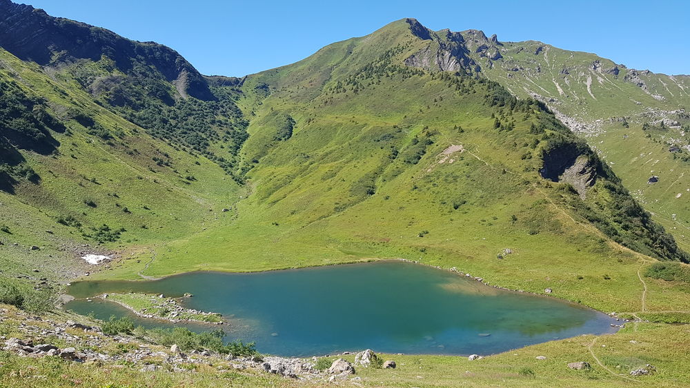
You will then reach the Tavaneuse lake located at the foot of the cliffs of the small Pointe du Piron, between scree and alpine meadows, one of the most beautiful lakes in the Chablais.
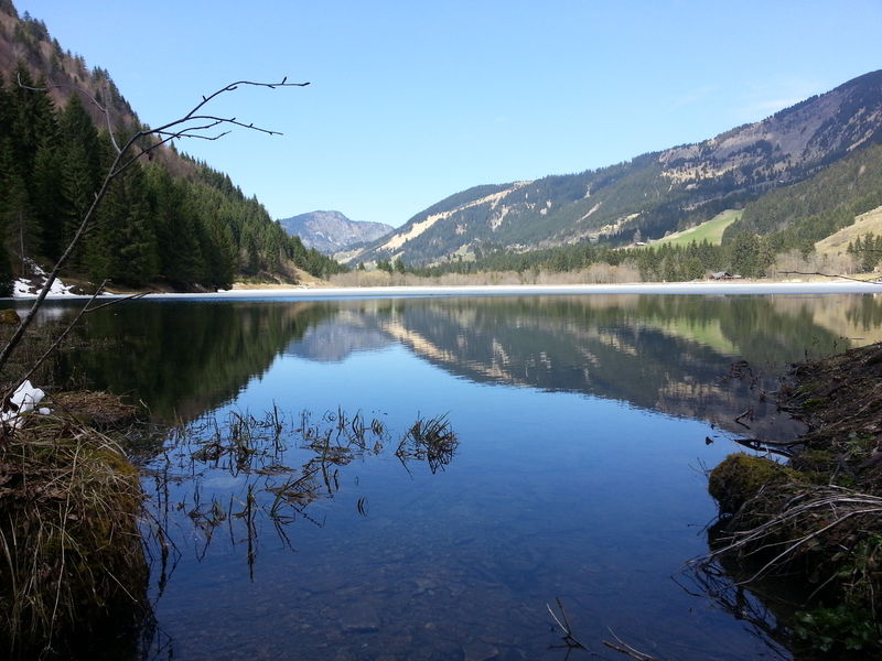
You will then go back down to the north of the Pointe d'Ardens to reach the Lac des Plagnes. Take advantage of the restaurants and picnic tables near the lake to recover from your hike and enjoy this unmissable geosite of the UNESCO Chablais World Geopark.
Translated with www.DeepL.com/Translator (free version)Marking : Departmental markings called P.D.I.P.R. on beige metal panel and green writing.Equipments : Picnic area, Car park, Free car park, Admission fee : Free access.Opening : From 01/06 to 01/11. Accessible except during snow and depending on weather conditions. Please check with the Tourist Office for the latest information on access conditions. This route is usually suitable for strong walkers during spring, summer, and autumn, except in adverse weather.
Starting from the Plagnes lake, you will first go through the Ardens chalet located south of the summit of the same name: La Pointe d'Ardens, which culminates at 1959 m in altitude.
You will then reach the Tavaneuse lake located at the foot of the cliffs of the small Pointe du Piron, between scree and alpine meadows, one of the most beautiful lakes in the Chablais.
You will then go back down to the north of the Pointe d'Ardens to reach the Lac des Plagnes. Take advantage of the restaurants and picnic tables near the lake to recover from your hike and enjoy this unmissable geosite of the UNESCO Chablais World Geopark.
Translated with www.DeepL.com/Translator (free version)Marking : Departmental markings called P.D.I.P.R. on beige metal panel and green writing.Equipments : Picnic area, Car park, Free car park, Admission fee : Free access.Opening : From 01/06 to 01/11. Accessible except during snow and depending on weather conditions. Please check with the Tourist Office for the latest information on access conditions. This route is usually suitable for strong walkers during spring, summer, and autumn, except in adverse weather.
Report a problem
Website Pdf file
Add your time and share your feelings


Information updated on 2023-04-28 by Conseil Départemental de la Haute-Savoie


Follow us on
the digital trails
the digital trails


![]()
Info & contacts
Portes du Soleil Association
1401, route de Vonnes
74390 Châtel FRANCE
+33(0)4.50.73.32.54
info@portesdusoleil.com
 Trail Running Portes du Soleil - Parcours - Tour of the Pointe d'Ardens from Lac des Plagnes
Hello, world! This is a toast message.
Trail Running Portes du Soleil - Parcours - Tour of the Pointe d'Ardens from Lac des Plagnes
Hello, world! This is a toast message.
Trail Running Portes du Soleil - Parcours - Tour of the Pointe d'Ardens from Lac des Plagnes
Hello, world! This is a toast message.


OK
Annuler