Circuit 15 blue - Nyon Joux Plane
Add to my favorites

Be careful, you are on your own
Route closed
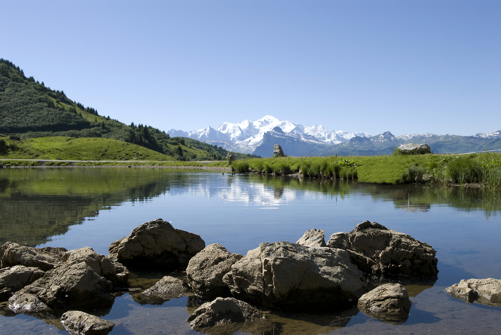
Morzine is breaking new ground with a route that uses the ski lifts to avoid the steep gradients at the start of the outing and takes you directly to the ridge lines with their 360° panoramas.
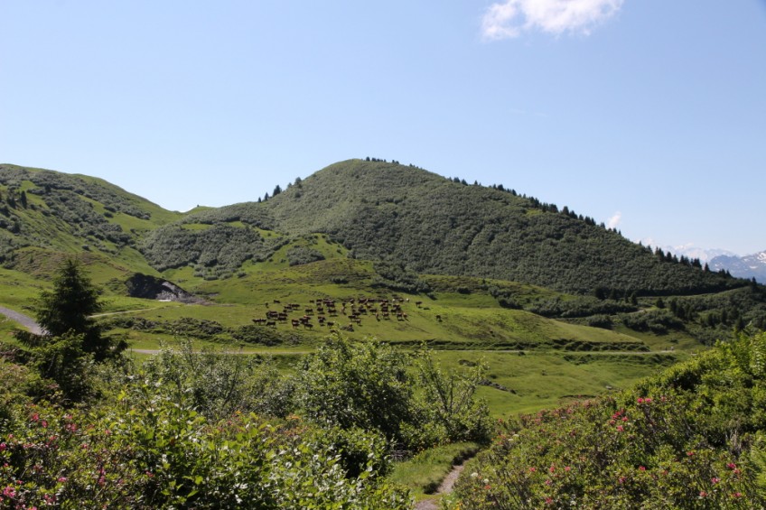
A remarkable route for the variety of its panoramas. A mix of wide stony paths, grassy singletrack, balcony paths and ridge paths. An immersion in the mountain pastures with their typical chalets and the tinkling of cowbells in the background. A must-do! Translated with www.DeepL.com/Translator (free version)
The characteristics of the route.
Morzine (74)
- Distance 12.6 km
- Elevation gain 970 m
- Elevation lost 430 m
- Min. elevation 957 m
- Max. elevation. 1822 m
- Duration (depending on pace) 1h45
- Marking yes
From the church at the city center, you will go to the Fox path to warm up for a few kilometers. Then you will take Nyon gondola. It takes you to Joux Plane pass, between lakes and magnificients points of view. The rest of the ascent on Tête de Vuargne is the makor difficulty of the track, but you will have an amazing 360° view at the top. With the Mont Blanc facing you, uou will continue on a ridge path and join Morzine.
Area : Vallée d'Aulps
Report a problem
Website PDF map
Add your time and share your feelings


Follow us on
the digital trails
the digital trails


![]()
Info & contacts
Portes du Soleil Association
1401, route de Vonnes
74390 Châtel FRANCE
+33(0)4.50.73.32.54
info@portesdusoleil.com
 Trail Running Portes du Soleil - Parcours - Circuit 15 blue - Nyon Joux Plane
Hello, world! This is a toast message.
Trail Running Portes du Soleil - Parcours - Circuit 15 blue - Nyon Joux Plane
Hello, world! This is a toast message.
Trail Running Portes du Soleil - Parcours - Circuit 15 blue - Nyon Joux Plane
Hello, world! This is a toast message.


OK
Annuler