De Placy à la Motte
Add to my favorites

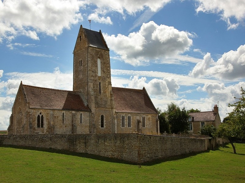
Randonnée de 7 km autour de Placy. Allez voir son église où le blason des seigneurs de Placy a été récemment découvert lors d'une rénovation!
The characteristics of the route.

CESNY-LES-SOURCES (14)
- Distance 7.18 km
- Elevation gain 120 m
- Elevation lost 120 m
- Min. elevation 122 m
- Max. elevation. 172 m
- Duration (depending on pace) 02:00:00
Report a problem
All the routes on your smartphone
Download the Suisse Normande Outdoor mobile app
Get all the routes on your smartphone with the Suisse Normande Outdoor app. You'll find a host of functions:
- Take advantage of detailed IGN maps
- Download data for consultation even when you're not connected to the network
- Geolocate yourself at any time on the route and altimeter profile
- Activate the off-track alarm to be alerted if you stray from the itinerary
- Find nearby services
- Share your experience (add a report, share your lap time)...

Jormüngand
finished in 01:27:00
The 2026/02/06
En savoir plus
Ajouter votre chrono et partager vos sensations
2026/02/06 01:27:00
Jormüngand
Jormüngand
Beaucoup de route. Quelques chemins sympas. Rien d'exceptionnel
2026/02/06 01:27:00
Jormüngand
Jormüngand
Beaucoup de route. Quelques chemins sympas. Rien d'exceptionnel
Services nearby

Thury Plein Air
THURY-HARCOURT-LE-HOM

Thury Plein Air
THURY-HARCOURT-LE-HOM
Kayak Club Thury-Harcourt
THURY-HARCOURT-LE-HOM
Club Multisports Thury-Harcourt
THURY-HARCOURT-LE-HOM

Le Quai d'Harcourt Café Epicerie Associatif
THURY-HARCOURT-LE-HOM


Falaise - Suisse Normande Tourist Office
+33(0)2 31 90 17 26
Tourist Office
send mail
Suisse Normande Tourisme
+33(0)2 31 79 70 45
Tourist Office
send mail
![]()
Montagnes de Normandie
+33(0)2 31 59 13 13
Tourist Office
send mail
Val d'Orne Tourist Office
+33(0)2 33 35 86 57
Tourist Office
send mail
 Suisse Normande Outdoor - Parcours - De Placy à la Motte
Hello, world! This is a toast message.
Suisse Normande Outdoor - Parcours - De Placy à la Motte
Hello, world! This is a toast message.
Suisse Normande Outdoor - Parcours - De Placy à la Motte
Hello, world! This is a toast message.


OK
Annuler