The "Pom-Pom" - Trail Itinerary
Add to my favorites

Caution! Zone of vigilance near the route
POINGT RAVIER - du 01/06/2026 au 10/10/2026 In progress
LES CLOTS - du 15/05/2026 au 31/10/2026 In progress
BEAUJOURNAL - du 15/05/2026 au 31/10/2026 In progress
Presence of livestock guard dogs
Route opened
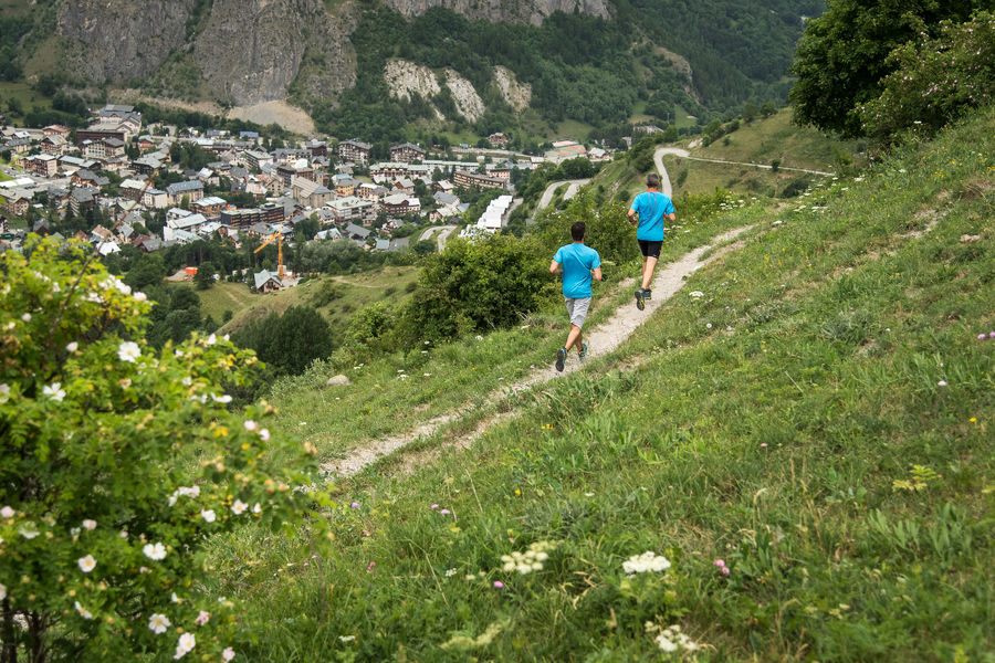
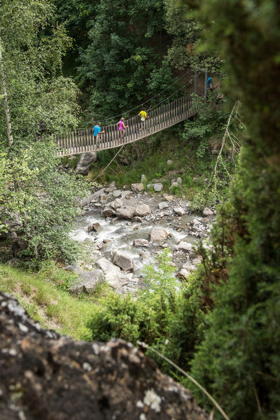
This course without technical difficulty is aimed at a wide audience. To reach its highest point, you will pass by the Devil's Bridge before taking a pretty single track in the forest. You will then descend via a pretty balcony path.
The characteristics of the route.

Office de Tourisme (73)
- Distance 10.38 km
- Elevation gain 680 m
- Elevation lost 680 m
- Min. elevation 1410 m
- Max. elevation. 1935 m
- Duration (depending on pace) 1h40
- Marking No
Itinerary suggested by the Trail du Galibier organization,
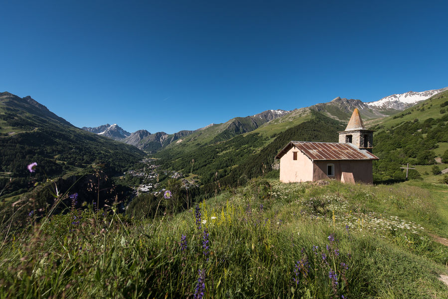
To activate geolocation, click on the map icon.Good plans : Your security: - Keep in mind that you are riding in mountain areas with sometimes technical trails, significant elevation where weather conditions can change quickly. - Don't overestimate your abilities - Check the local weather forecast before leaving / www.meteofrance.com / tel: 3250 - Anticipate and adapt your clothing according to the sectors traveled and provide a survival blanket, windbreaker and whistle. - If you are going alone, leave information about your itinerary with those around you and make sure you have a charged mobile phone. - Always provide a reserve of water. - Stay on the marked paths. - Be careful of electric fences. - During hunting season (September to January) and near big game hunts, show your presence. - Help: in case of emergency contact 112 Your environment: - Respect private property. - Do not light a fire. - Keep your waste and bring it back. - Respect fruit production and do not cross cultivated fields. - Do not frighten the cattle. - Close the park barriers after your visit. - Respect the direction of the routes. - Be careful and courteous when overtaking and crossing hikers.Admission fee : Free access.Opening : From 20/04 to 01/11 daily. Subject to favorable snow and weather conditions. Cancelled in case of bad weather.Step by step description : Departure point: Auberge D+. 1 - After touring the town center, head up Rue des Grandes Alpes to cross the bridge towards Col du Galibier. 2 - At the Chapelle Saint Bernard, follow the path up to the Chapelle de Poingt-Ravier. 3 - From the fountain, take the single track towards the gorges de l'enfer. 4 - Cross the Devil's Bridge and continue your ascent through the forest. 5 - At the top of the old Crey Rond chairlift, follow the balcony path to the Balais alpine chalets and then to Beaujournal. 6 - Continue towards the Arolles chalets to reach the hamlet of Les Verneys. 7 - Descend to cross the D902 road and the Valloirette river. 8 - After the bridge, take the path on the left which runs alongside the river on the right bank for 300m, before turning right onto a bucolic single which takes you around the Rocher St. Pierre on the east side to the finish.
To activate geolocation, click on the map icon.Good plans : Your security: - Keep in mind that you are riding in mountain areas with sometimes technical trails, significant elevation where weather conditions can change quickly. - Don't overestimate your abilities - Check the local weather forecast before leaving / www.meteofrance.com / tel: 3250 - Anticipate and adapt your clothing according to the sectors traveled and provide a survival blanket, windbreaker and whistle. - If you are going alone, leave information about your itinerary with those around you and make sure you have a charged mobile phone. - Always provide a reserve of water. - Stay on the marked paths. - Be careful of electric fences. - During hunting season (September to January) and near big game hunts, show your presence. - Help: in case of emergency contact 112 Your environment: - Respect private property. - Do not light a fire. - Keep your waste and bring it back. - Respect fruit production and do not cross cultivated fields. - Do not frighten the cattle. - Close the park barriers after your visit. - Respect the direction of the routes. - Be careful and courteous when overtaking and crossing hikers.Admission fee : Free access.Opening : From 20/04 to 01/11 daily. Subject to favorable snow and weather conditions. Cancelled in case of bad weather.Step by step description : Departure point: Auberge D+. 1 - After touring the town center, head up Rue des Grandes Alpes to cross the bridge towards Col du Galibier. 2 - At the Chapelle Saint Bernard, follow the path up to the Chapelle de Poingt-Ravier. 3 - From the fountain, take the single track towards the gorges de l'enfer. 4 - Cross the Devil's Bridge and continue your ascent through the forest. 5 - At the top of the old Crey Rond chairlift, follow the balcony path to the Balais alpine chalets and then to Beaujournal. 6 - Continue towards the Arolles chalets to reach the hamlet of Les Verneys. 7 - Descend to cross the D902 road and the Valloirette river. 8 - After the bridge, take the path on the left which runs alongside the river on the right bank for 300m, before turning right onto a bucolic single which takes you around the Rocher St. Pierre on the east side to the finish.
Report a problem
Website Pdf file
Add your time and share your feelings
Services nearby

Brasserie le K - Restaurant - Brasserie
386 avenue de la Vallée d'Or

Jullien Hervé - Menuisier
Avenue de la Vallée d'Or

Library - Multimedia room
Valloire

Tri Selectif : Les Conteneurs semi-enterrés
Valloire

La Souris Verte - Kindergarten - ESI children's group ski lessons
Immeuble Rochevert - Avenue de la Vallée d'Or


Information updated on 2026-03-13 by Office de Tourisme de Valloire


Follow us on
the digital trails
the digital trails





Valloire Tourist Office
210 rue des Grandes Alpes - 73450 Valloire
+33(0)4 79 59 03 96
Office de Tourisme
Contact mail
 Valloire Galibier Expériences - Parcours - The "Pom-Pom" - Trail Itinerary
Hello, world! This is a toast message.
Valloire Galibier Expériences - Parcours - The "Pom-Pom" - Trail Itinerary
Hello, world! This is a toast message.
Valloire Galibier Expériences - Parcours - The "Pom-Pom" - Trail Itinerary
Hello, world! This is a toast message.


OK
Annuler